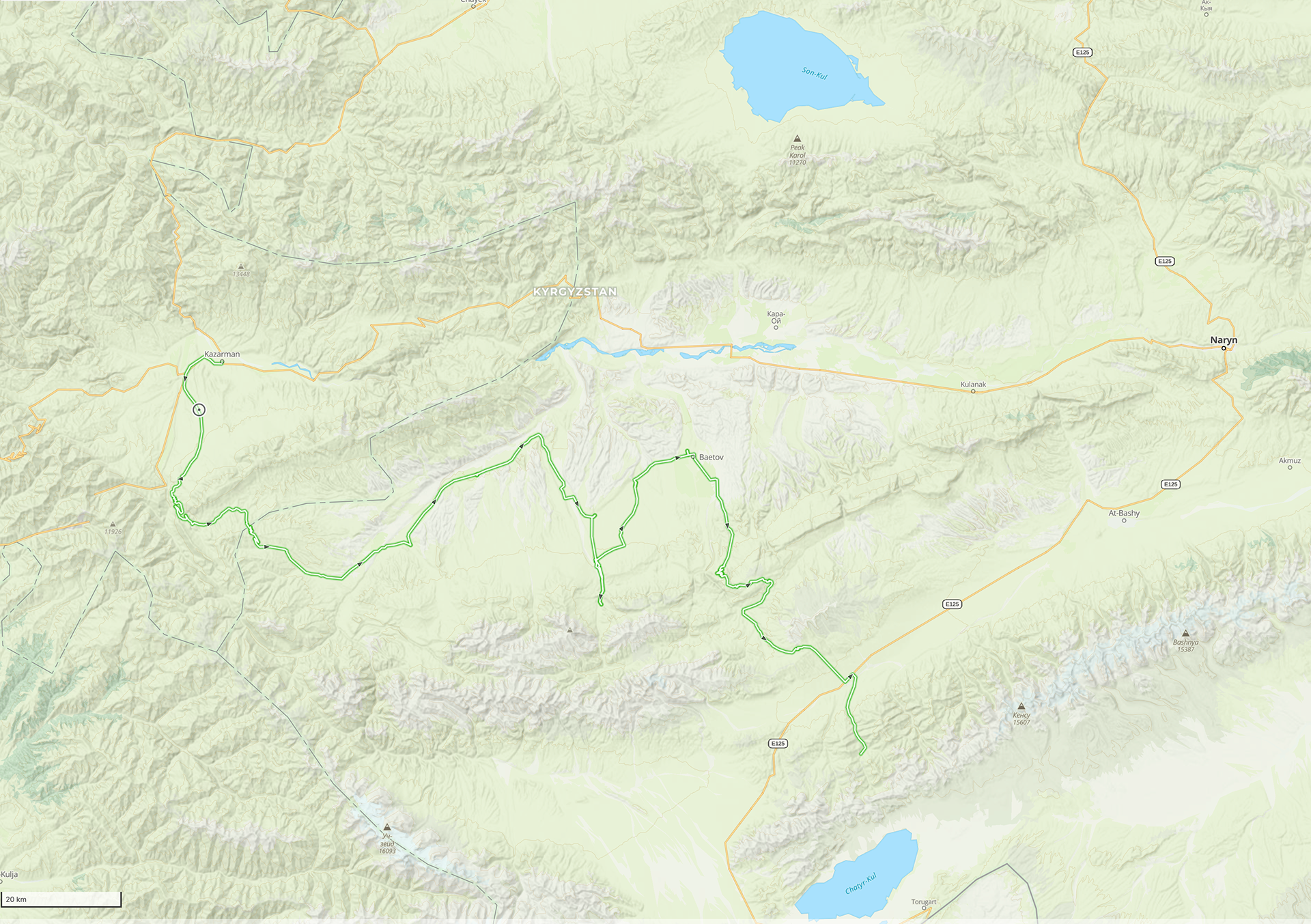
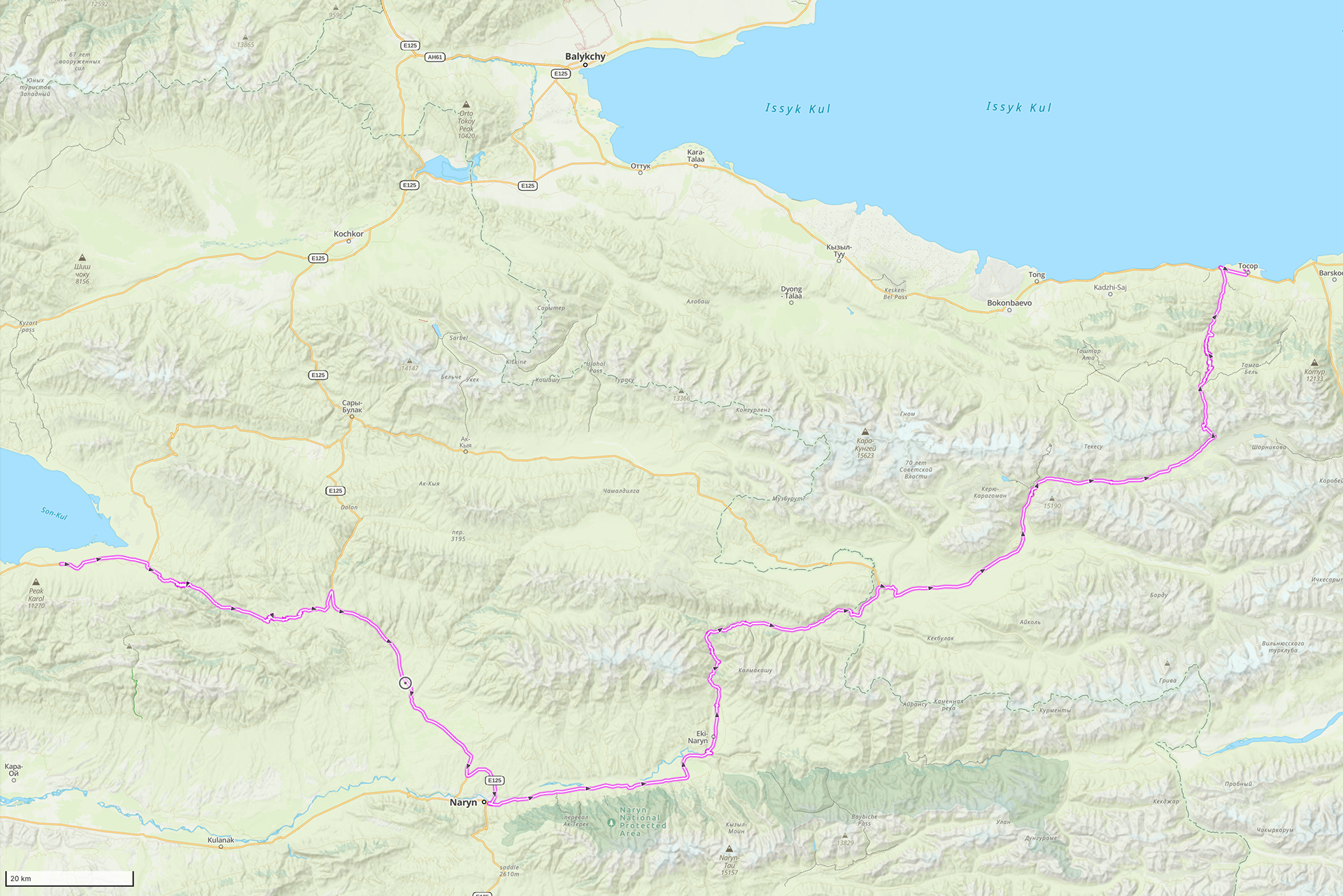
Kyrgyzstan tracks, from Osh
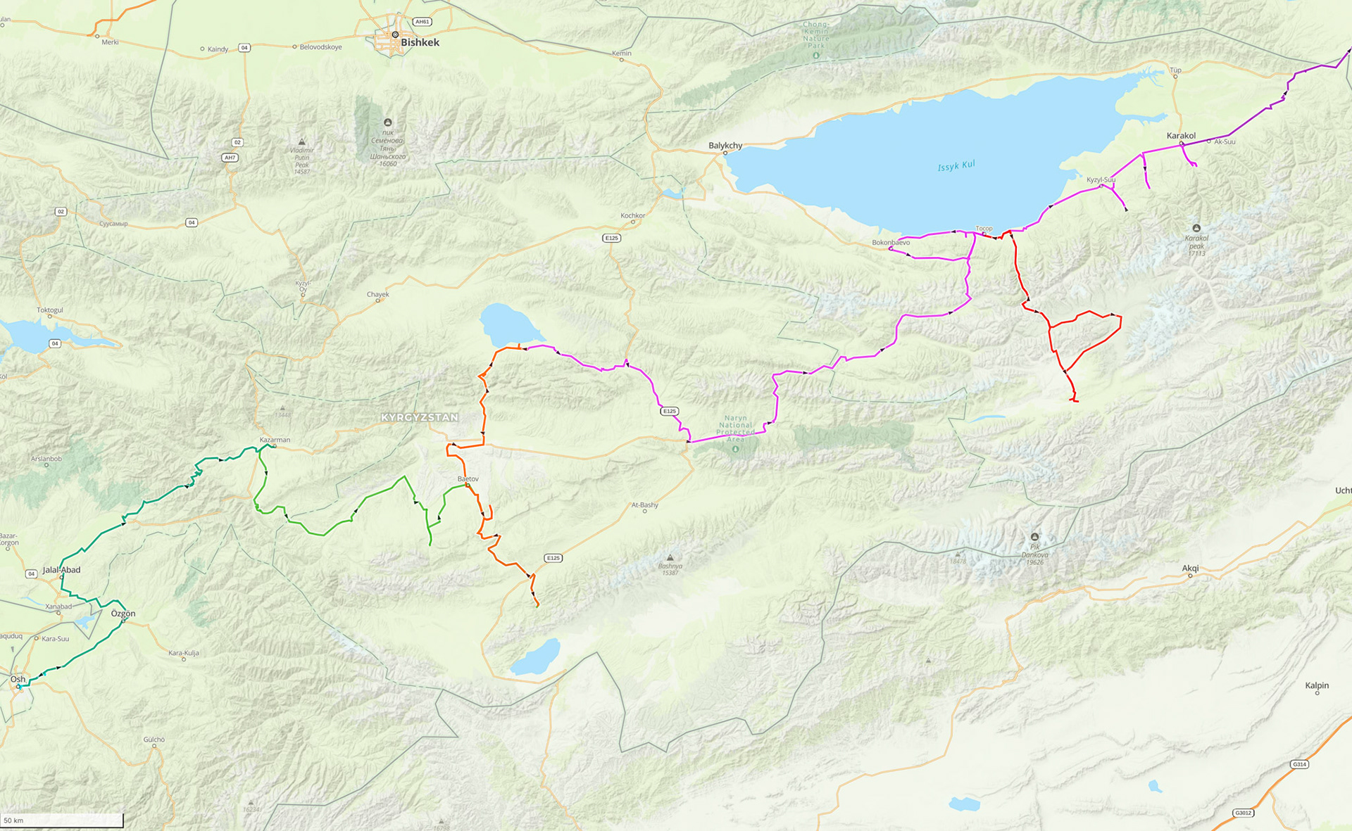
Day 68: Osh to Kazarman
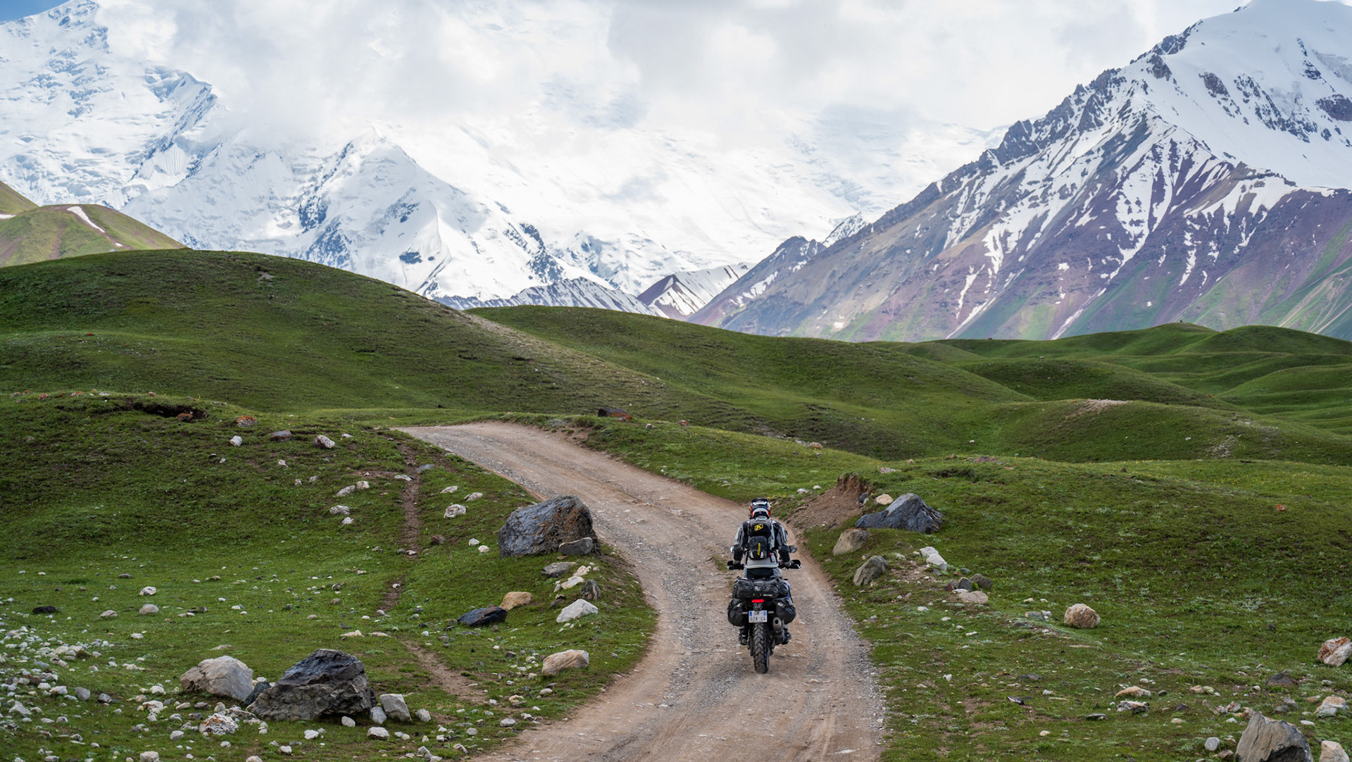
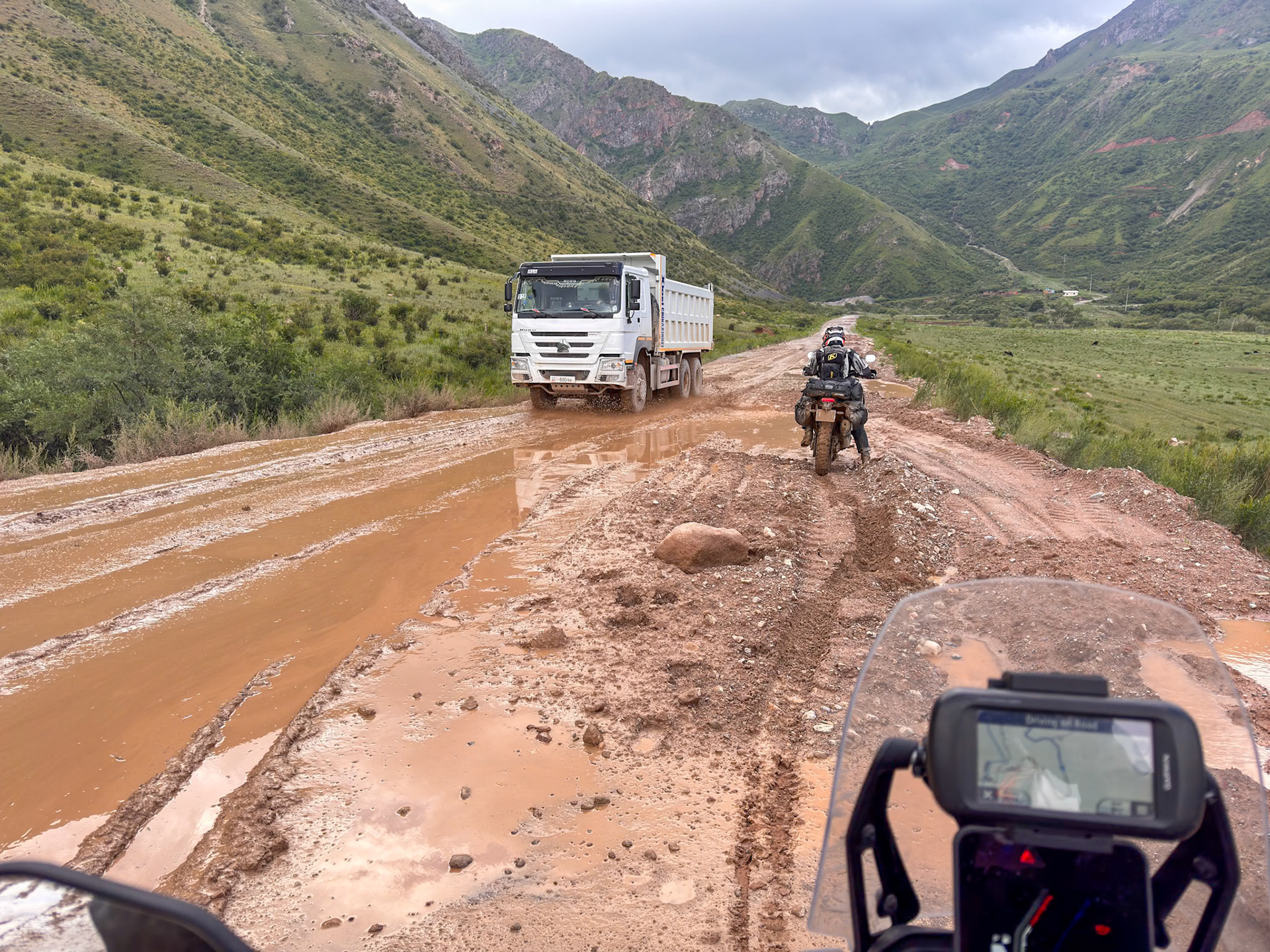
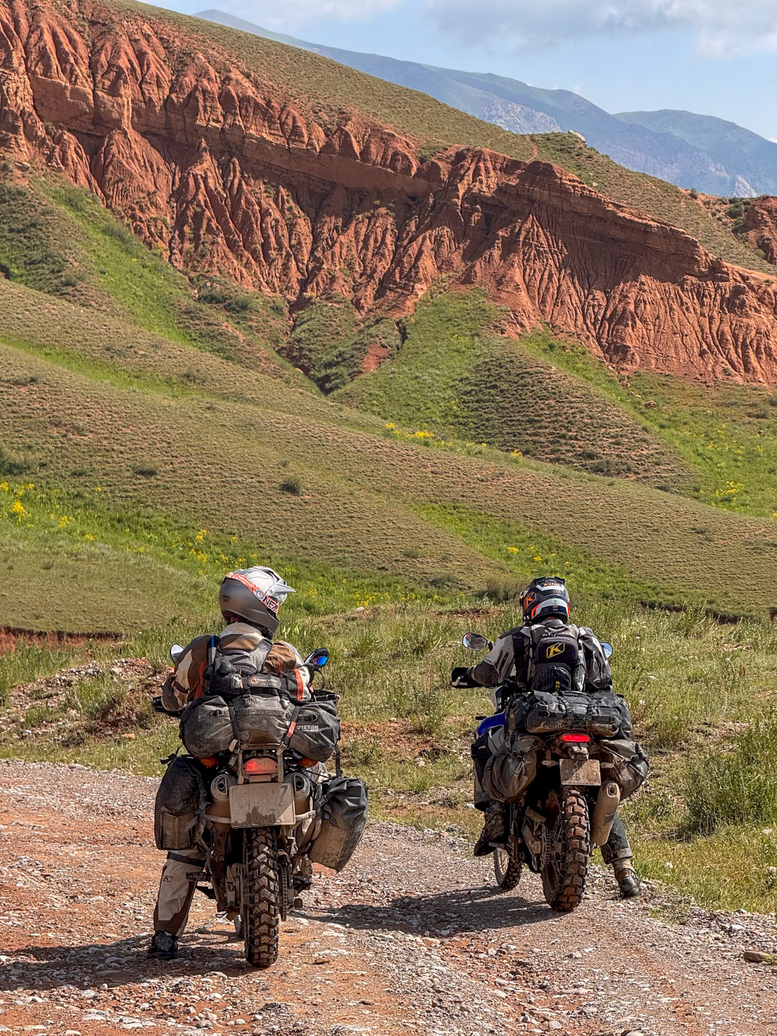
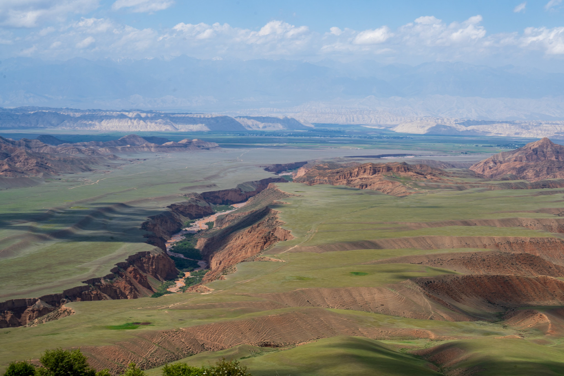
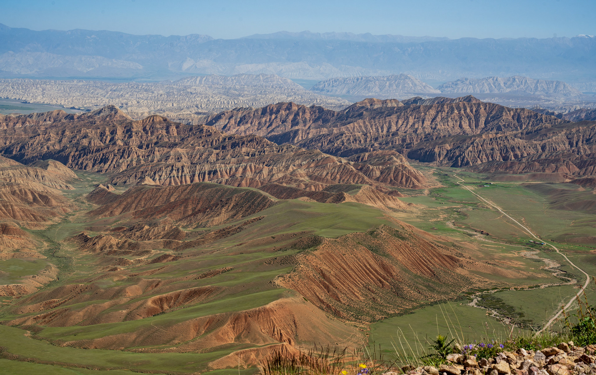
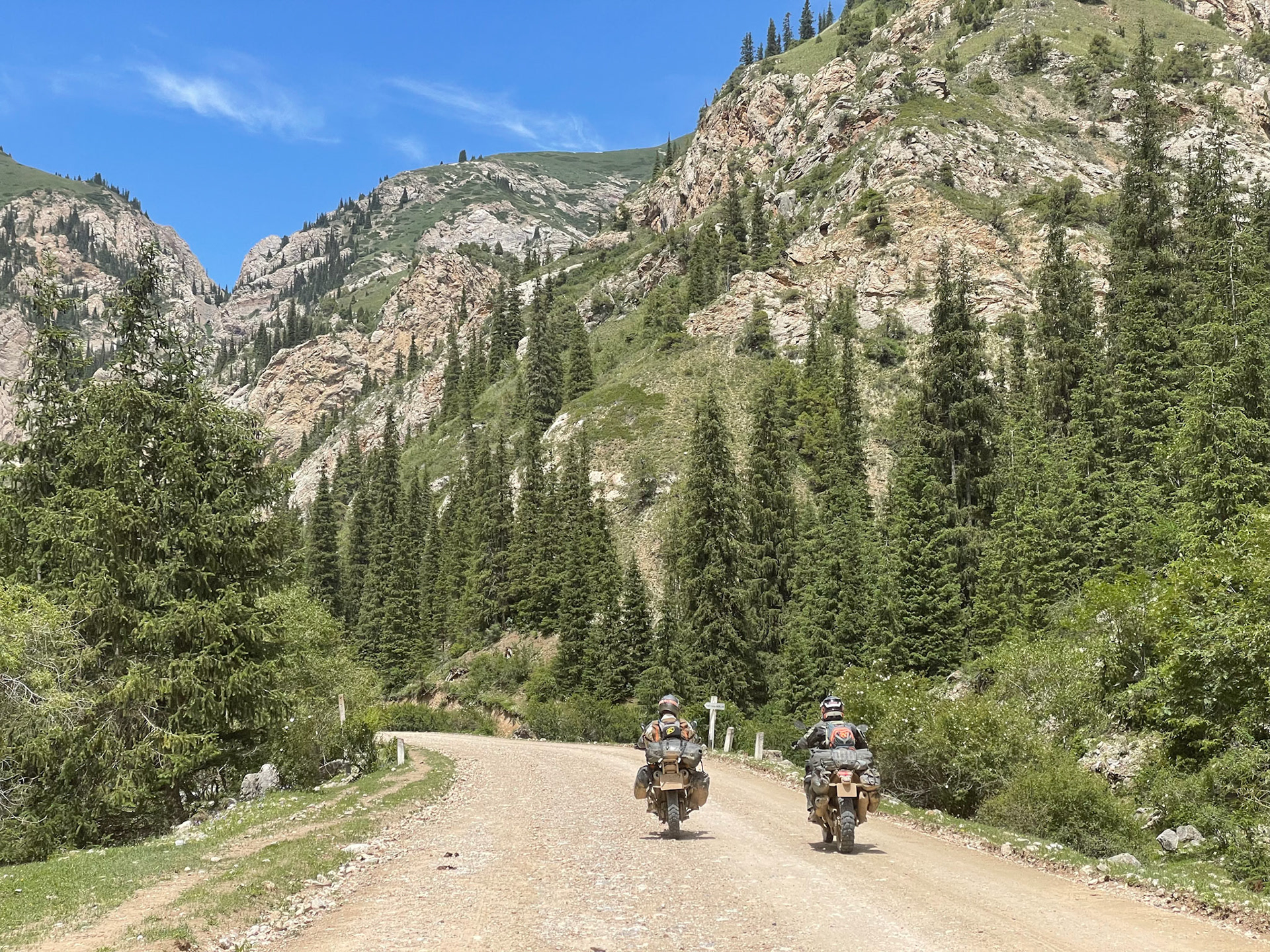
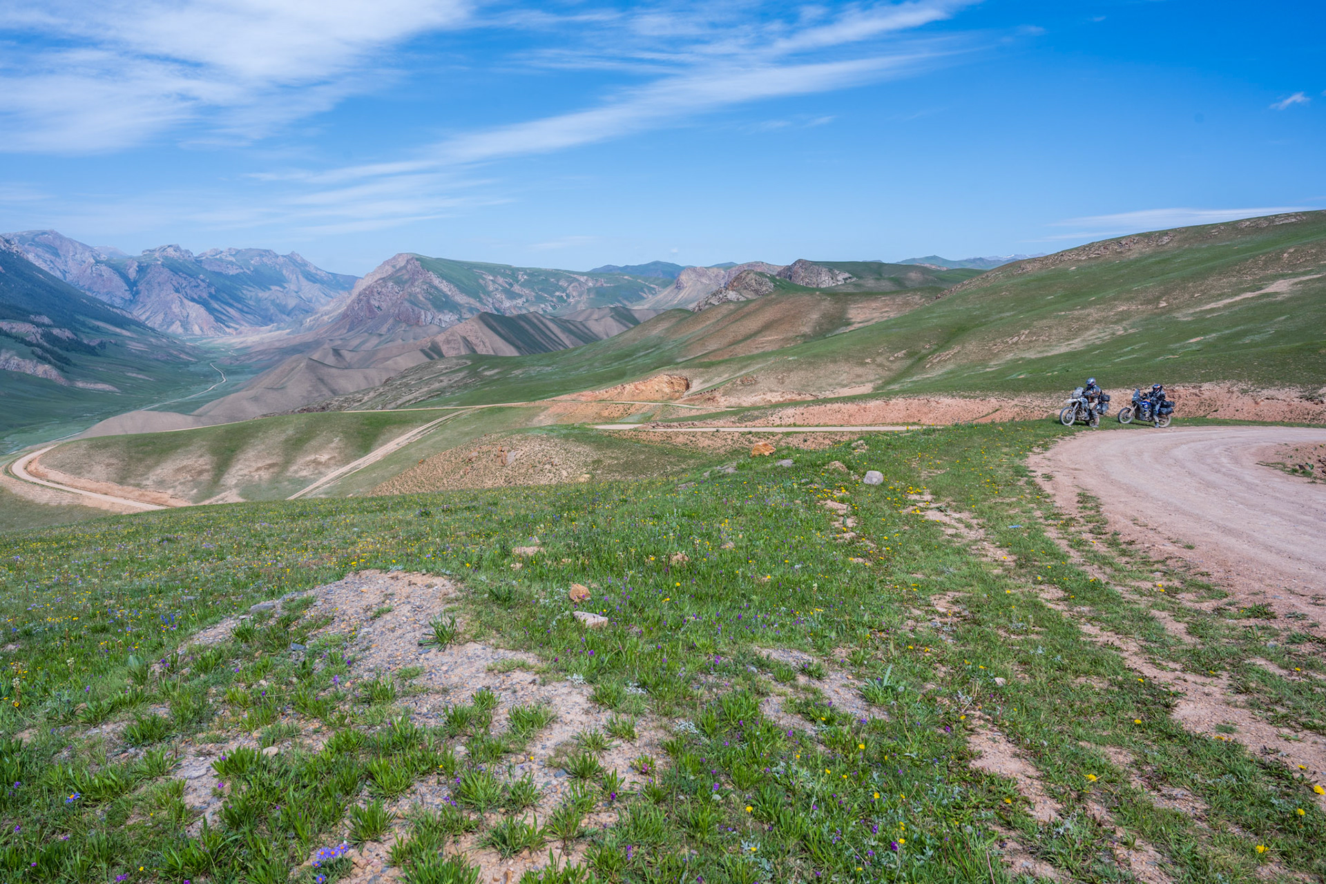
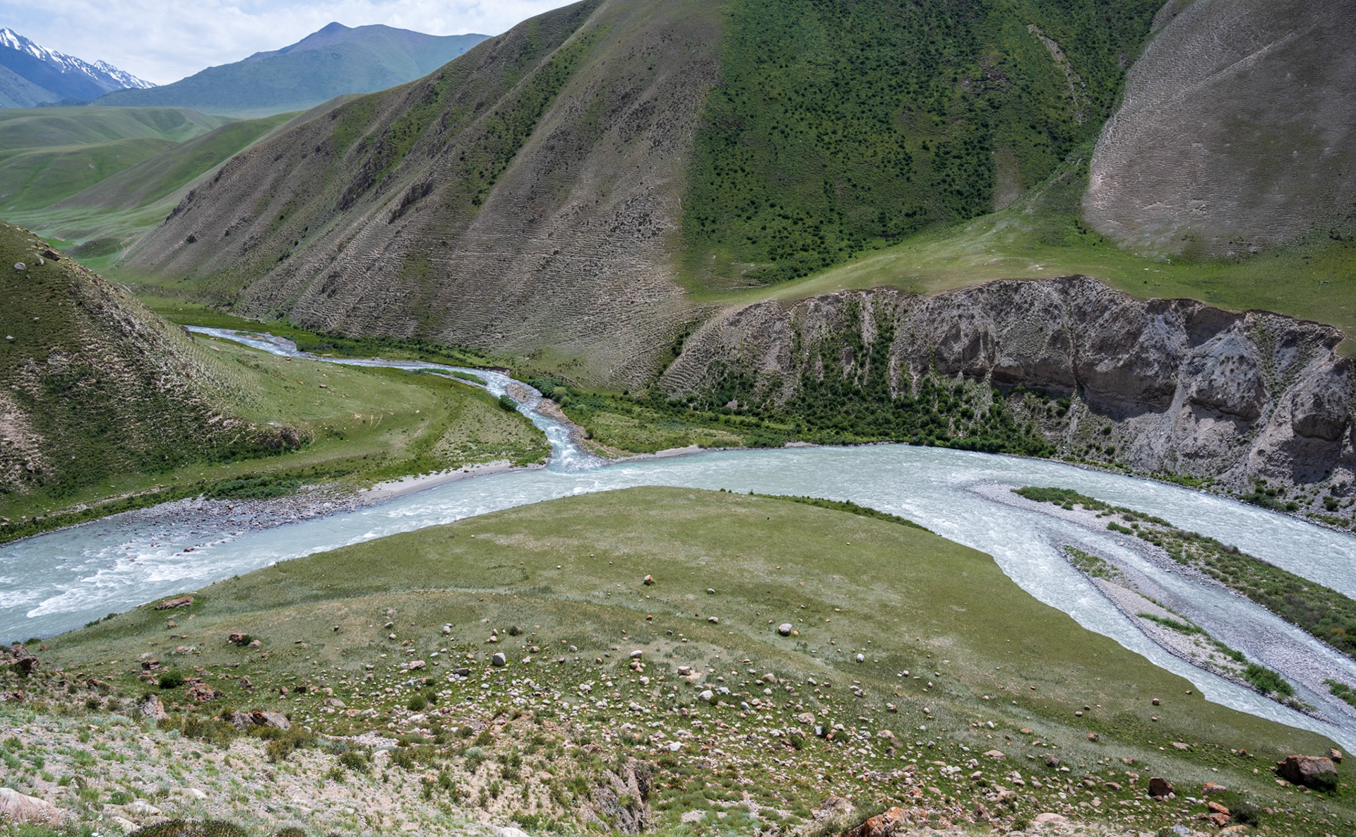
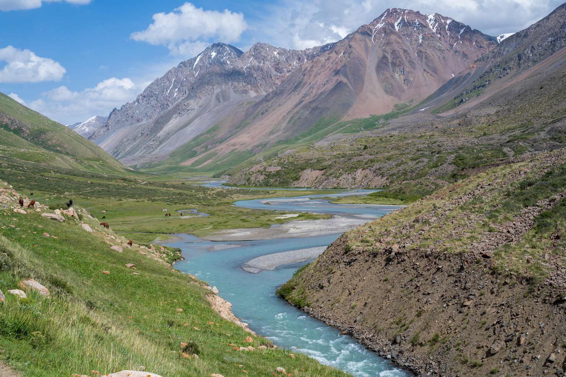
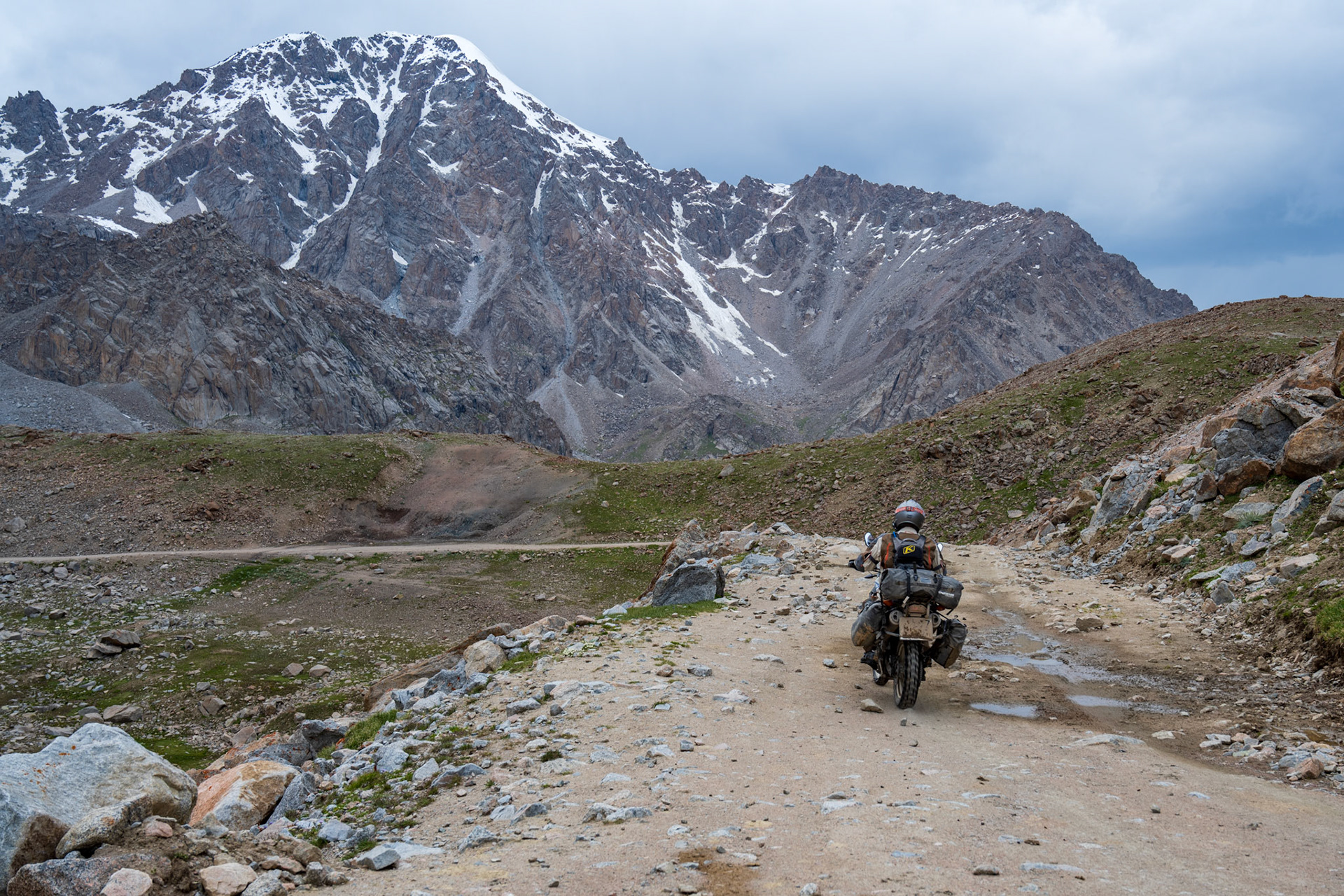
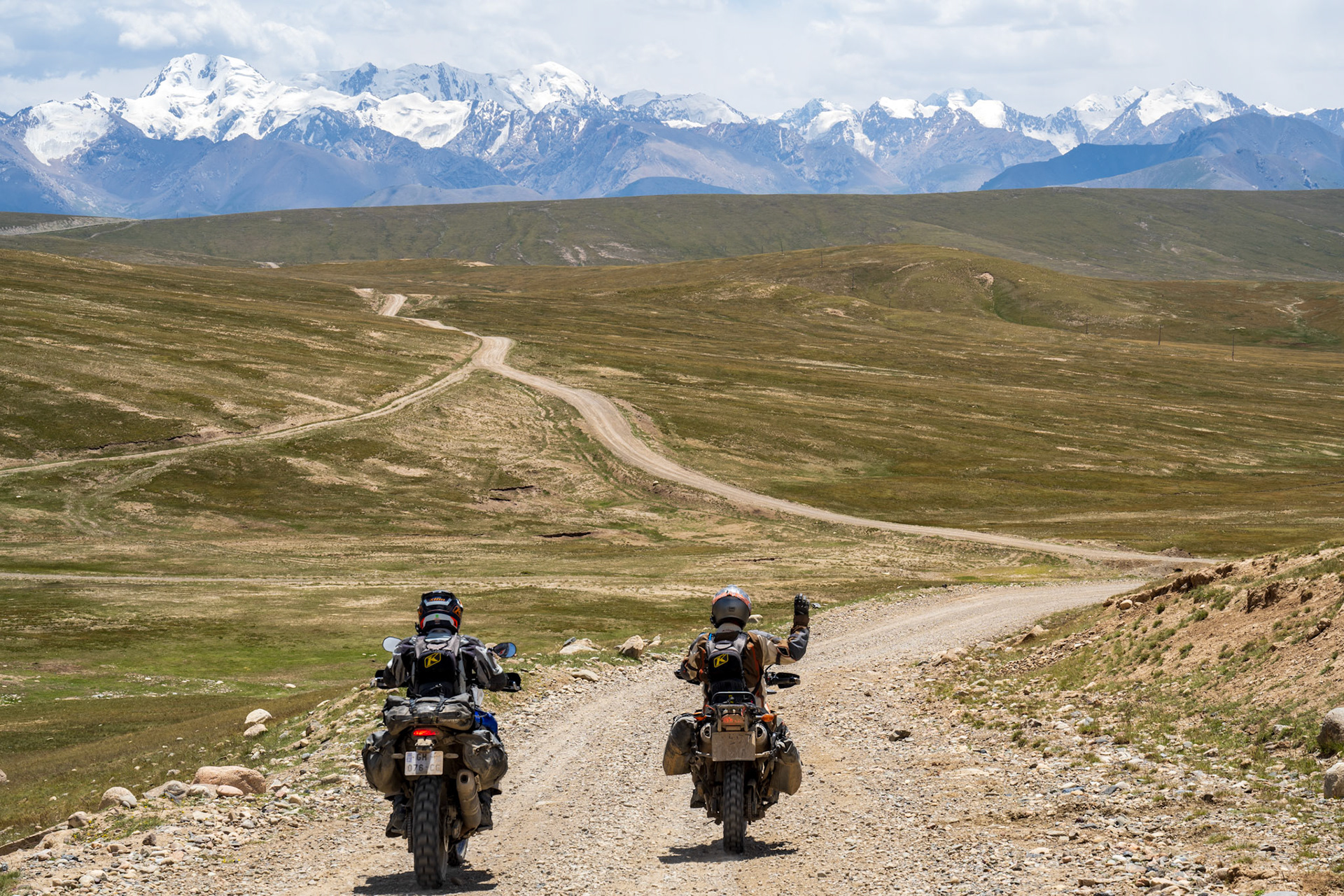
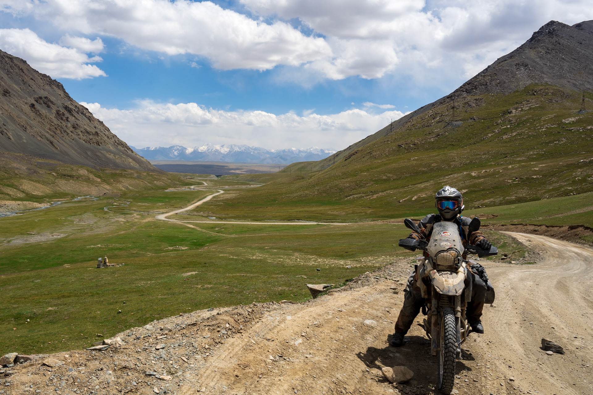
Leaving Osh was as unpleasant as ever. After about an hour of riding, the rain started. Not long after passing Jalal-Abad, we turned onto a dirt road leading us over the Kaldamo Pass at 3,000 meters (9,850 feet). This road had been abandoned for some time due to the construction of a tunnel for the new main road.
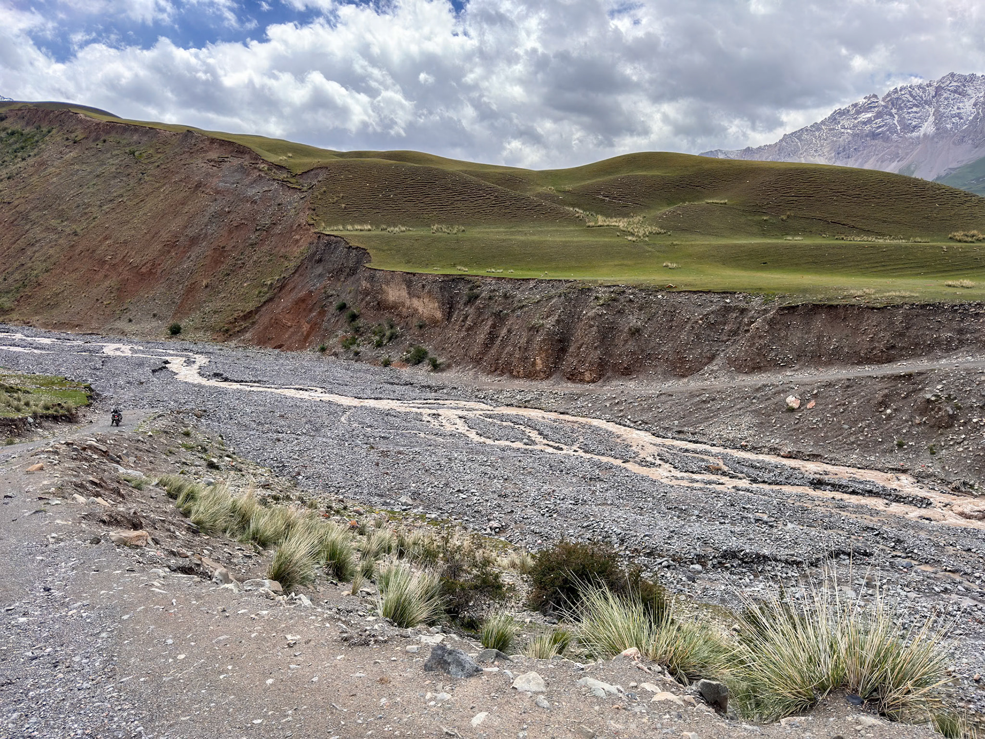
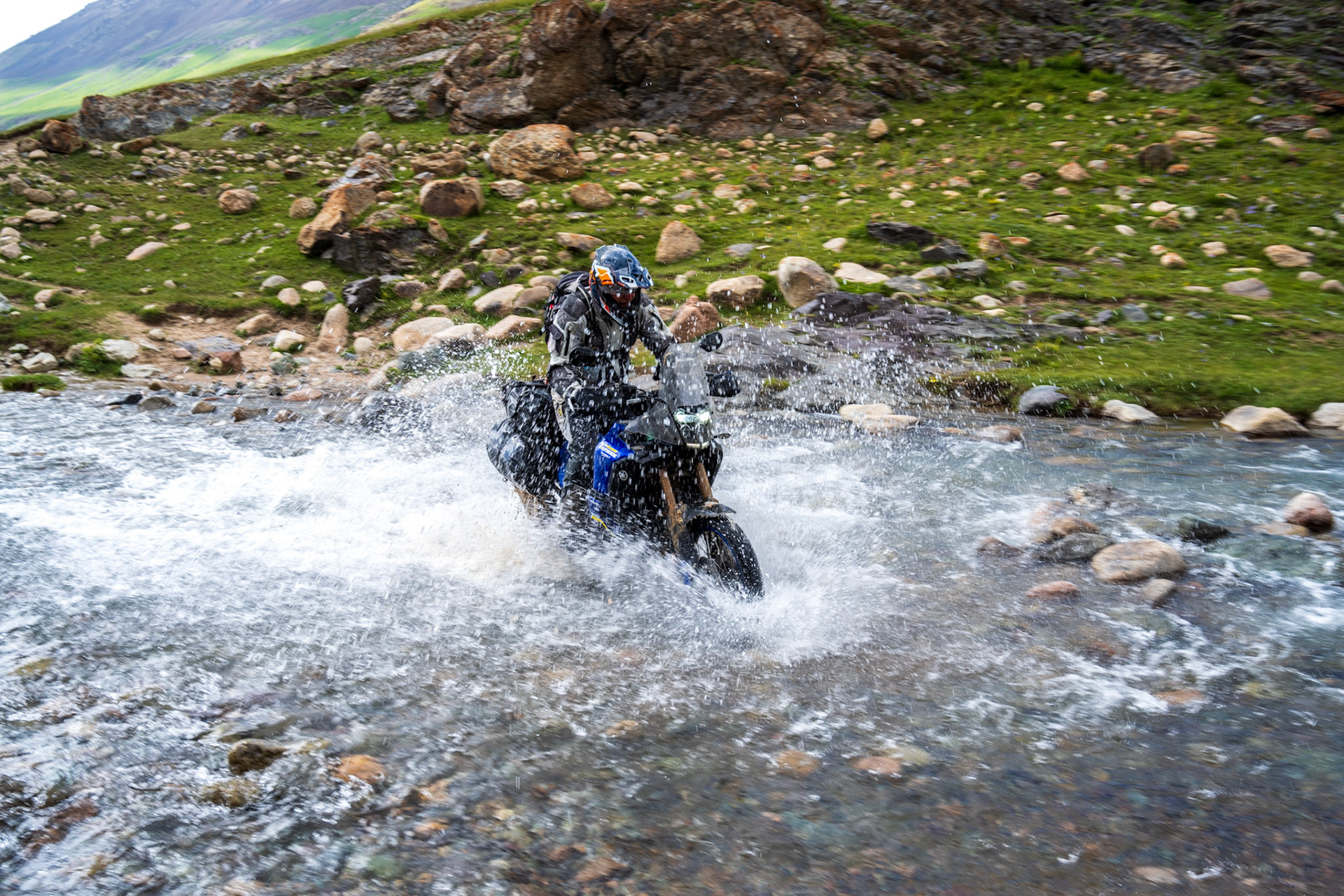
Initially, the dirt road was in decent shape, but as we began our ascent, we encountered numerous washouts requiring tricky maneuvering through water and rocks. The sky was overcast and quite dark, but we managed to avoid the rain. At just below 2,900 meters, we entered the clouds, making visibility difficult. Some switchbacks finally took us out of the clouds.
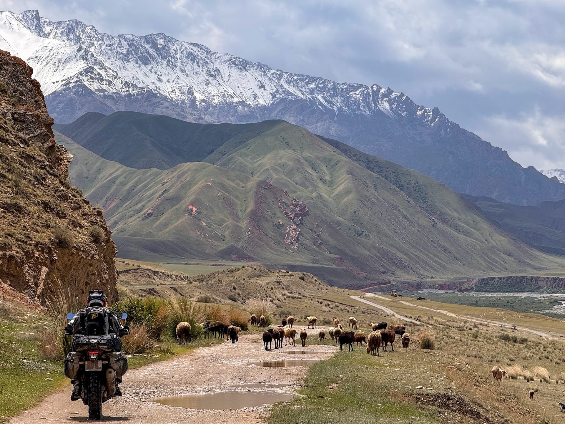
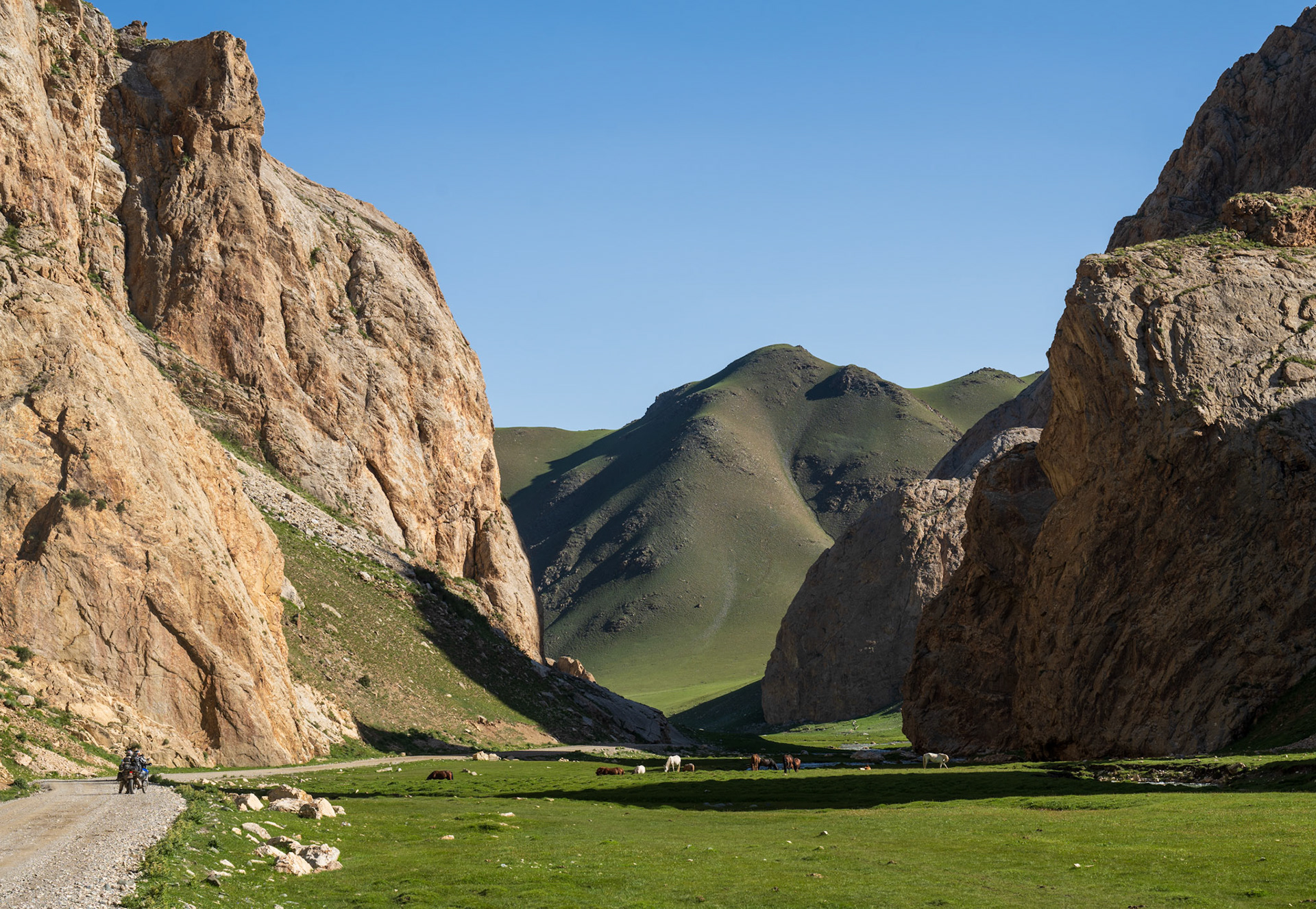
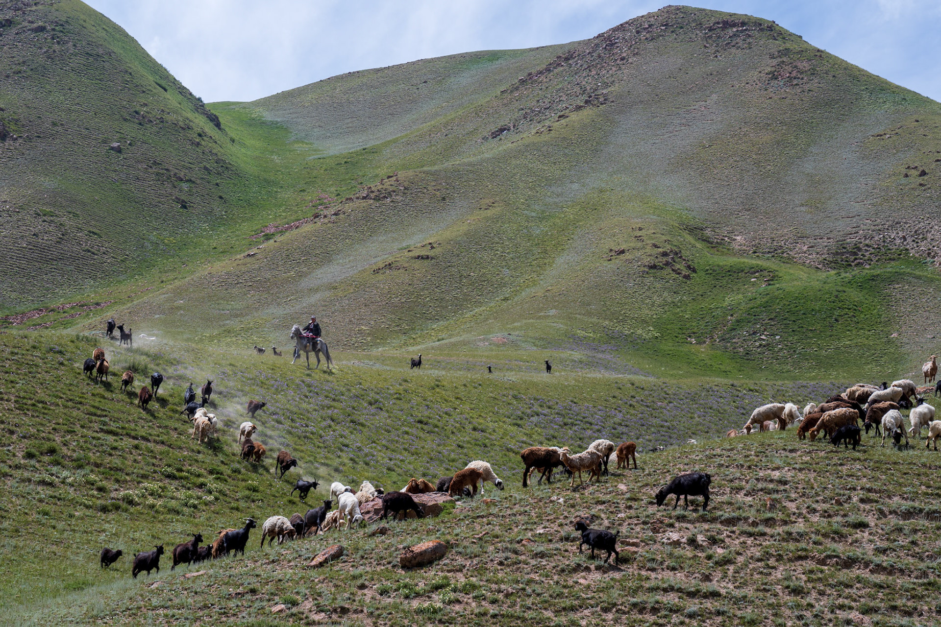
On our descent, we passed a few yurt camps where the inhabitants lived a precarious life.
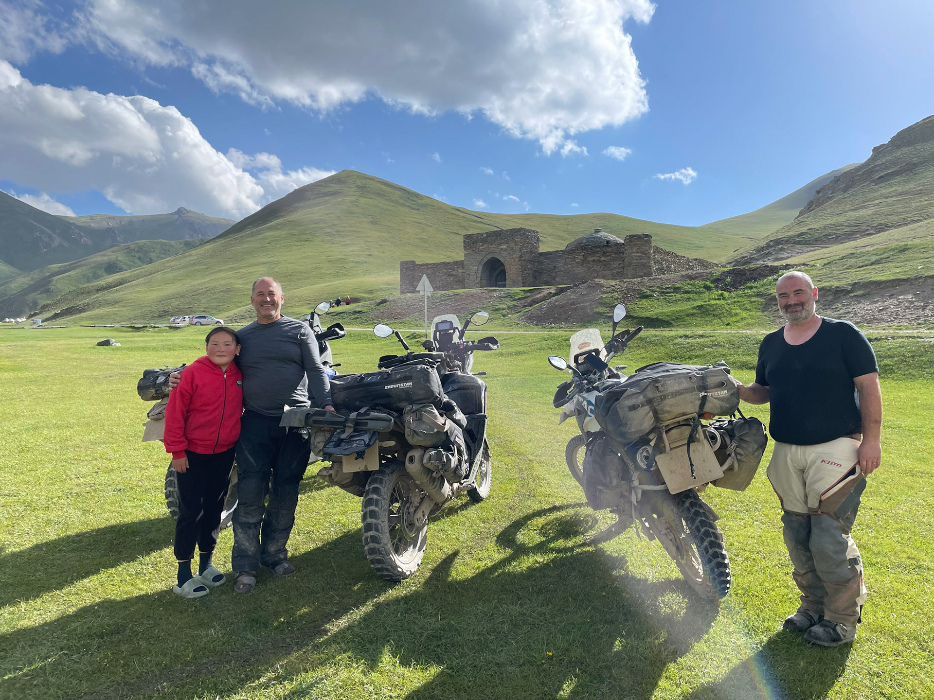
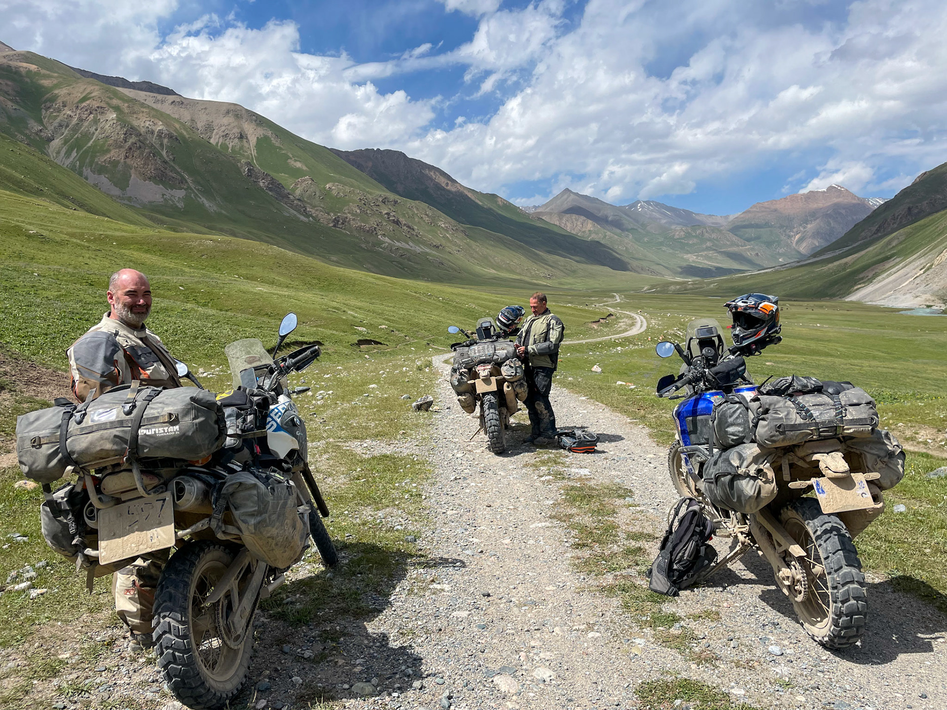
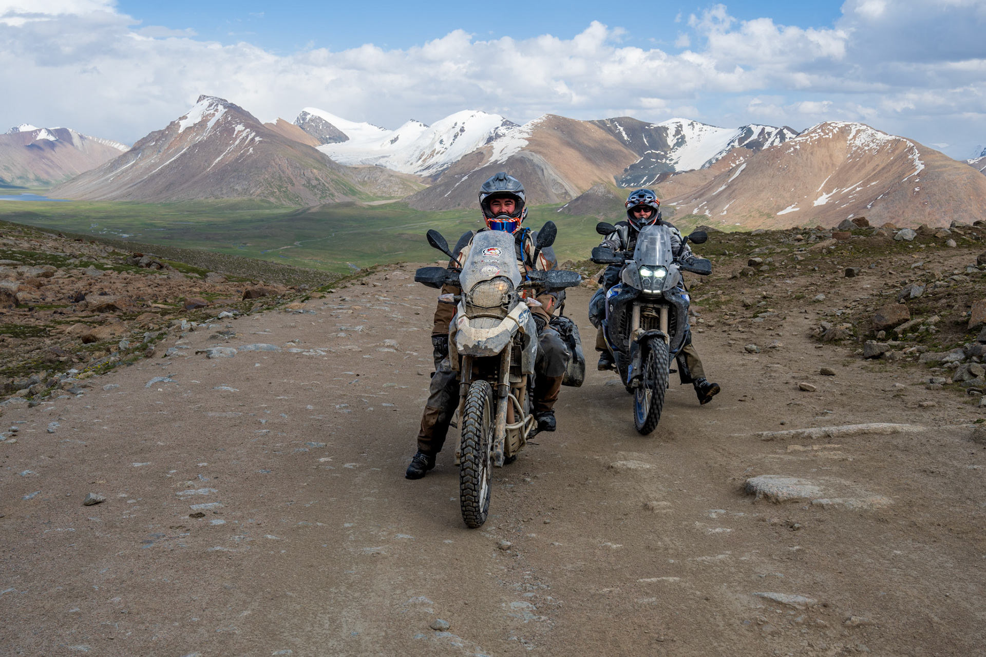
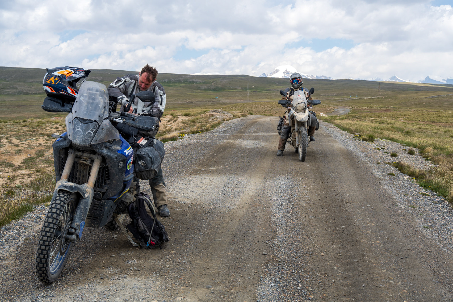
We met Vincent at the guesthouse in Kazarman where he had been staying. I’m incredibly proud of my nephew, who, just three hours after spending the night on a plane, jumped on a motorcycle he had never ridden before and navigated solo on bad roads and dirt trails! It feels great to be the three of us again, just like when we started the trip last year.
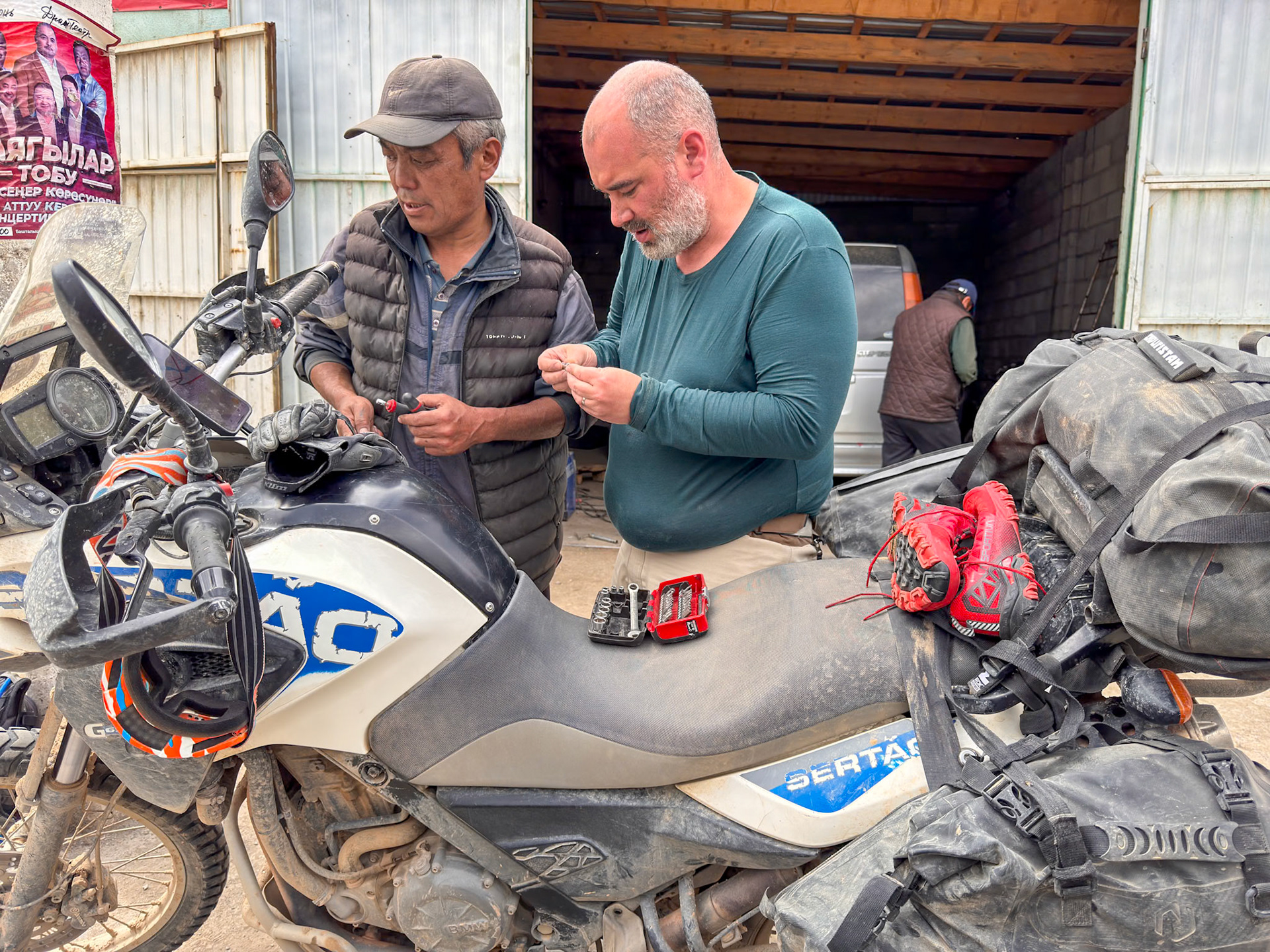
We quickly changed into our street clothes and headed to the garage Vincent had located to install the rear tire I brought for his bike.
With everything set, it was time to celebrate our reunion in this peculiar Soviet-style town.
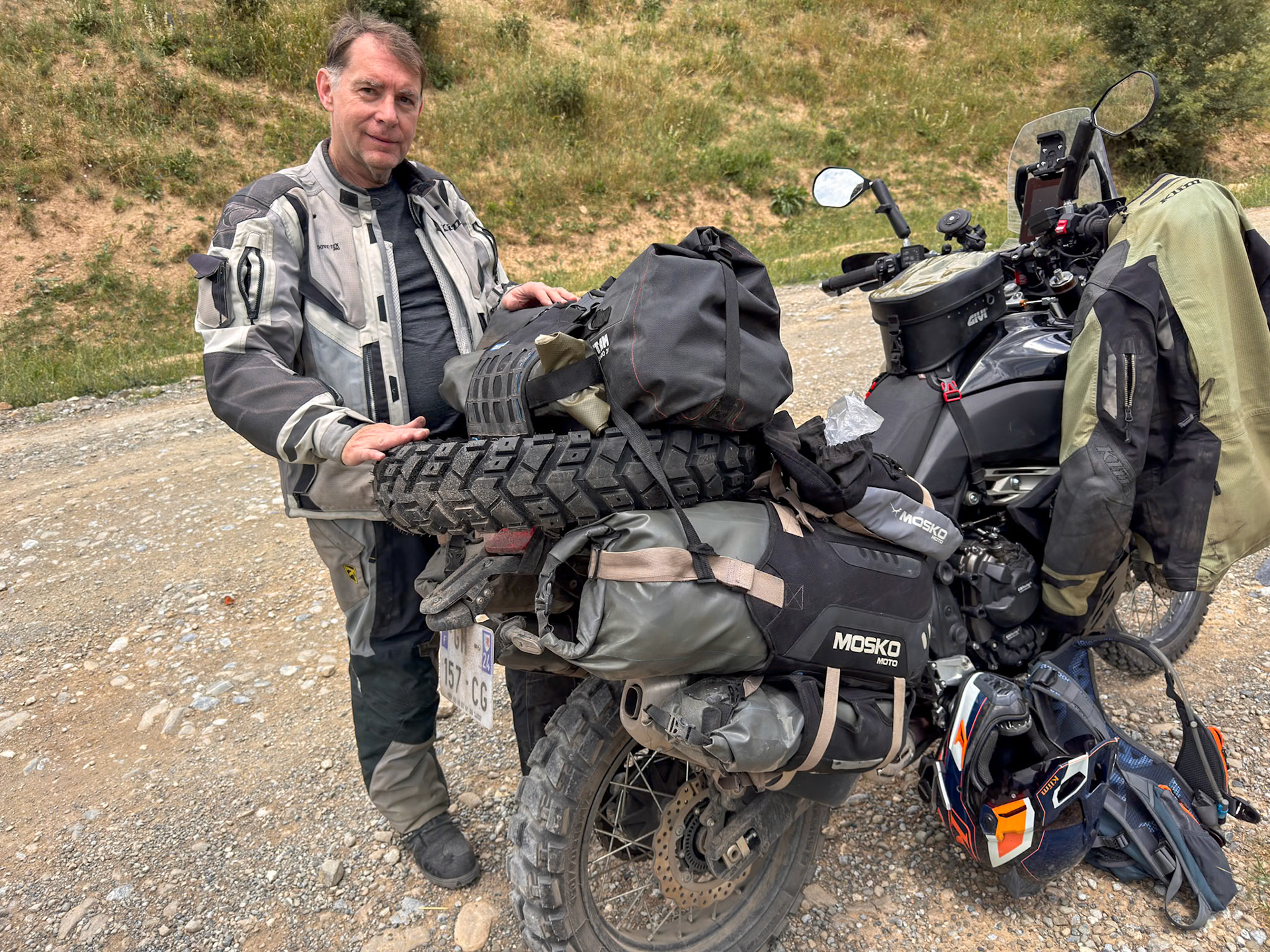
It’s always cumbersome to carry a tire on a motorcycle and all the rocks of the dirt road did not help
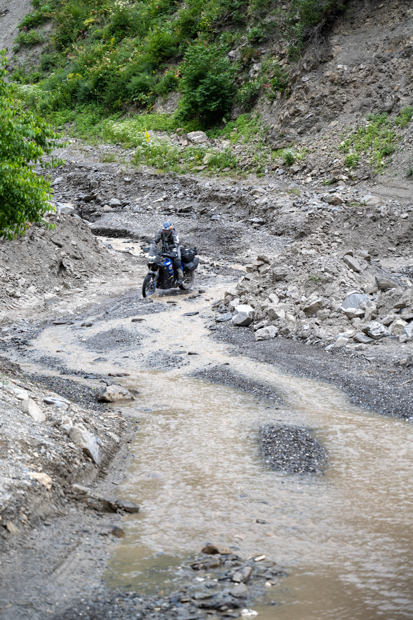
A few times we wondered if the road was actually going through!
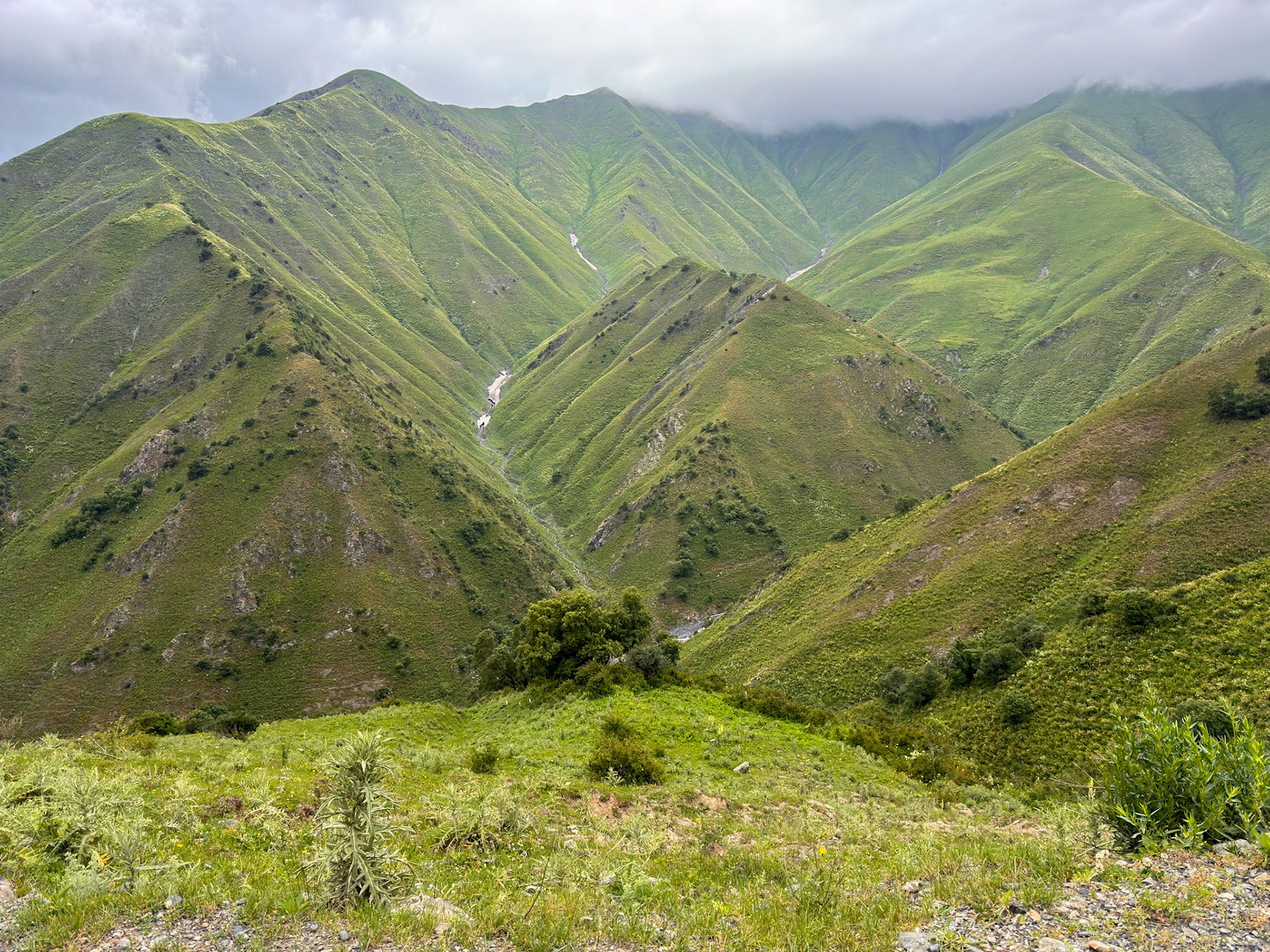
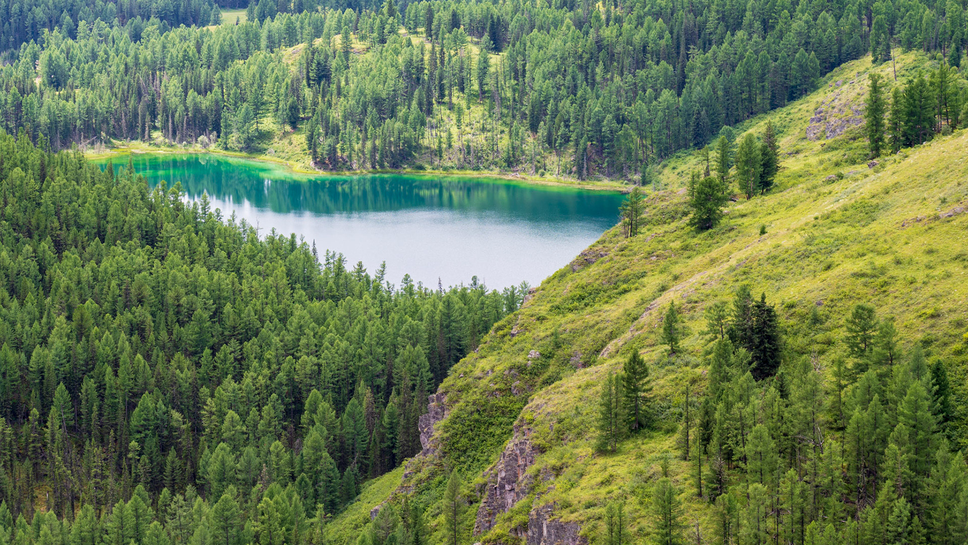
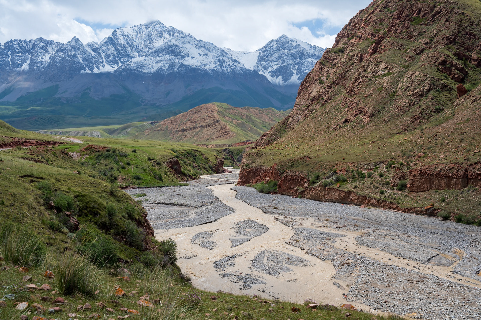
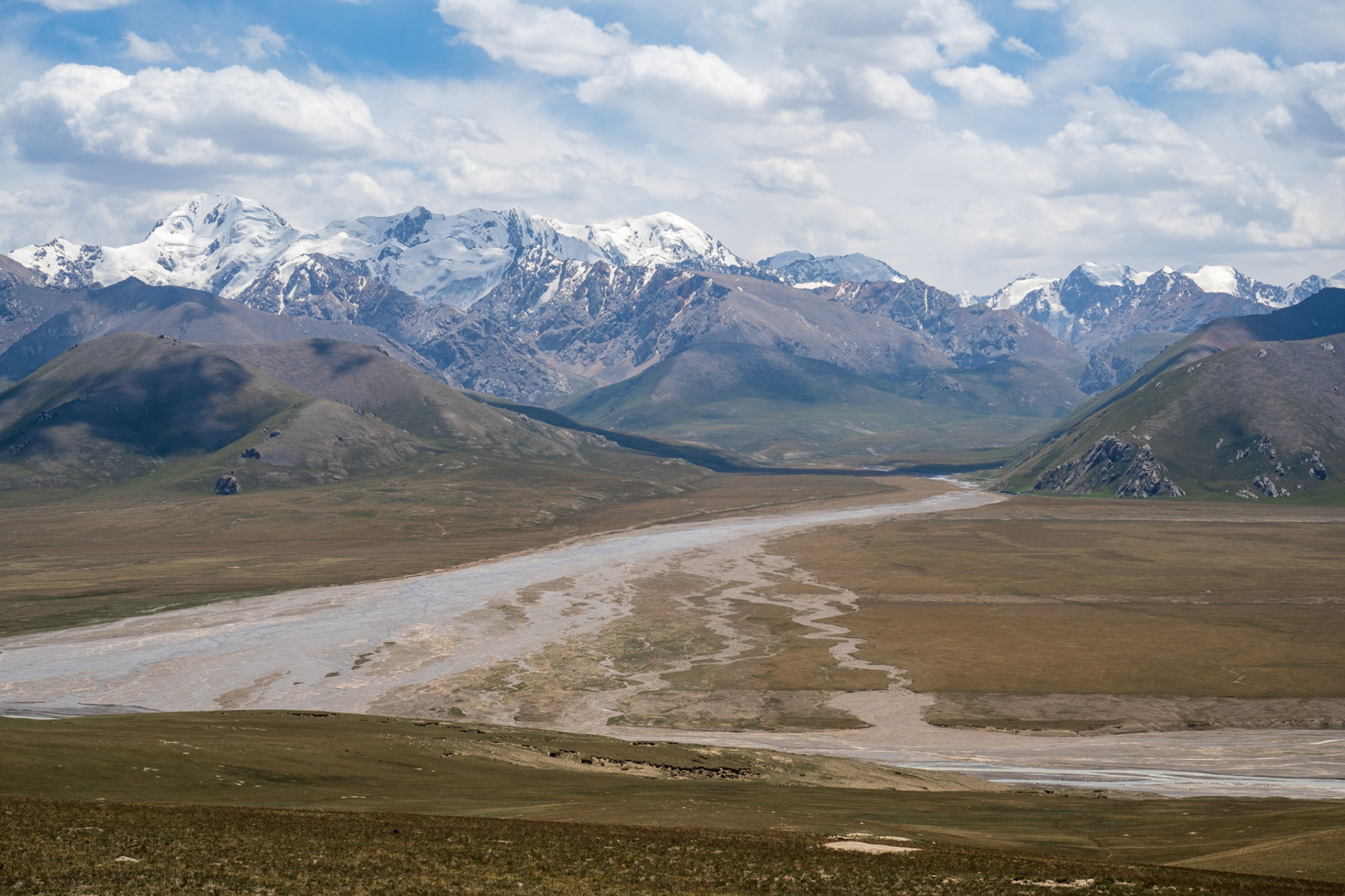
Beautiful scenery as long as we stayed below the clouds
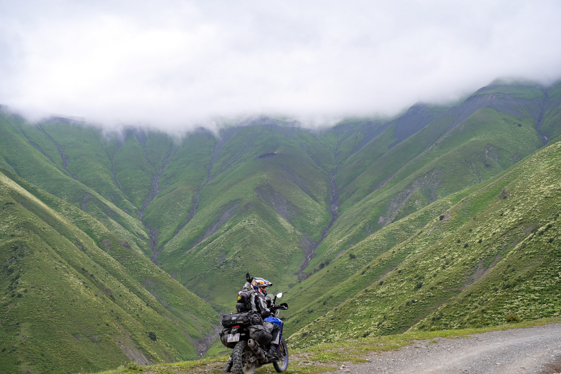
Dirk showing the way
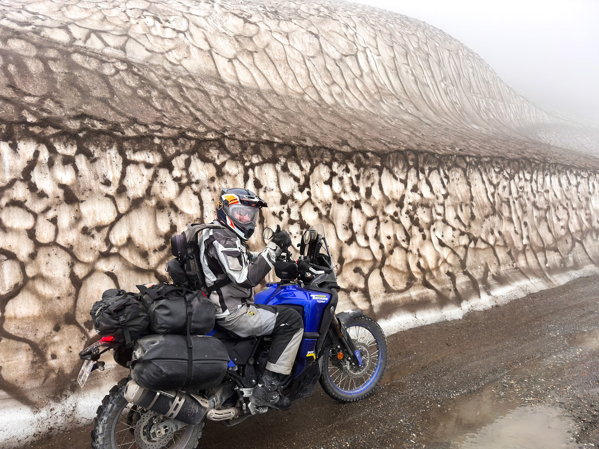
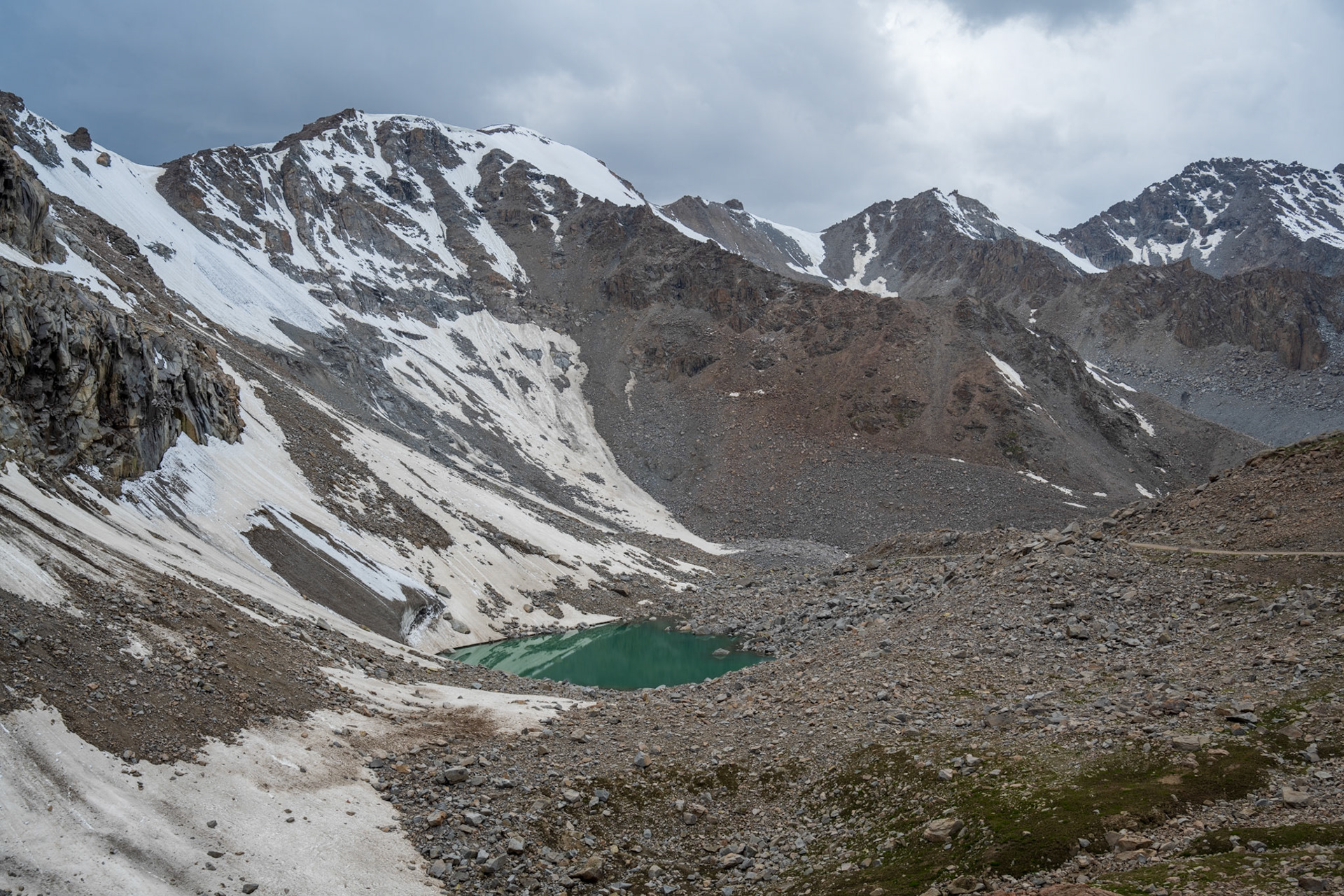
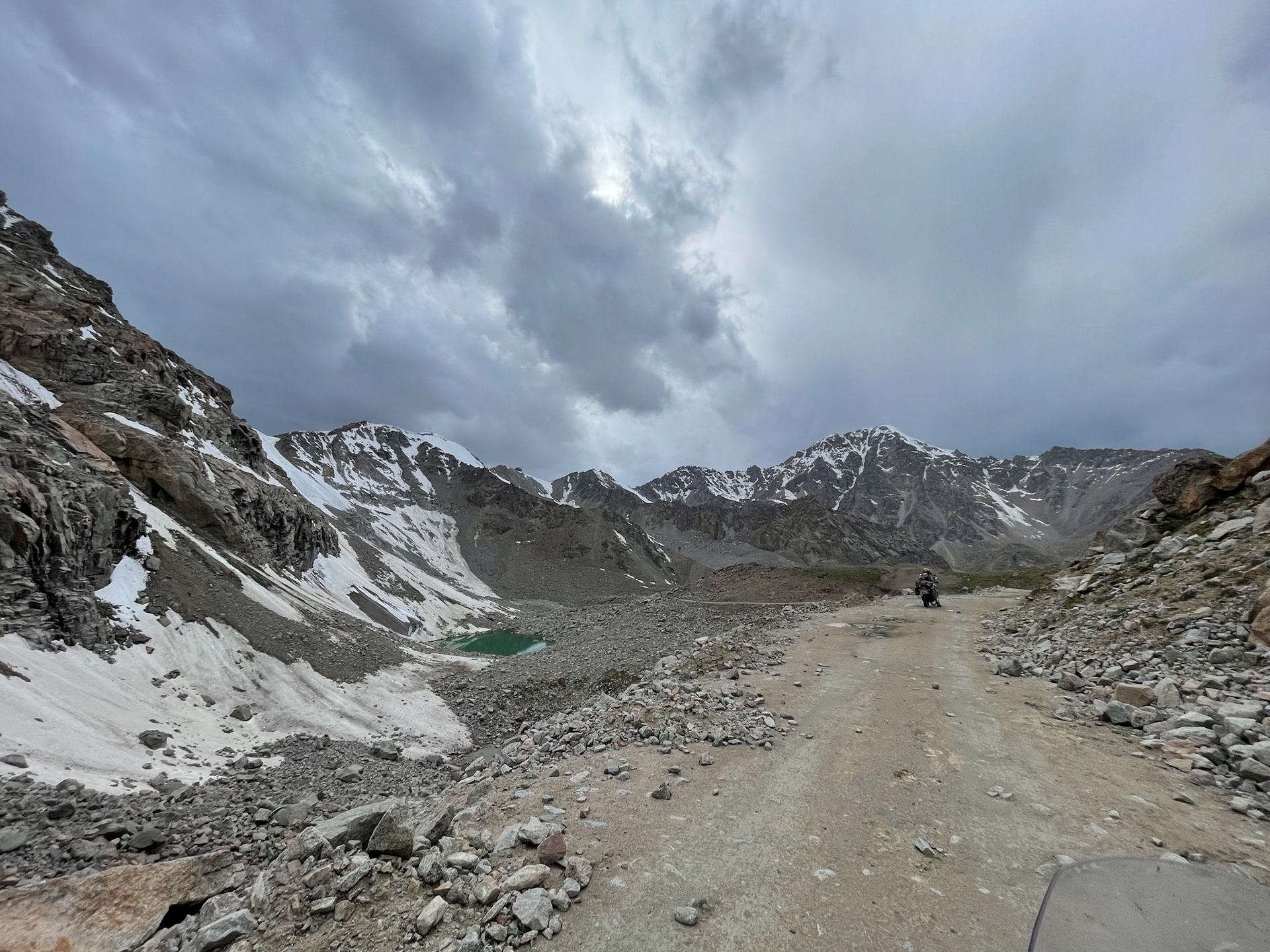
At the summit, there is still a wall of snow
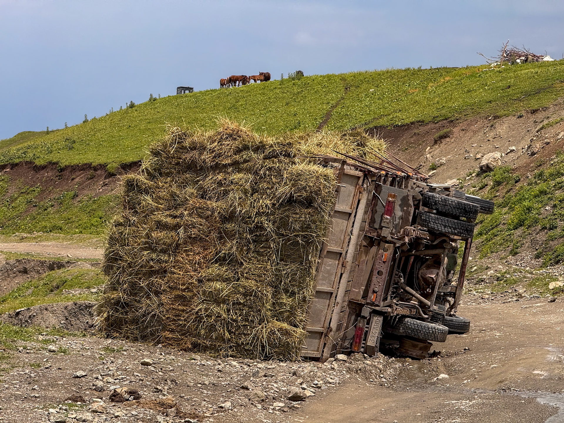
Unlike this truck we managed to keep the rubber down 🤞🏻
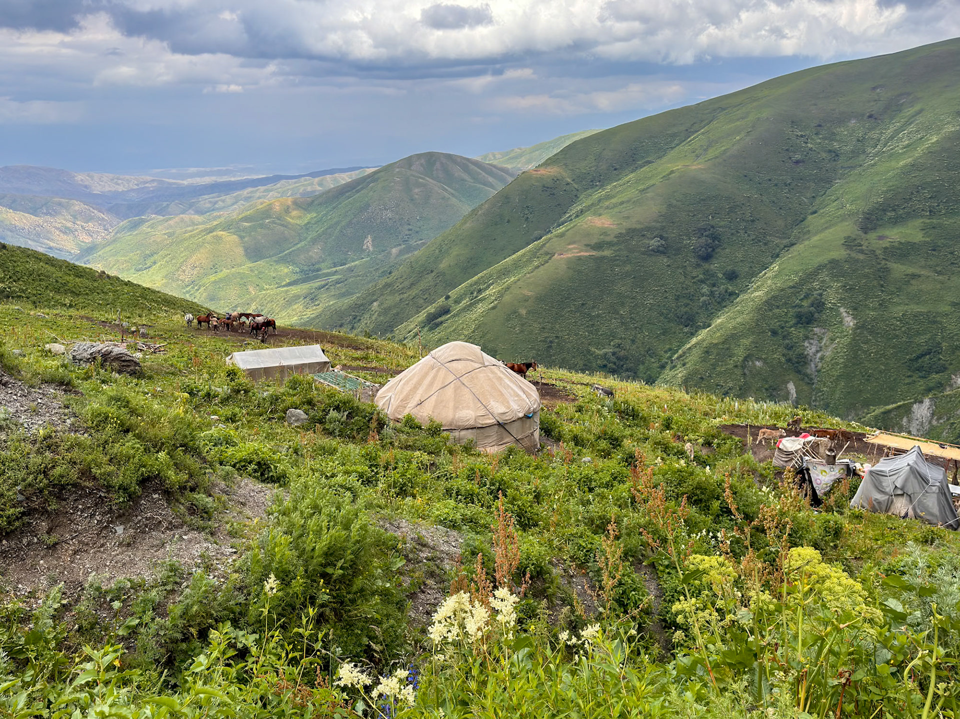
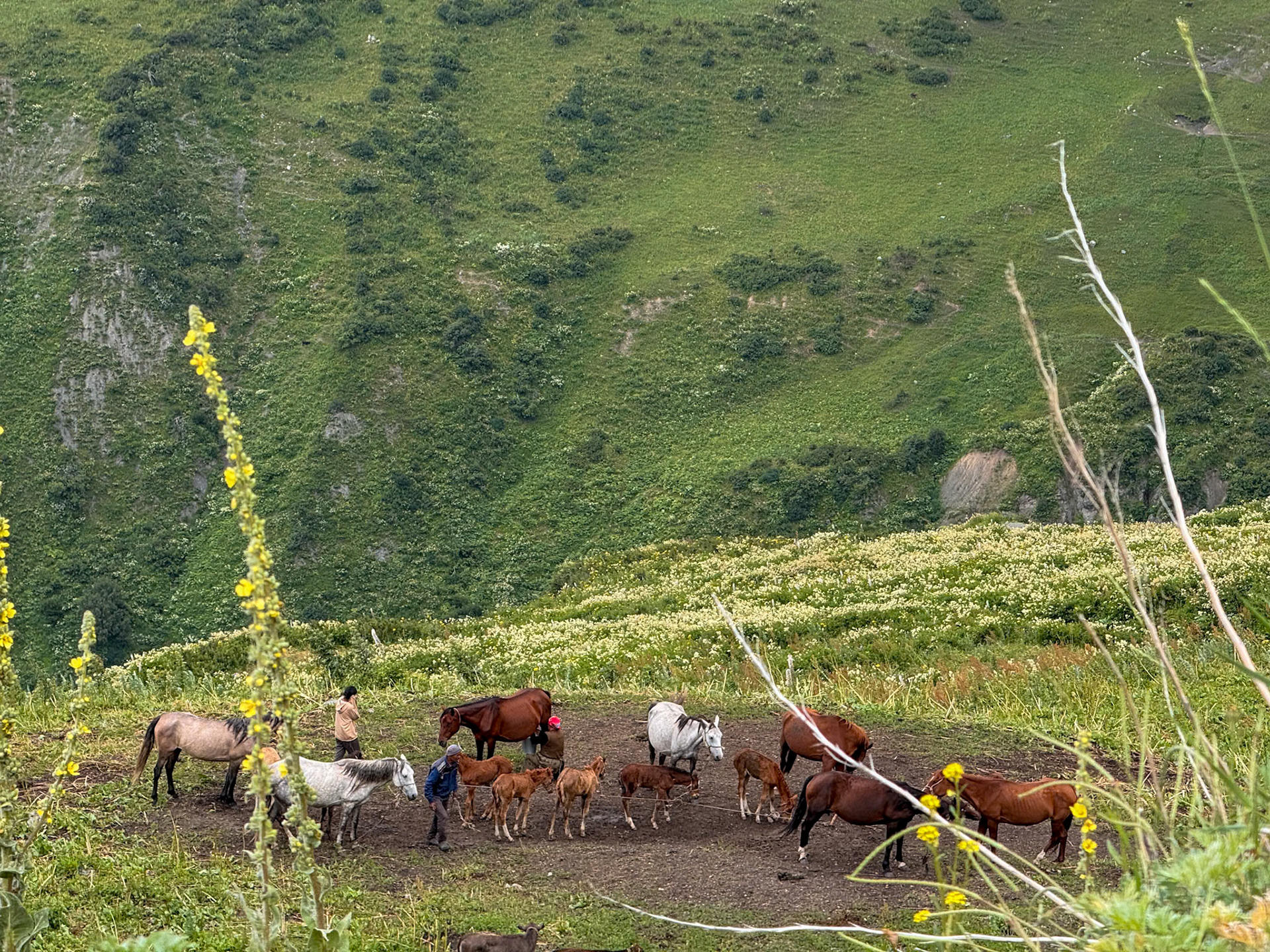
In the middle of nowhere, with no facilities of any kind, a family lives from a few horses
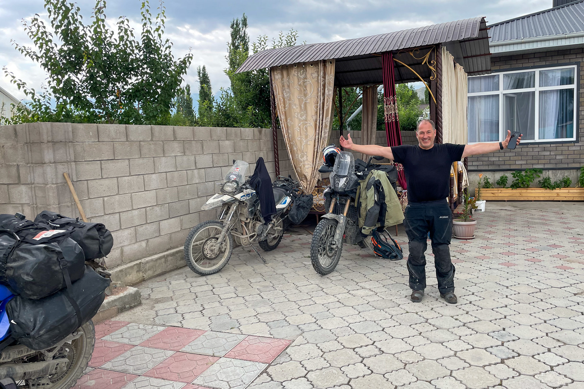
Reuniting with Vincent, at his homestay
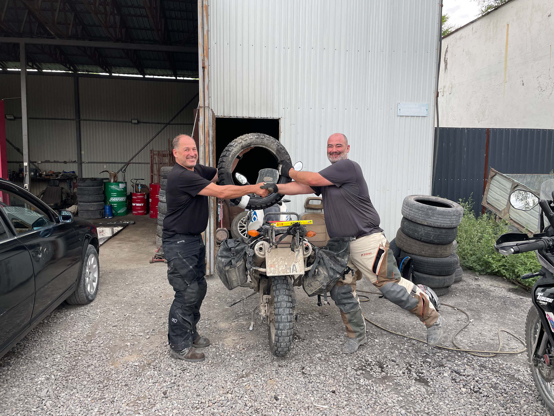
New tire to the rescue 😄
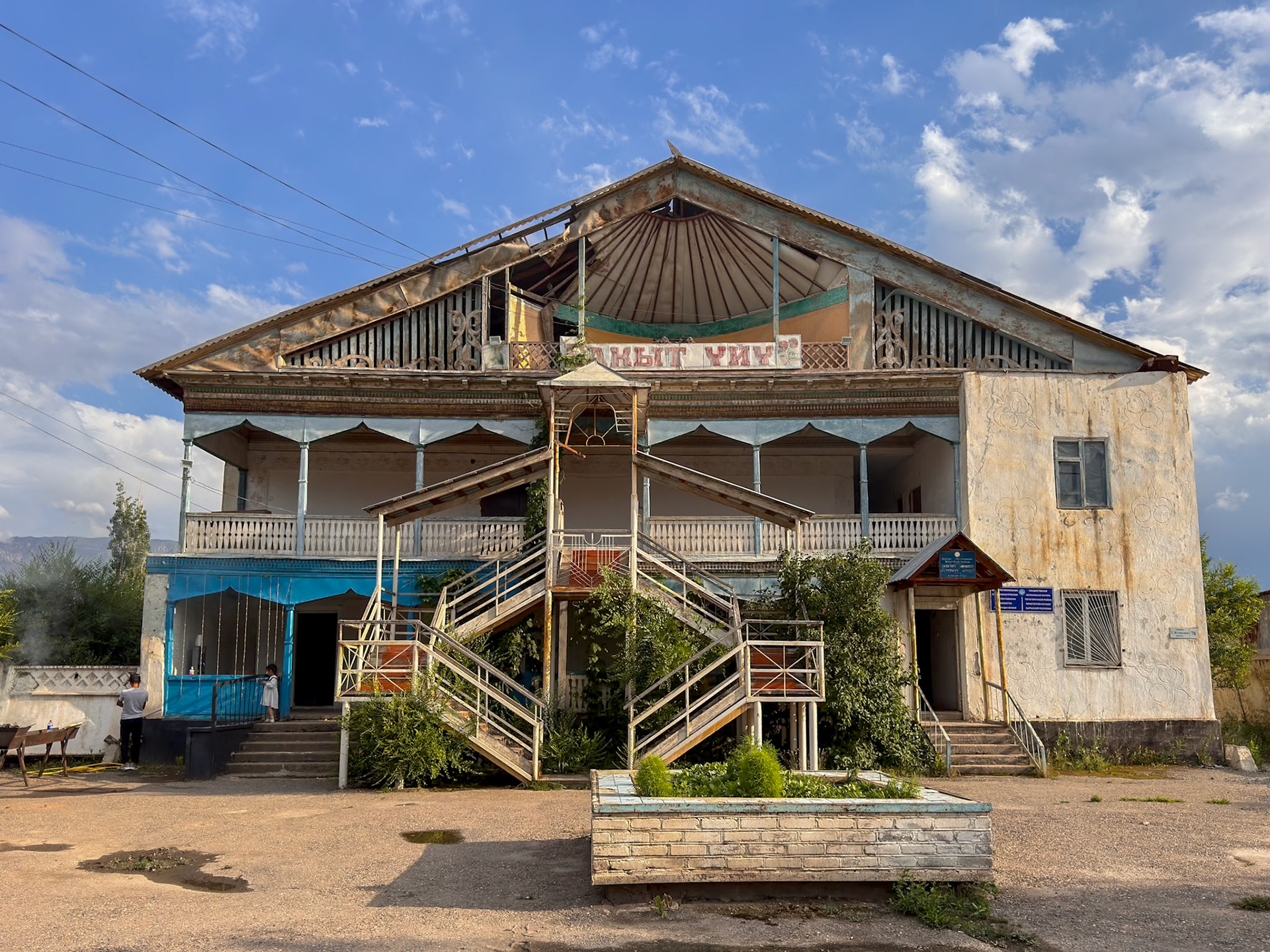
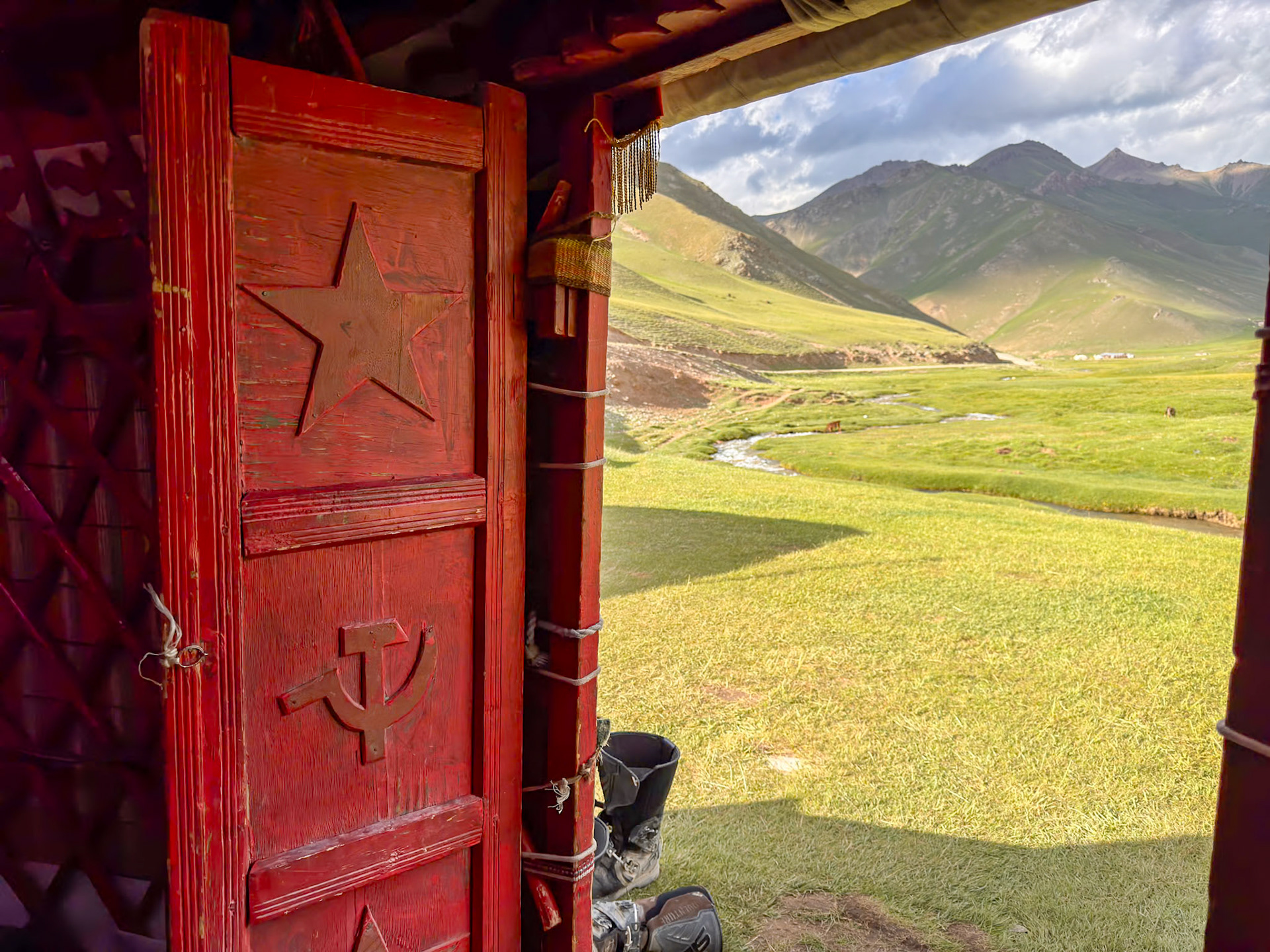
One of the strange buildings of this rundown town
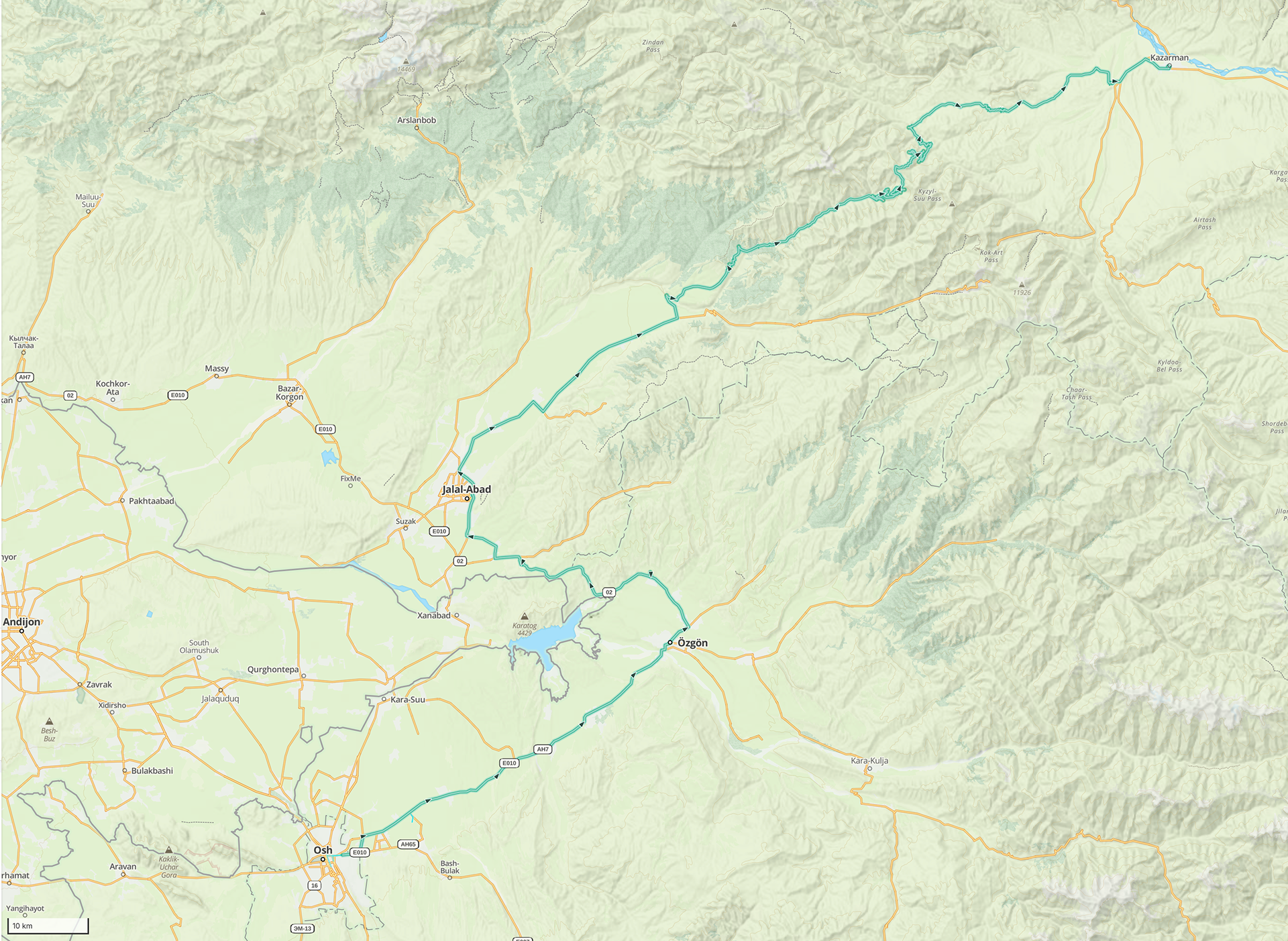
Day 68 - 255 km
Day 69a - Kazarman to Tash Rabat
This morning, I have mixed feelings. On one hand, I’m very excited because we’re heading to Tash Rabat, the most beautiful caravanserai I've heard of. On the other hand, I’m a bit anxious as it’s been raining continuously, making everything muddy, and I’m not sure if the dirt trails I’ve selected will be passable.
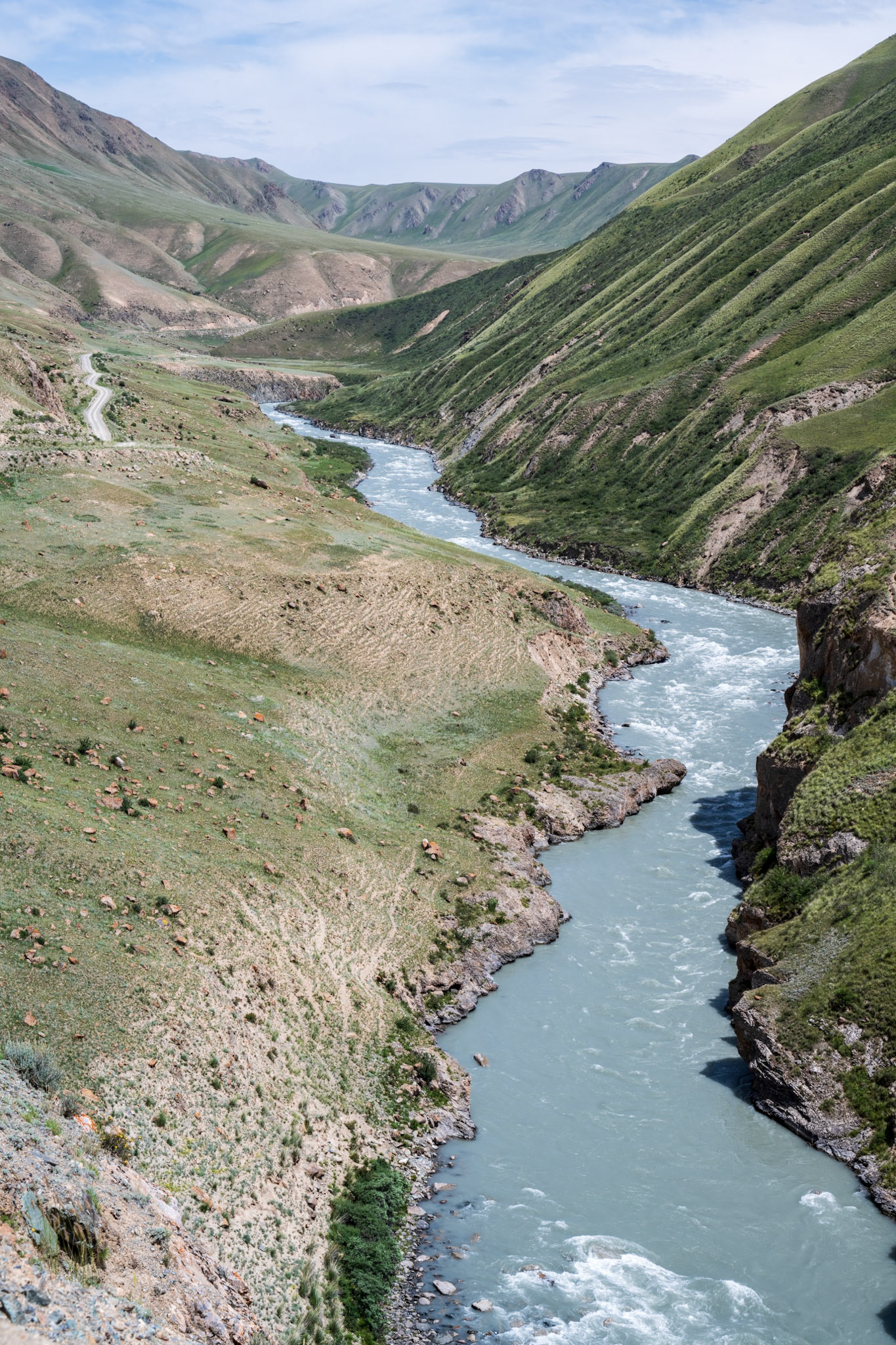
The road we started on had quite a few muddy sections where dirt was washed down from the hills. There was a particularly bad stretch just before our first set of switchbacks, covered in deep mud and resembling quicksand in parts.
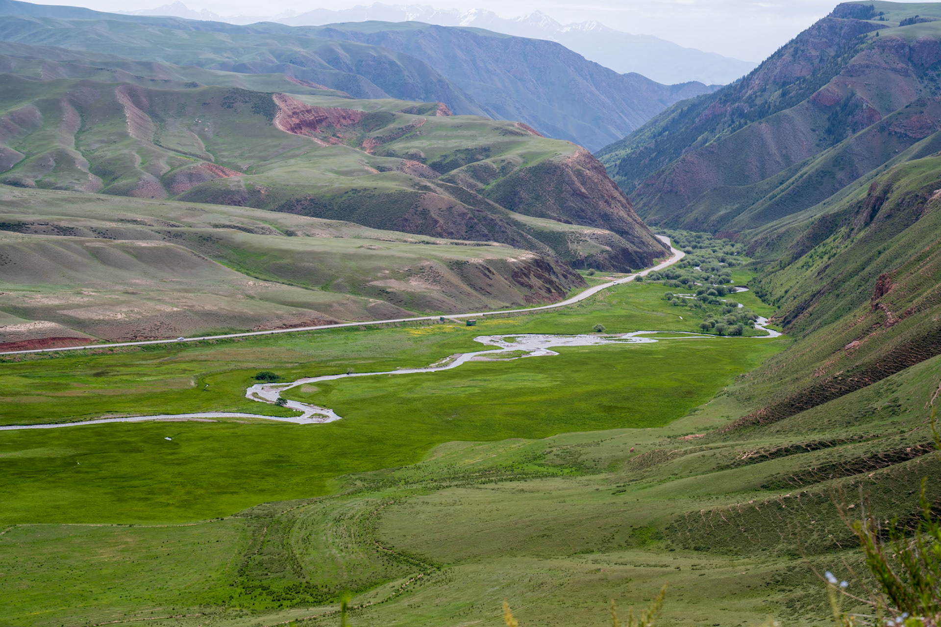
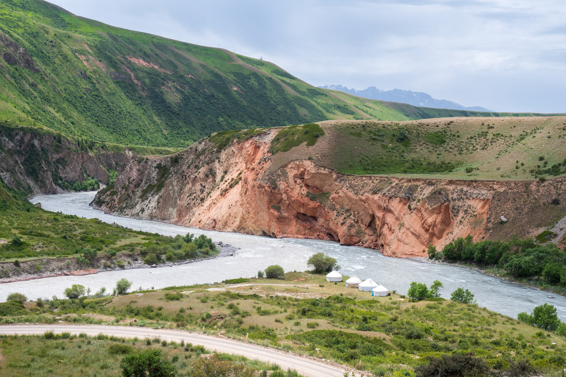
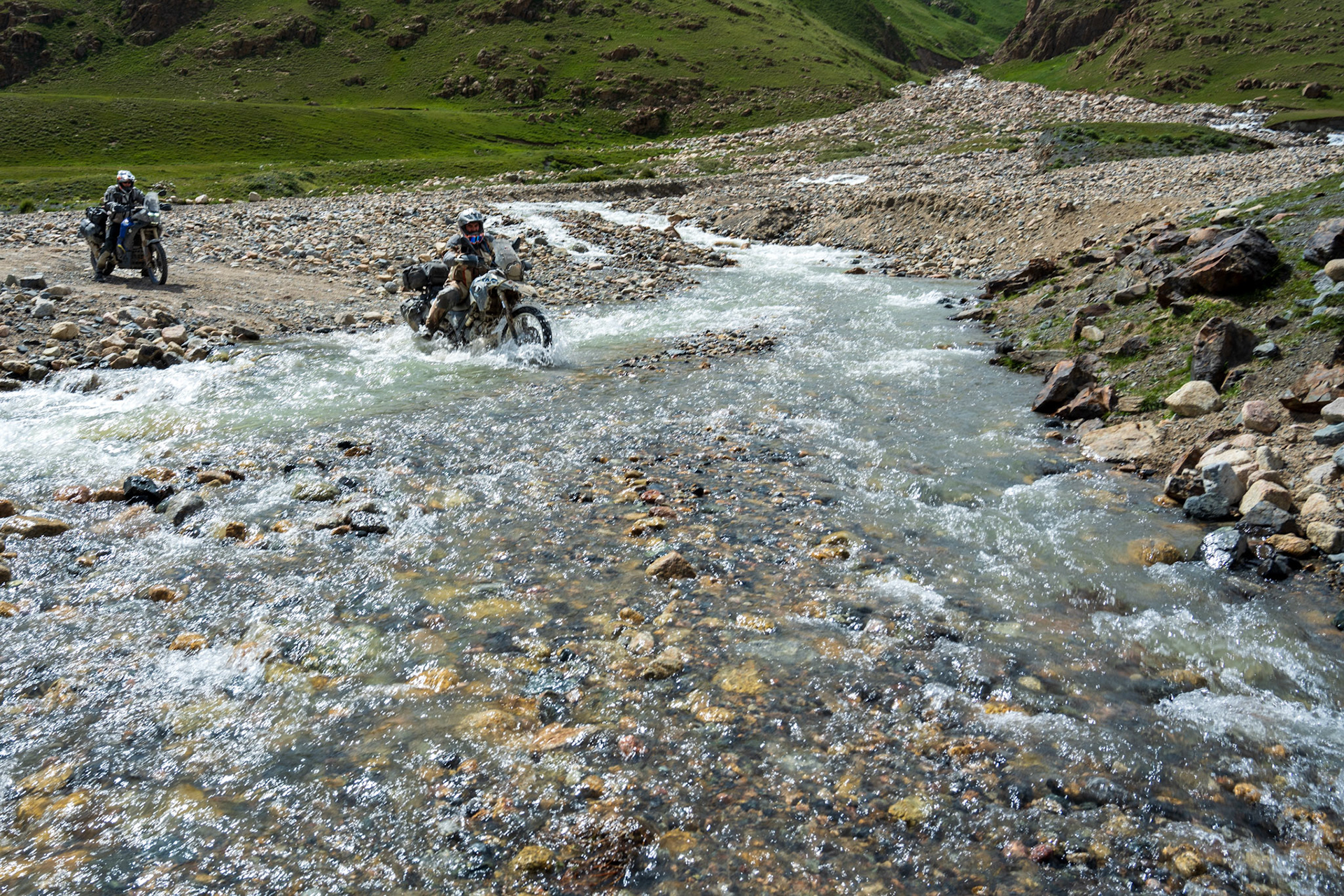
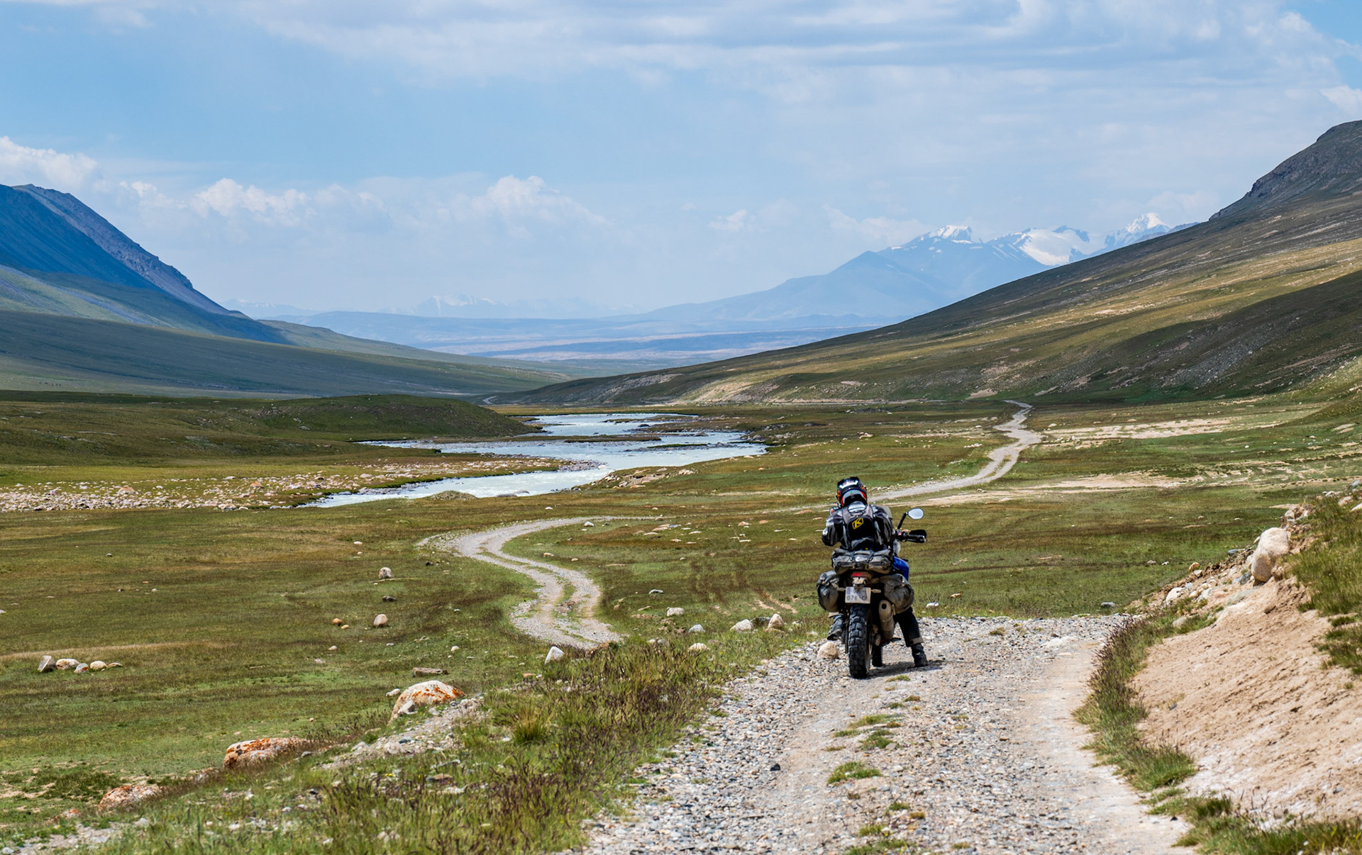
Once we got past all the trucks, likely coming and going from a mine in the hills, the route south became much nicer until we reached a big river crossing. We spent some time trying to find a way across but realized there was no way to get three fully loaded bikes to the other side of the river.
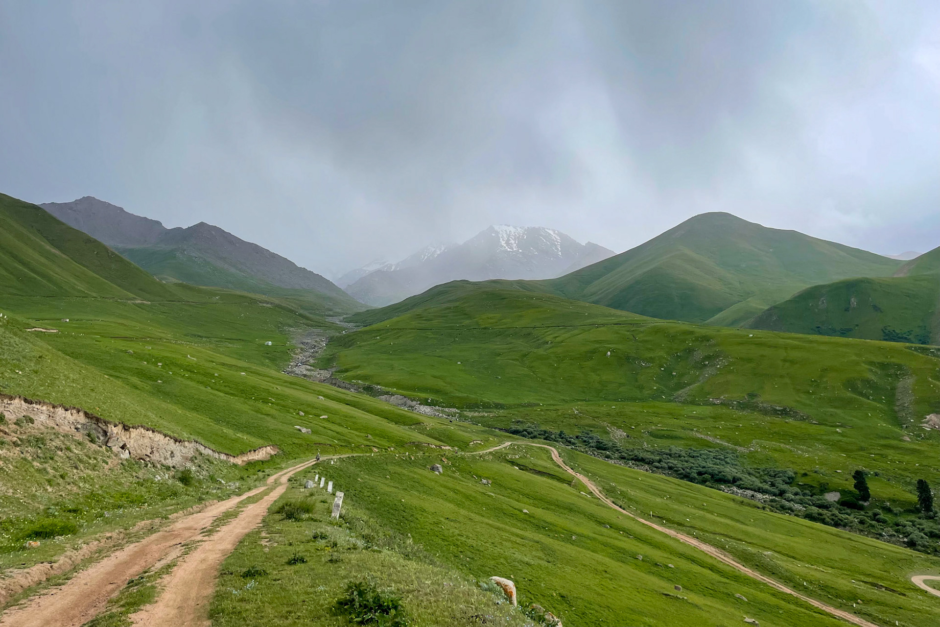
We backtracked a bit and took an alternate route towards Tash Rabat. This new route, suggested by a Kyrgyzstan guide, took us over a beautiful mountain pass and into a series of stunning valleys on the other side.
The journey was beautiful, though it seemed endless at times, until Tash Rabat appeared before us in the sunlight as we rounded the last corner.
This was definitely one of the highlights of the trip, fitting perfectly with our focus on following the old Silk Road.
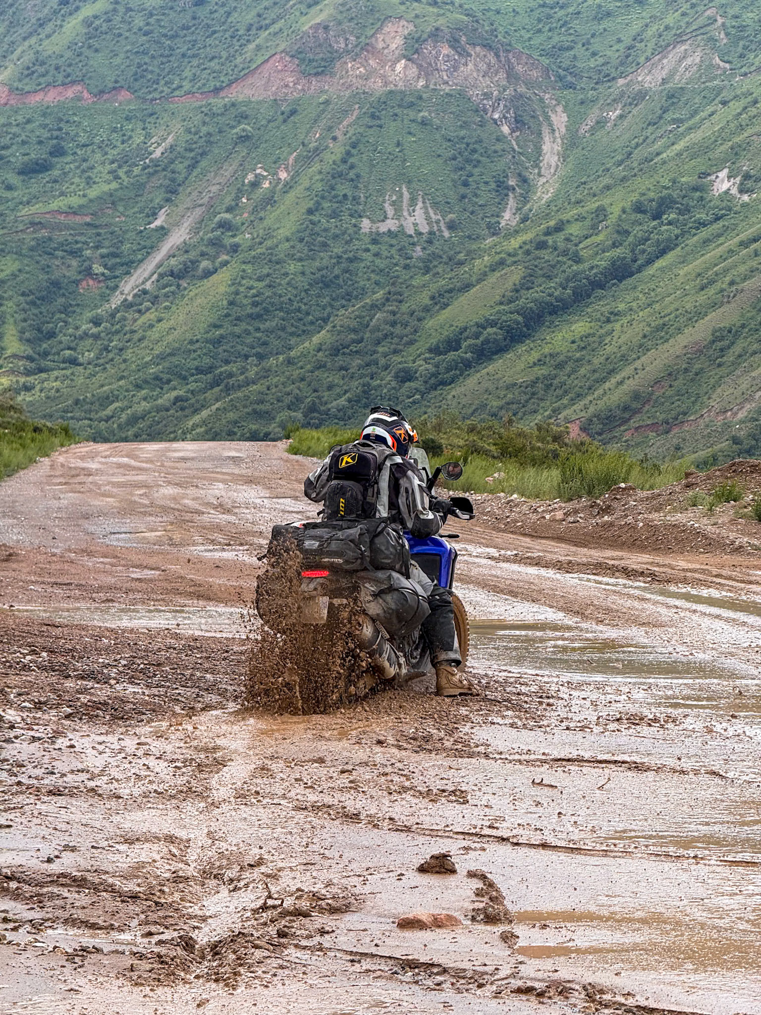
The mud on the road was treacherous and exhausting!
And we had to be cautious with the trucks coming down from a mine in the mountains
Finally, the muddy section was behind us, allowing us to fully enjoy the scenery
The weather clears up but the road is still wet
I absolutely loved the feeling of riding through this section!
The only person we encountered there
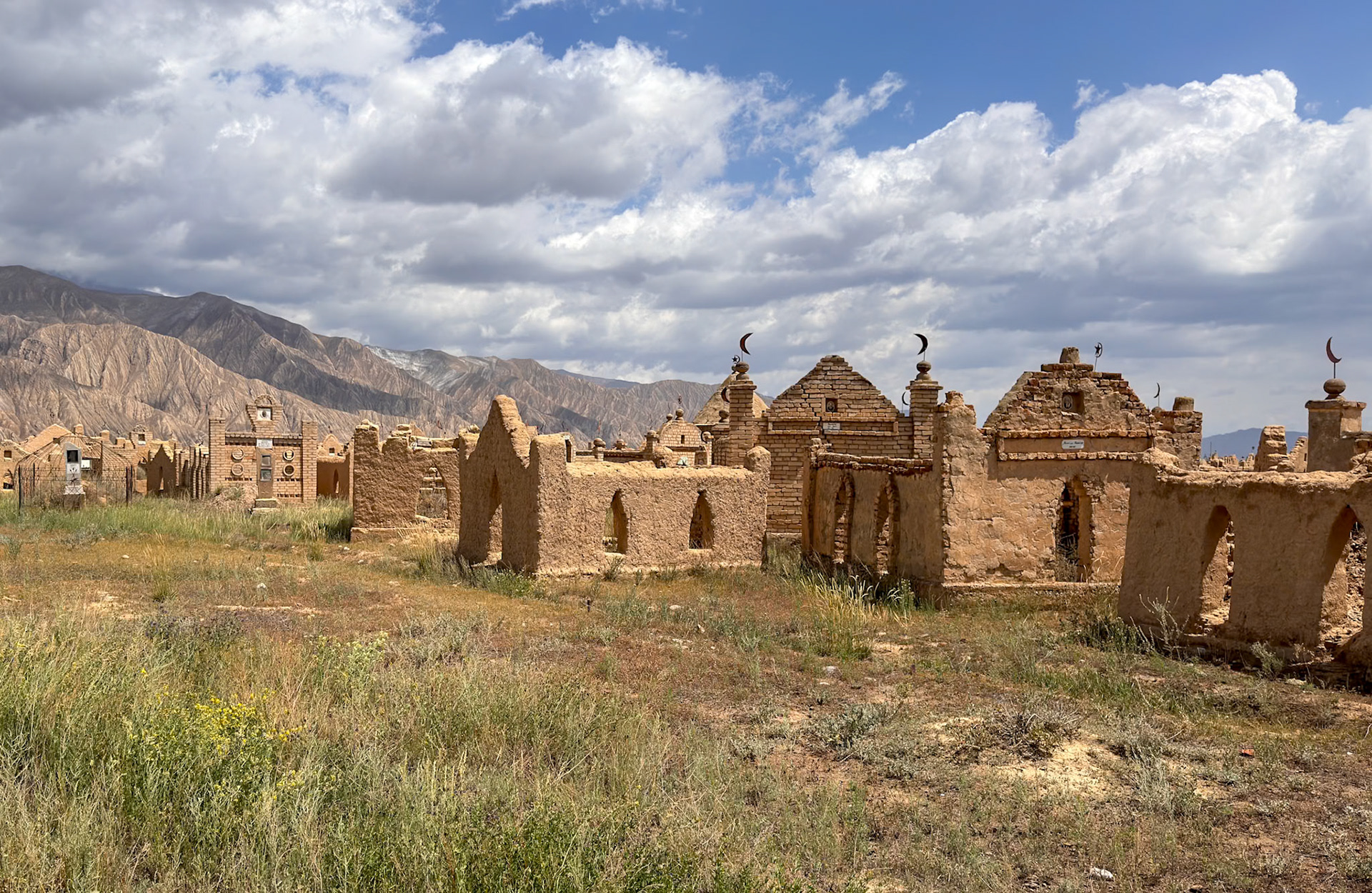
A typical Kyrgyz cemetery, similar to many others we had encountered
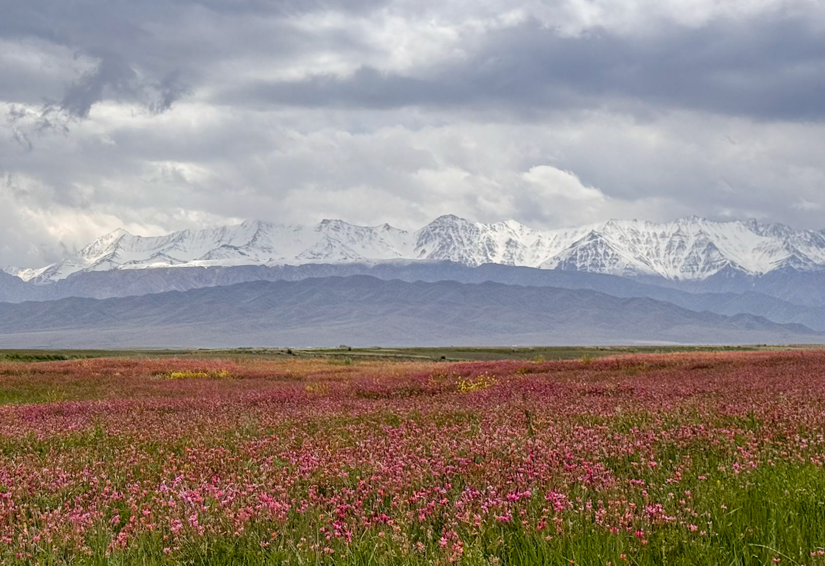
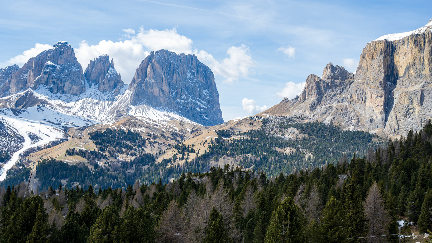
A stunning contrast of blooming flowers and snow-capped mountains!
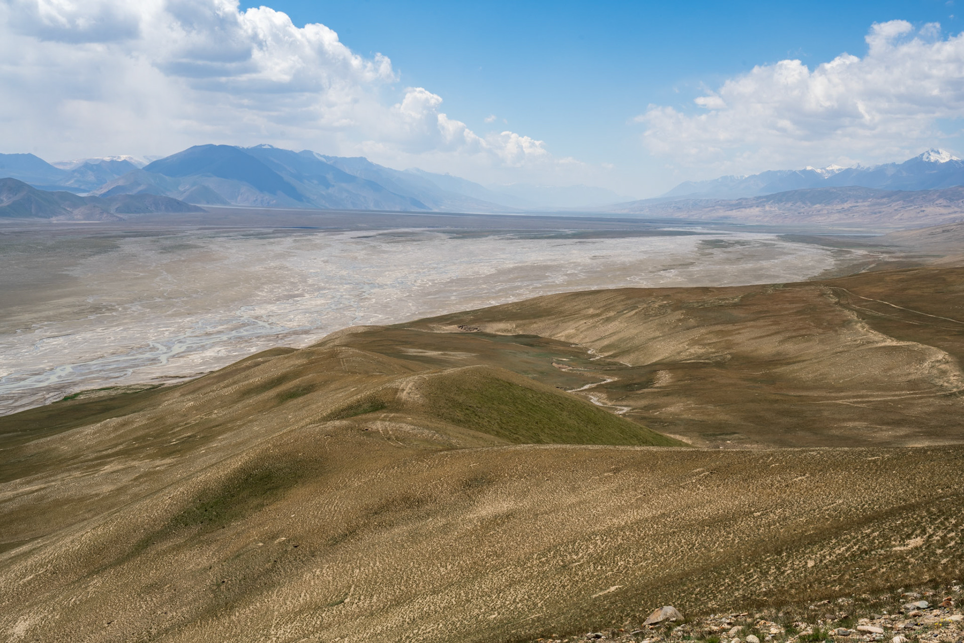
An incredible feeling of vastness
On the other side, the trail continued, but we had to abandon the idea of crossing the river. The current was too swift, and the boulders were simply too challenging to navigate.
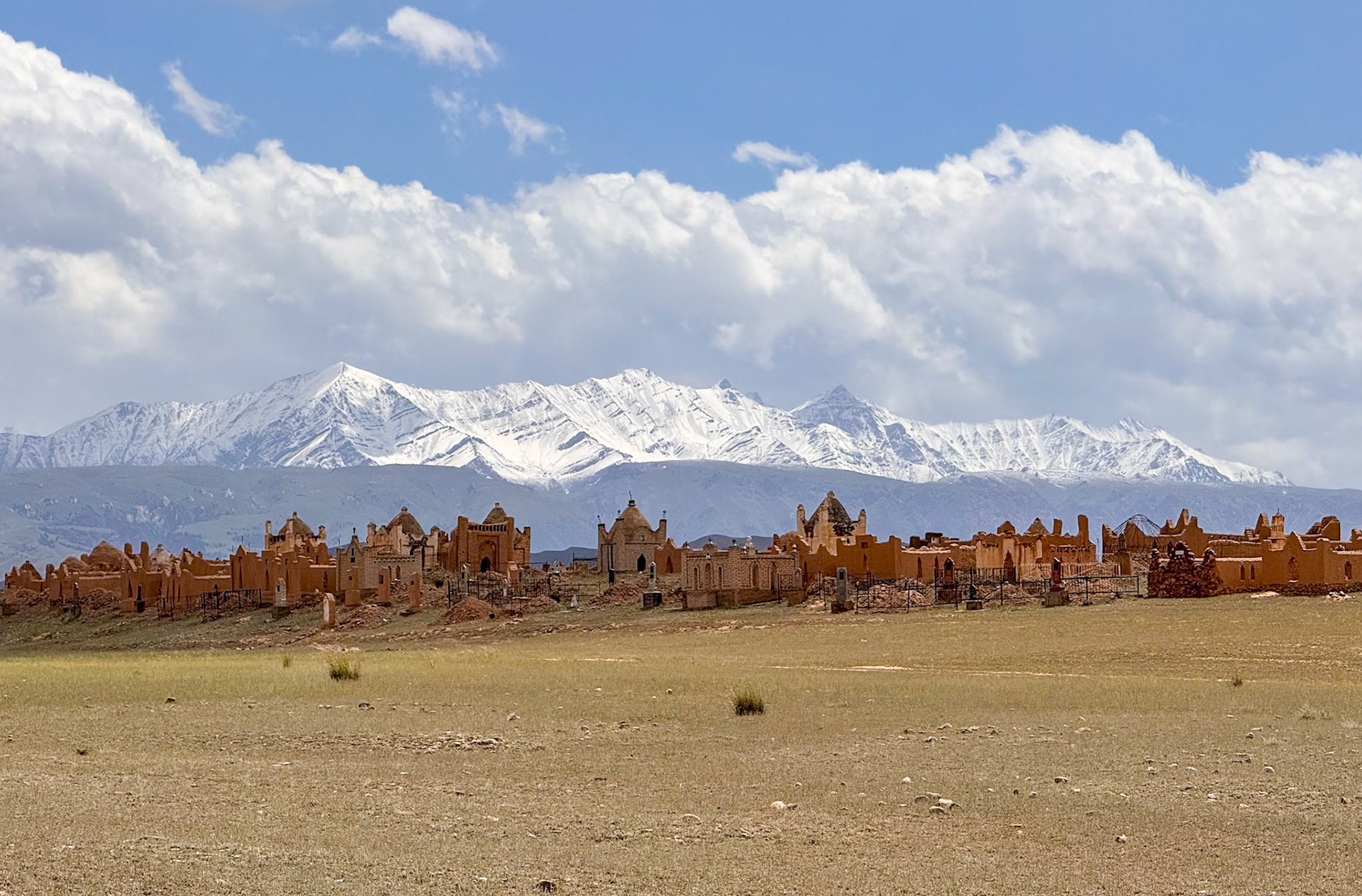
Another cemetery, with a great background
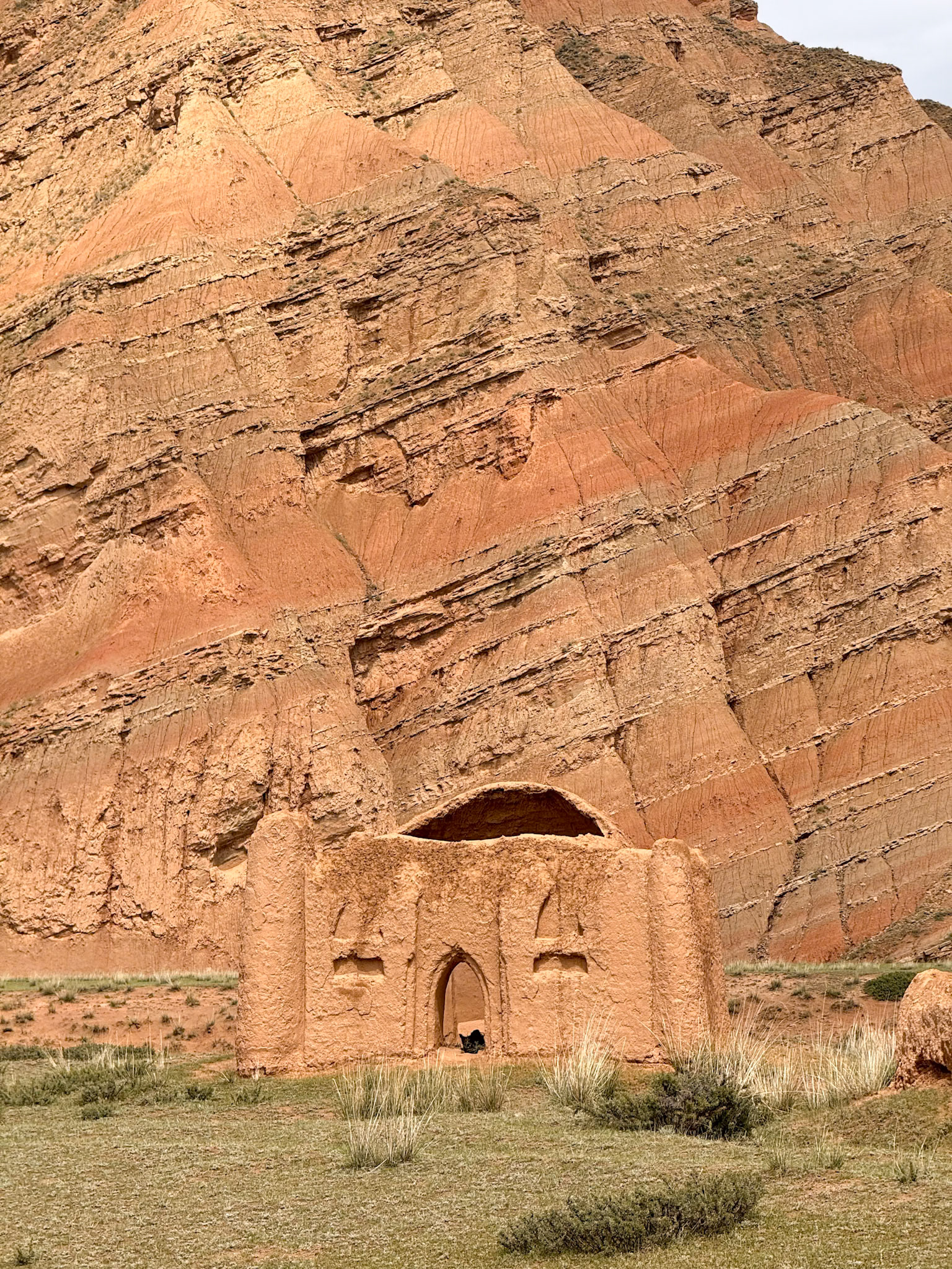
A mausoleum, seamlessly blending into its surroundings
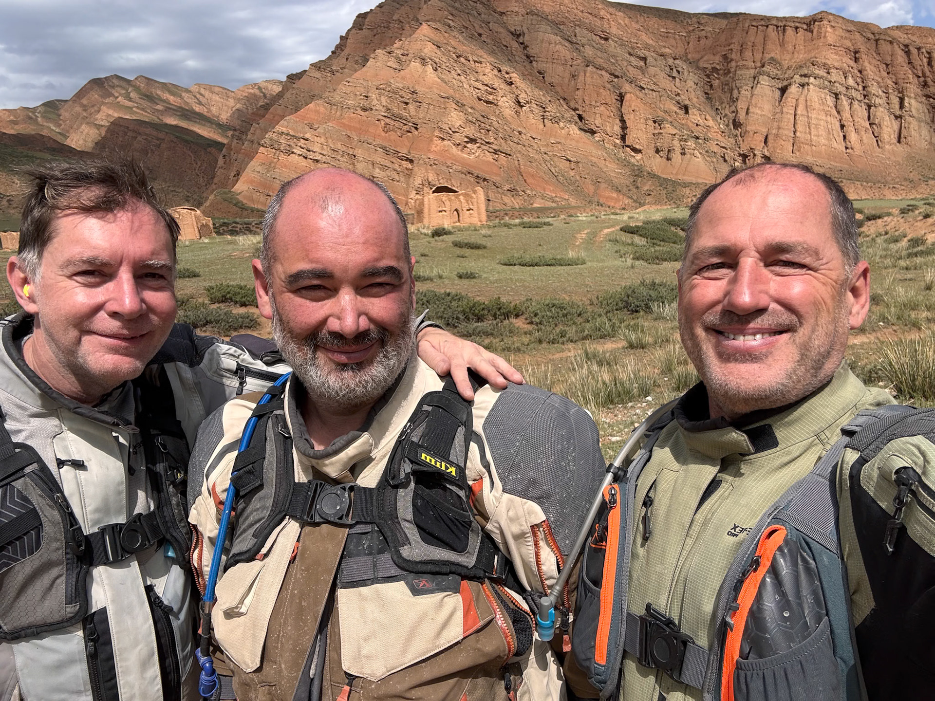
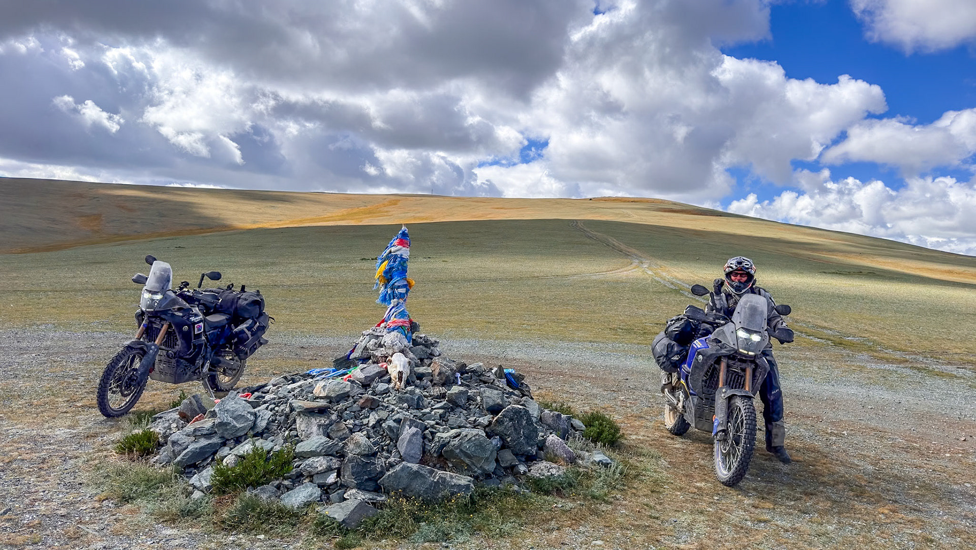
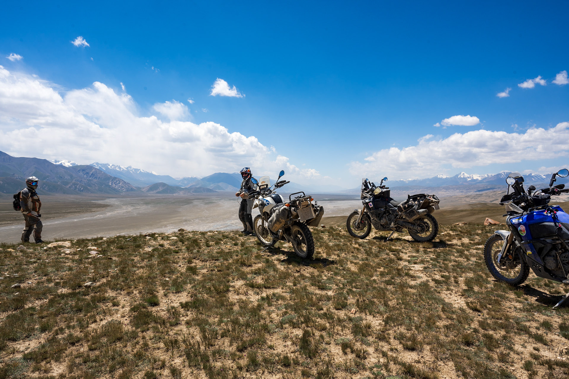
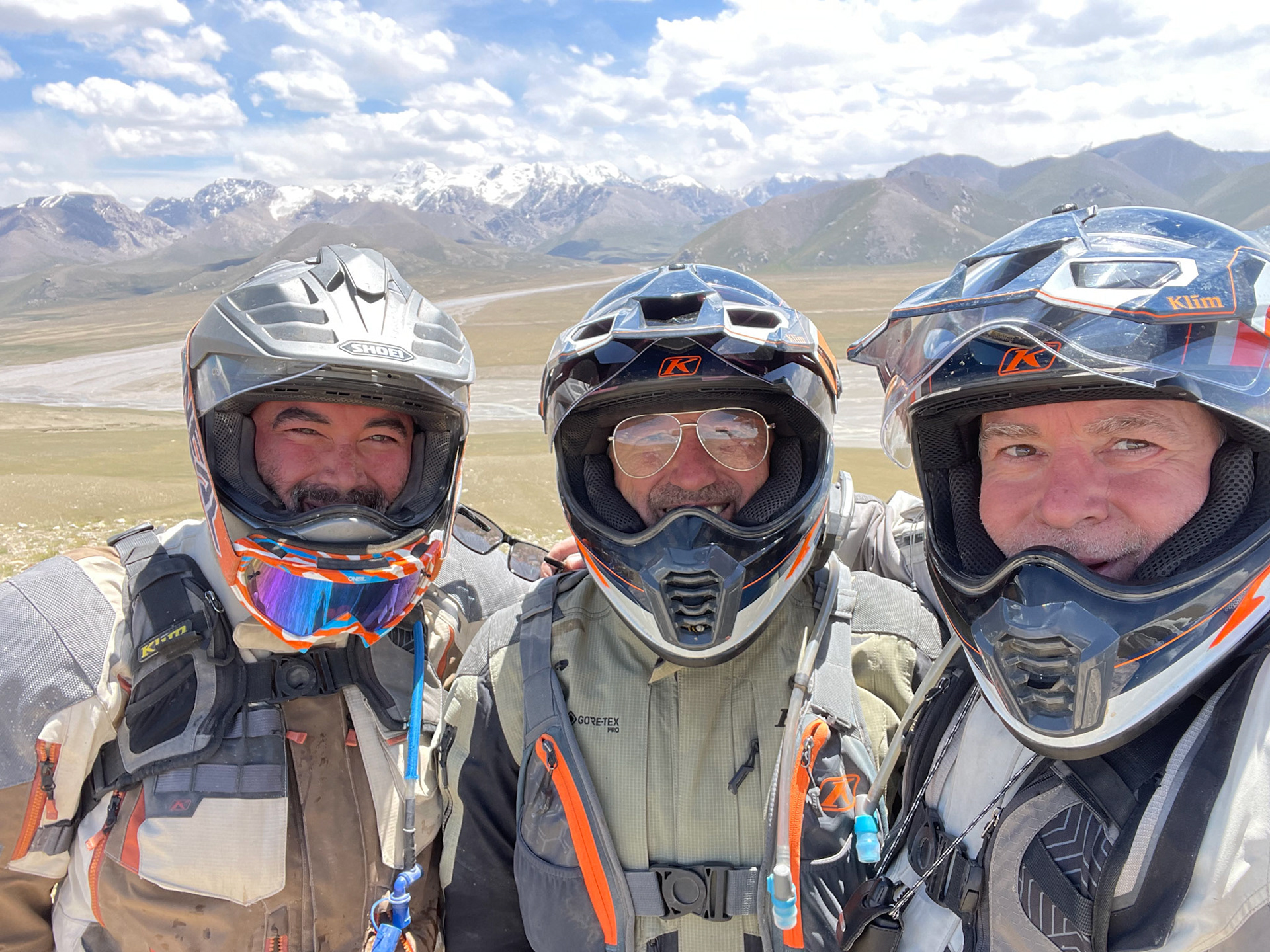
The Three Musketeers
The tireless force of erosion and the stunning results it creates
Day 69 - 290 km
Day 69b - Tash Rabat
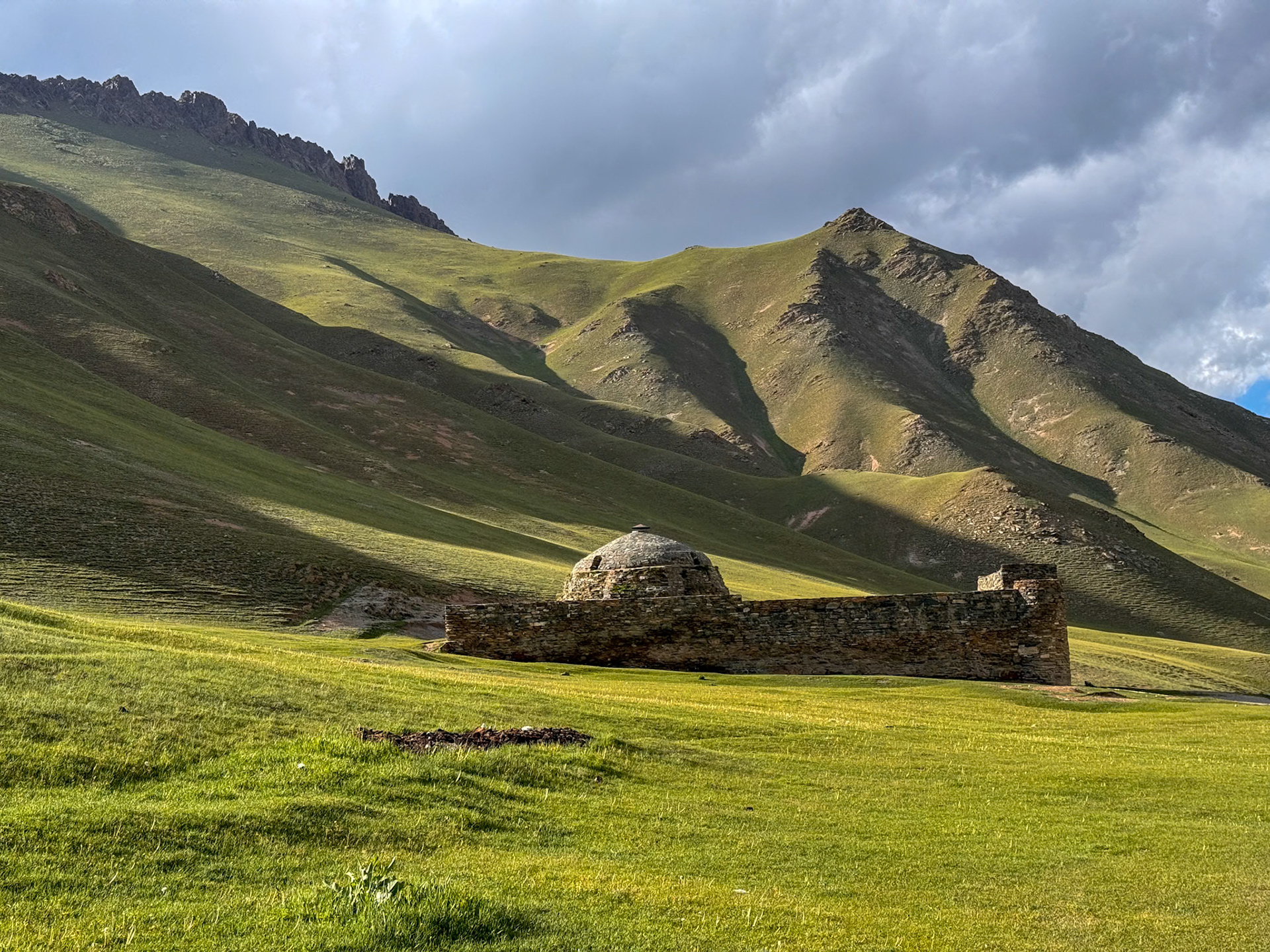
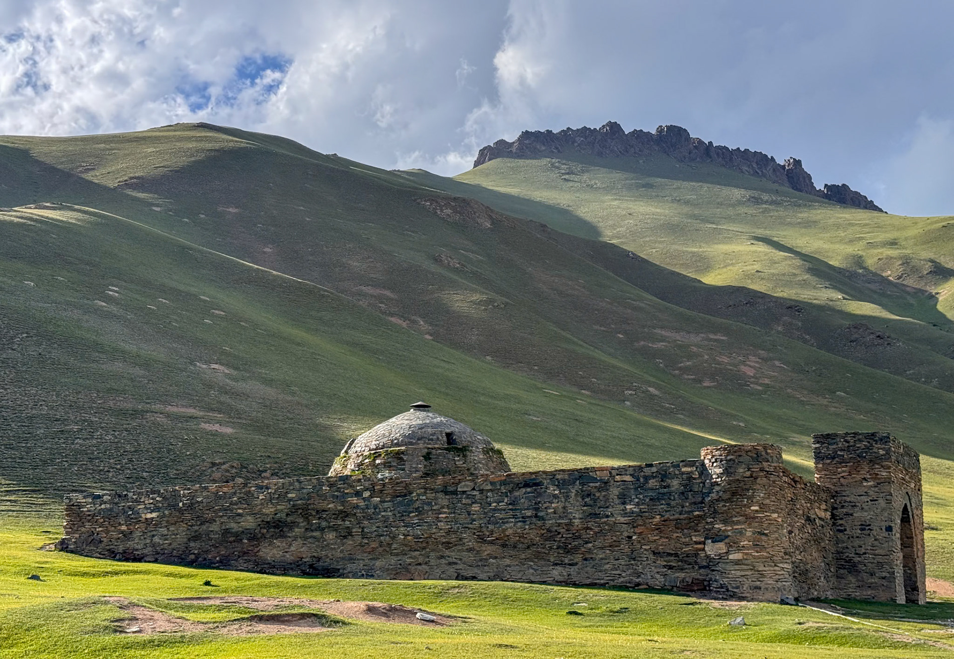
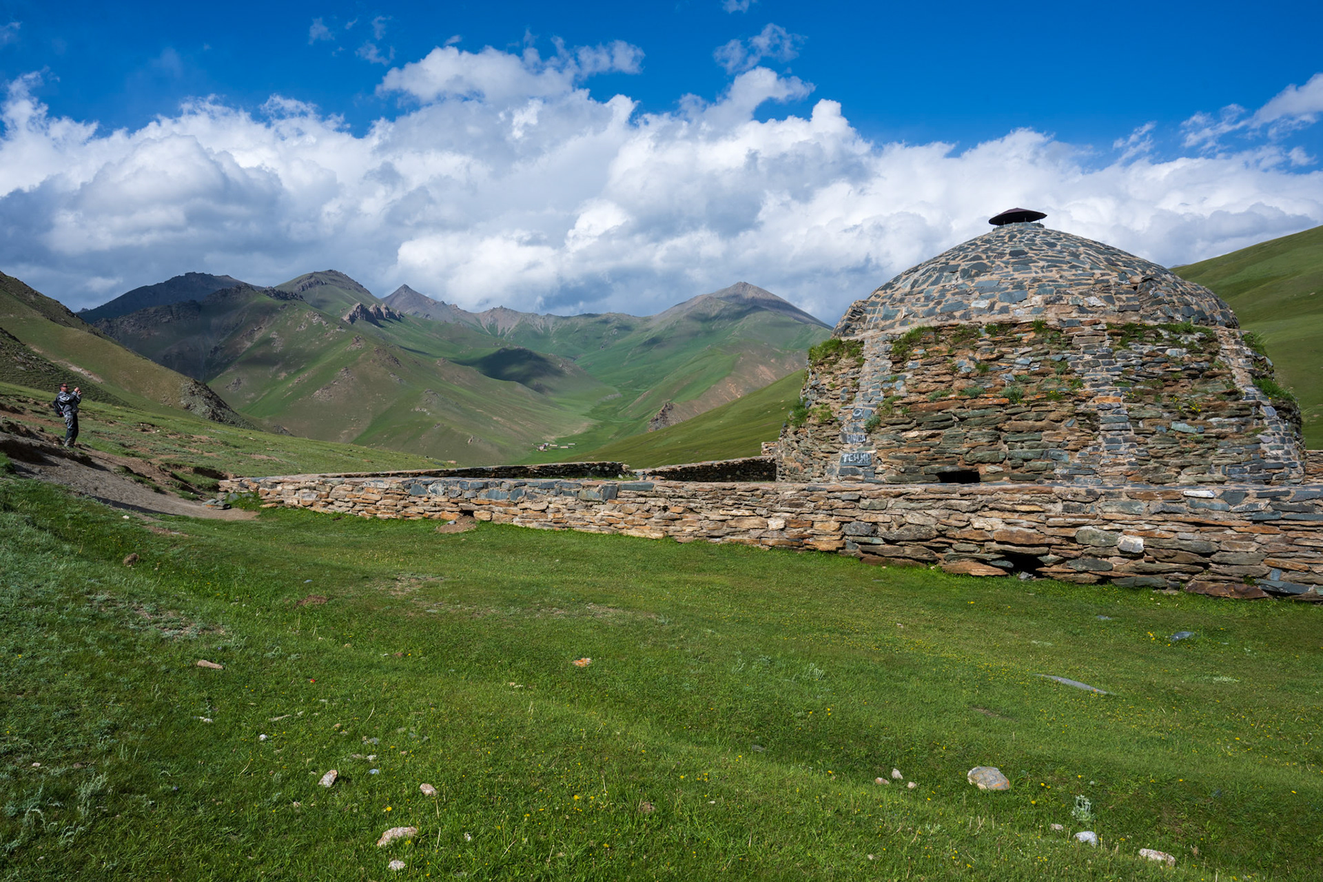
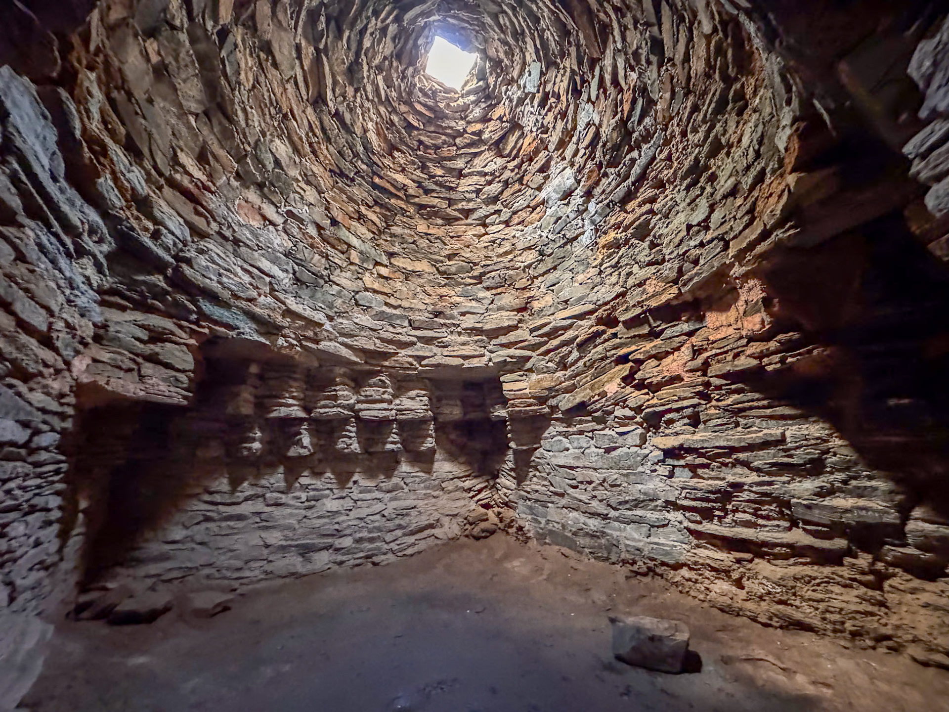
When I first began planning this trip years ago, few places sparked my imagination like the Tash Rabat caravanserai. Deeply remote yet brimming with history and memories of travelers from centuries past. I couldn't wait to be there in person!
"Tash Rabat is a Silk Road monument par excellence: a small but perfectly formed 15th-century caravanserai that sheltered merchants and travelers along one of the wilder stretches of the Silk Road. Its location is even more remarkable: tucked away from sight, half-buried in a hillside, up a valley at 3,530 meters above sea level. The building is entirely stone-built, half-sunken into the hillside from which it emerges almost organically like a rocky outcrop. It is a broad rectangle in shape, measuring 36 meters long but appearing smaller from the outside because some of its internal structure lies beneath the hillside. There is also a well for supplying water."
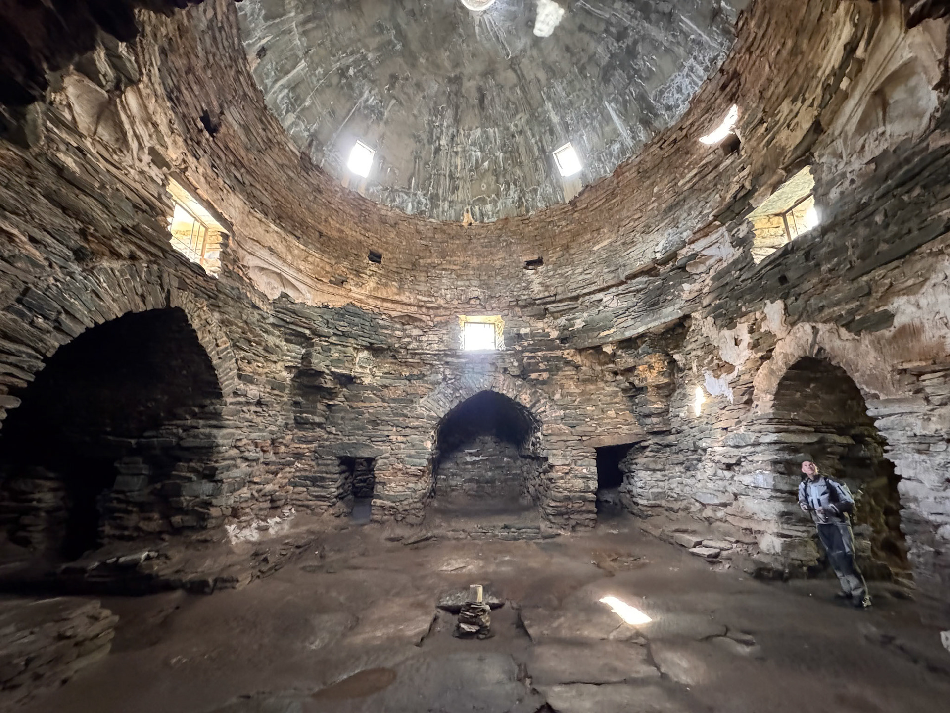
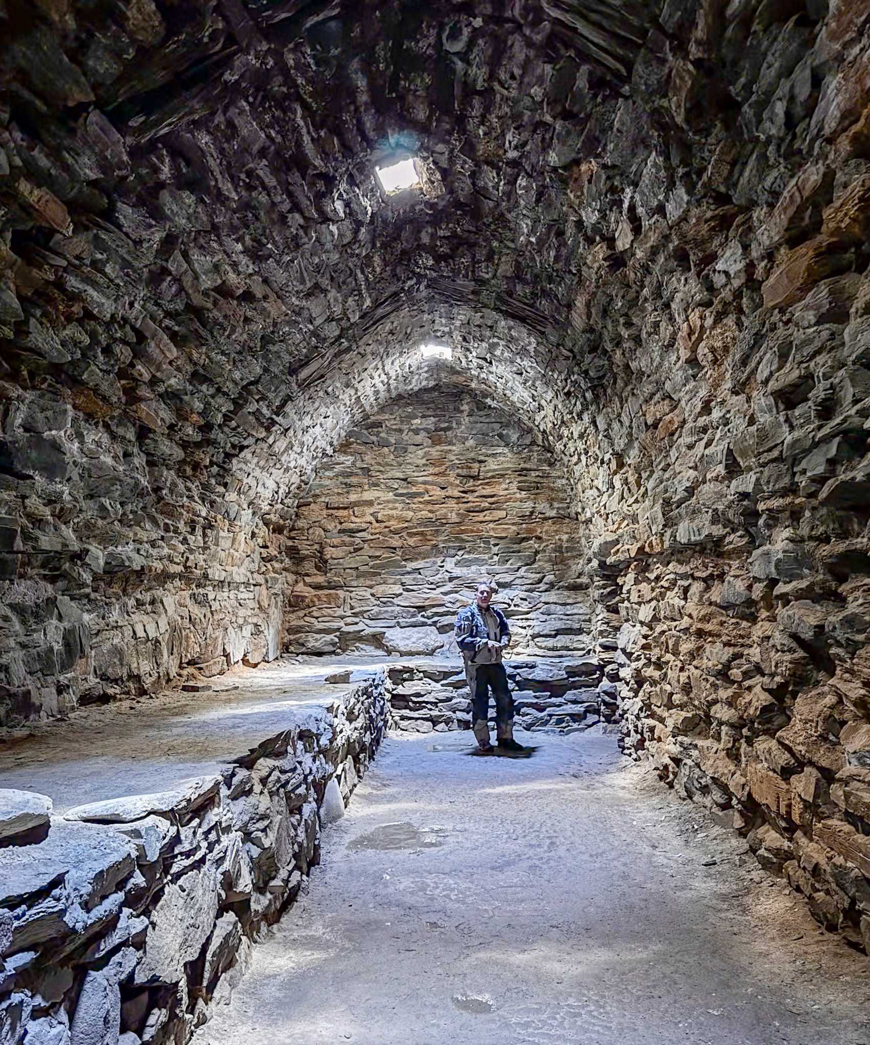
We were the only three people touring the caravanserai that late afternoon. The doorways are so low that you have to duck to enter the rooms. The only light is provided by small openings in the ceiling. It was really impressive to discover room after room—30 in total—all in great shape.
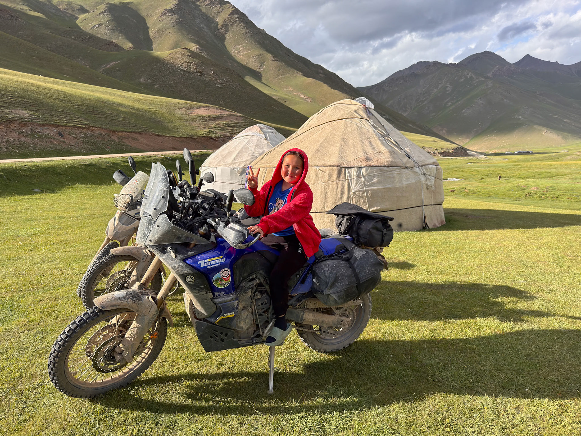
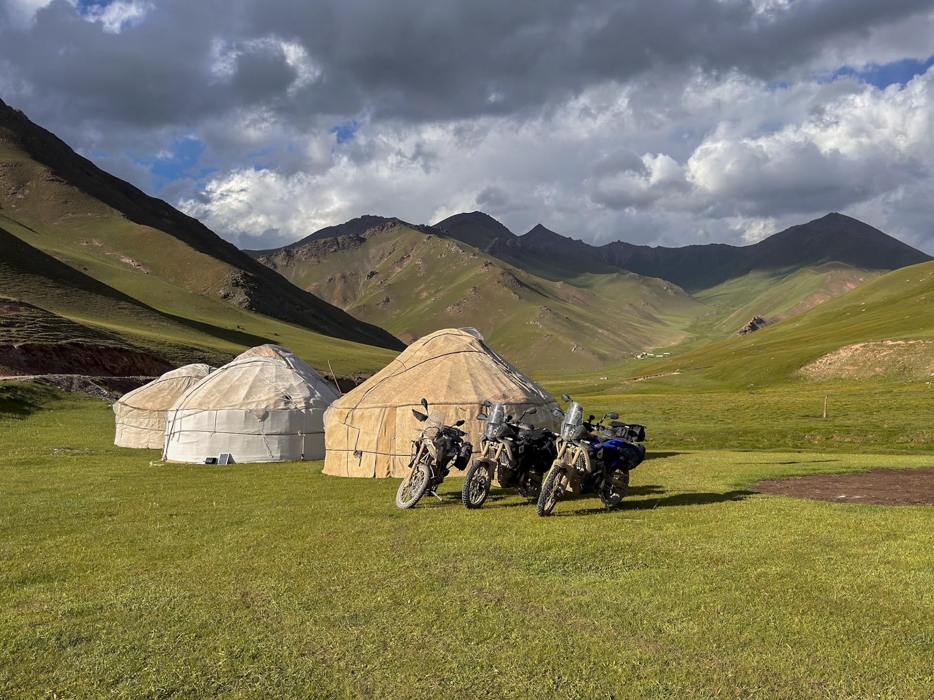
A young girl approached us at the gate and suggested we stay in her family's yurt, which they offer to tourists. She was the only one in her family who spoke a few words of English. Along with her mother, they took great care of us during our stay in the largest yurt of their camp, which had three yurts in total, directly below Tash Rabat.
We enjoyed tea and snacks, followed by dinner served on a table. Afterward, the tables were turned on their sides and placed along the walls of the yurt. The mother and daughter brought in thick blankets until all three of us had a cozy place to sleep.
This setup was more rudimentary than at Lenin Peak, with carpets placed directly on the ground (not on pallets) and no stove, despite the freezing temperatures outside.
We could not be closer to the Caravanserai!
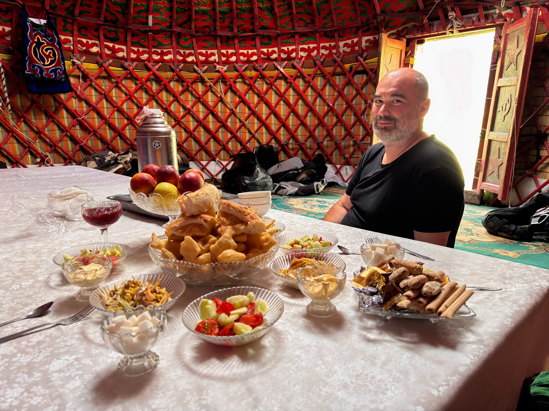
Vincent in front of the tea spread
A door from another era 😉
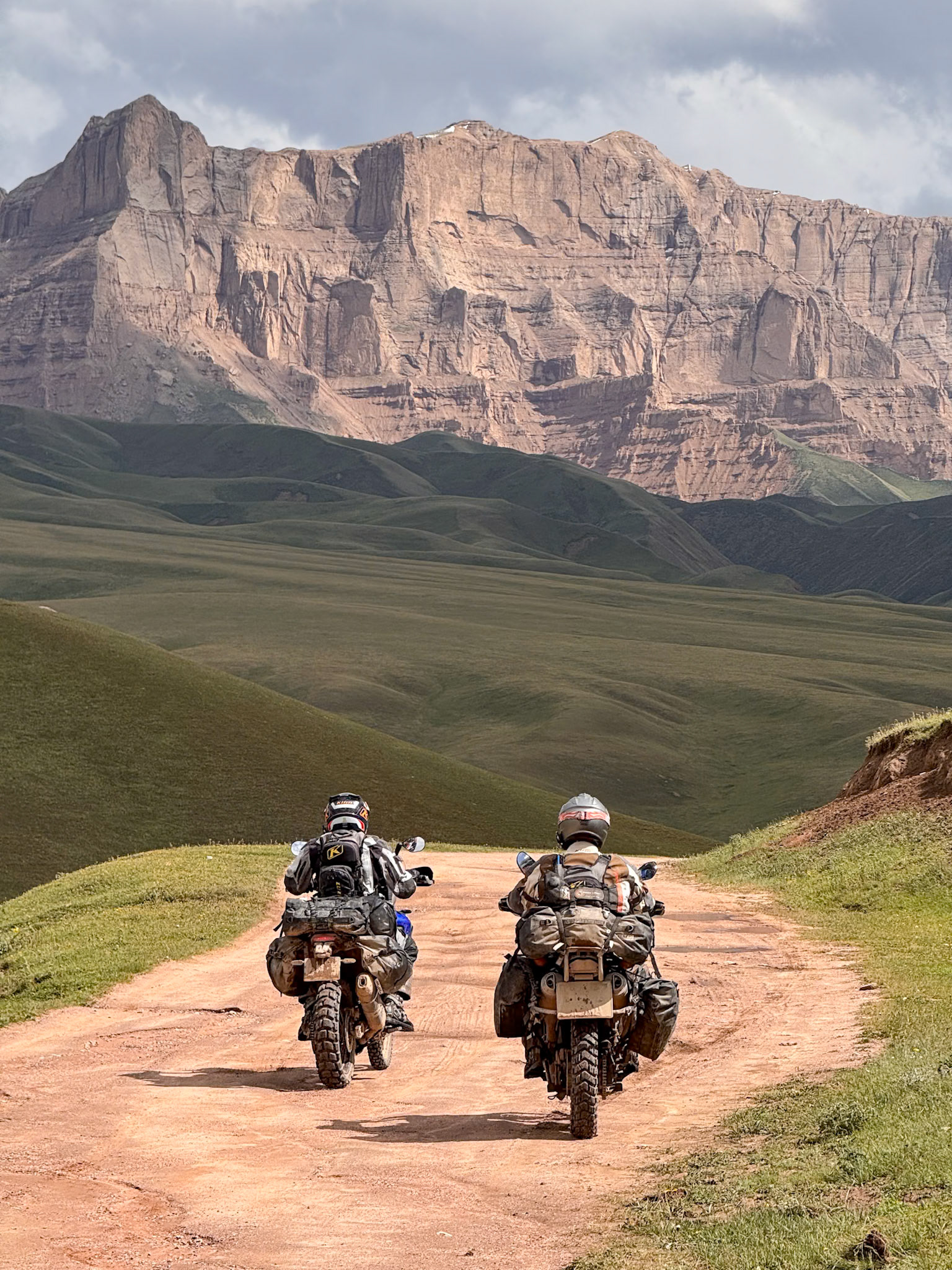
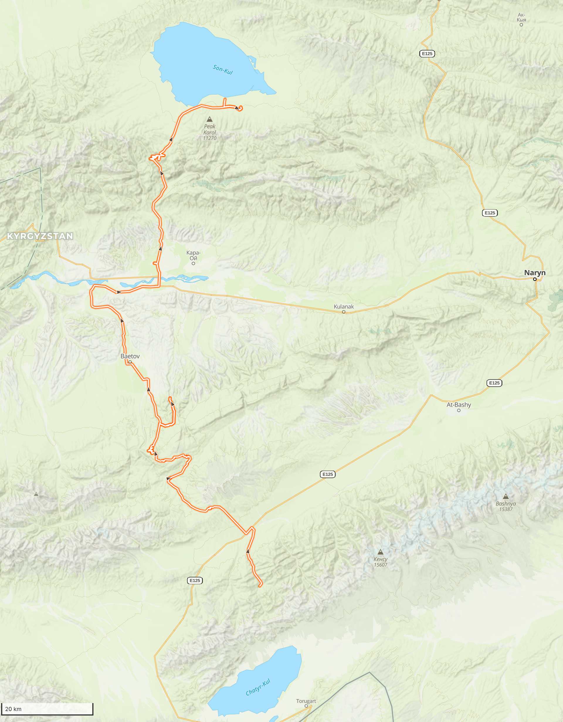
Day 70 - Tash Rabat to Son-Kul
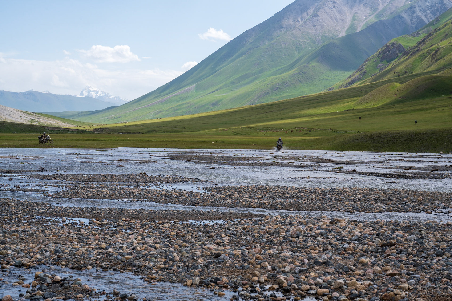
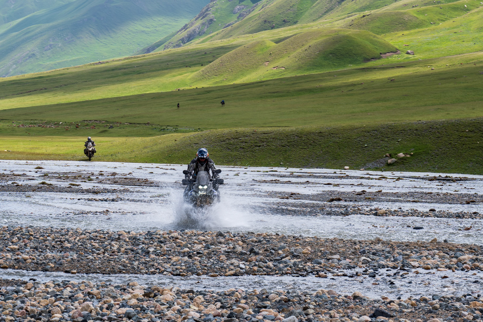
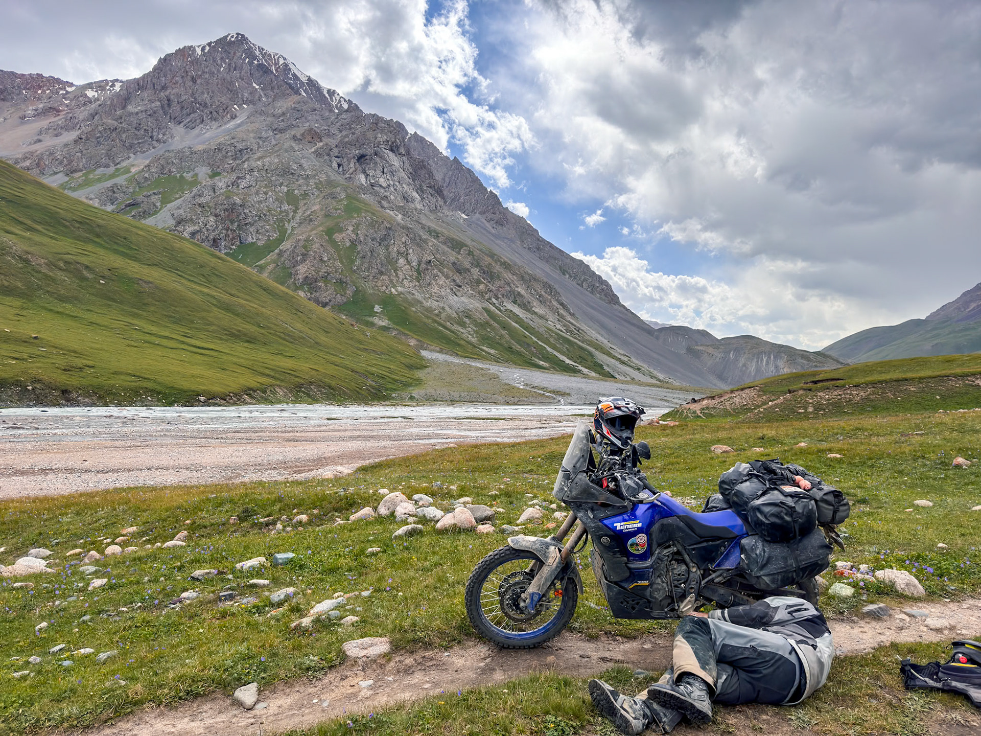
We woke up to a frosty morning, a thin layer of ice clinging to our saddles. The sun blazed though, promising an adventure. We had breakfast in a smaller, more rustic yurt where we realized how little this family had. Our destination: the stunning Son Kul Lake. Within kilometers, we startled dozens of marmots from their slumber. We retraced our route from the previous day for a couple of hours before trying an alternate route through a canyon. None of our maps showed a trail going through but I’ve gotten tracks from a fellow ADVrider who rode there a dozen years ago so it is (or it was) doable.
Sure enough there was a visible path and we followed it in to a wide canyon. We had numerous stream crossings which were not too difficult but the very muddy and sometimes steeper banks created by the previous day’s rain always proved to be a challenge.
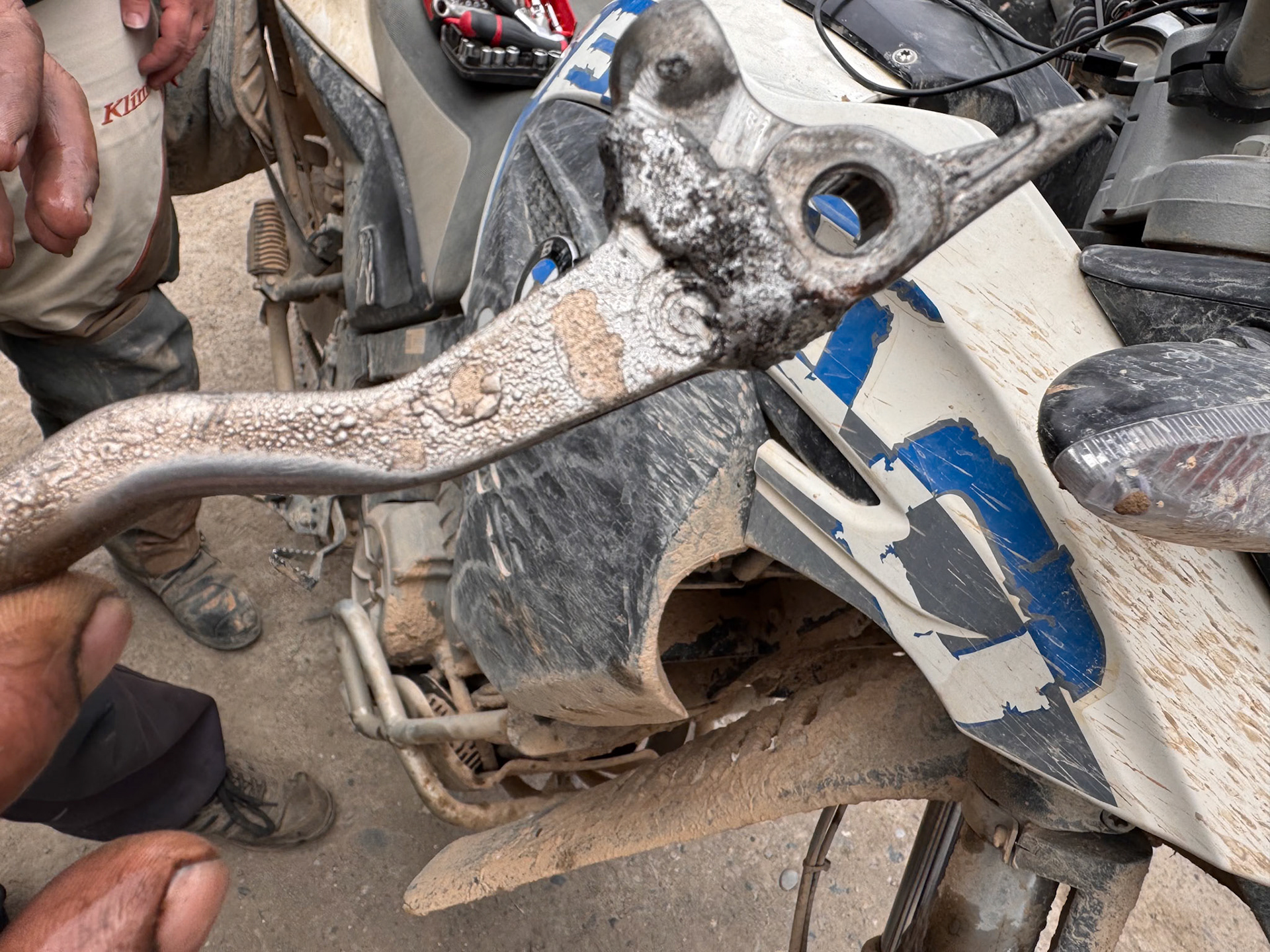
Vincent was leading this day and unfortunately had a small crash on a muddy part of the trail, certainly because of is worn out front tire. He was totally fine but his front lever broke in a way that made it impossible to repair. It’s very challenging to ride without front brake but Vincent managed it with brio.
Later Vincent started to go through yet another large pool of water when he slipped and just managed to keep his bike from completely submerging in the water. The ground was so slippery that he could barely keep the bike above water. Dirk rushed to help get his bike upright but he also could not get enough grip. I came to help them pull the bike from the opposite side. Too bad that both Vincent’s and Dirk’s boots were already full of muddy water at this point.
Once we got Vincent’s bike out of the water we decided to go back and find an alternate, dryer route.
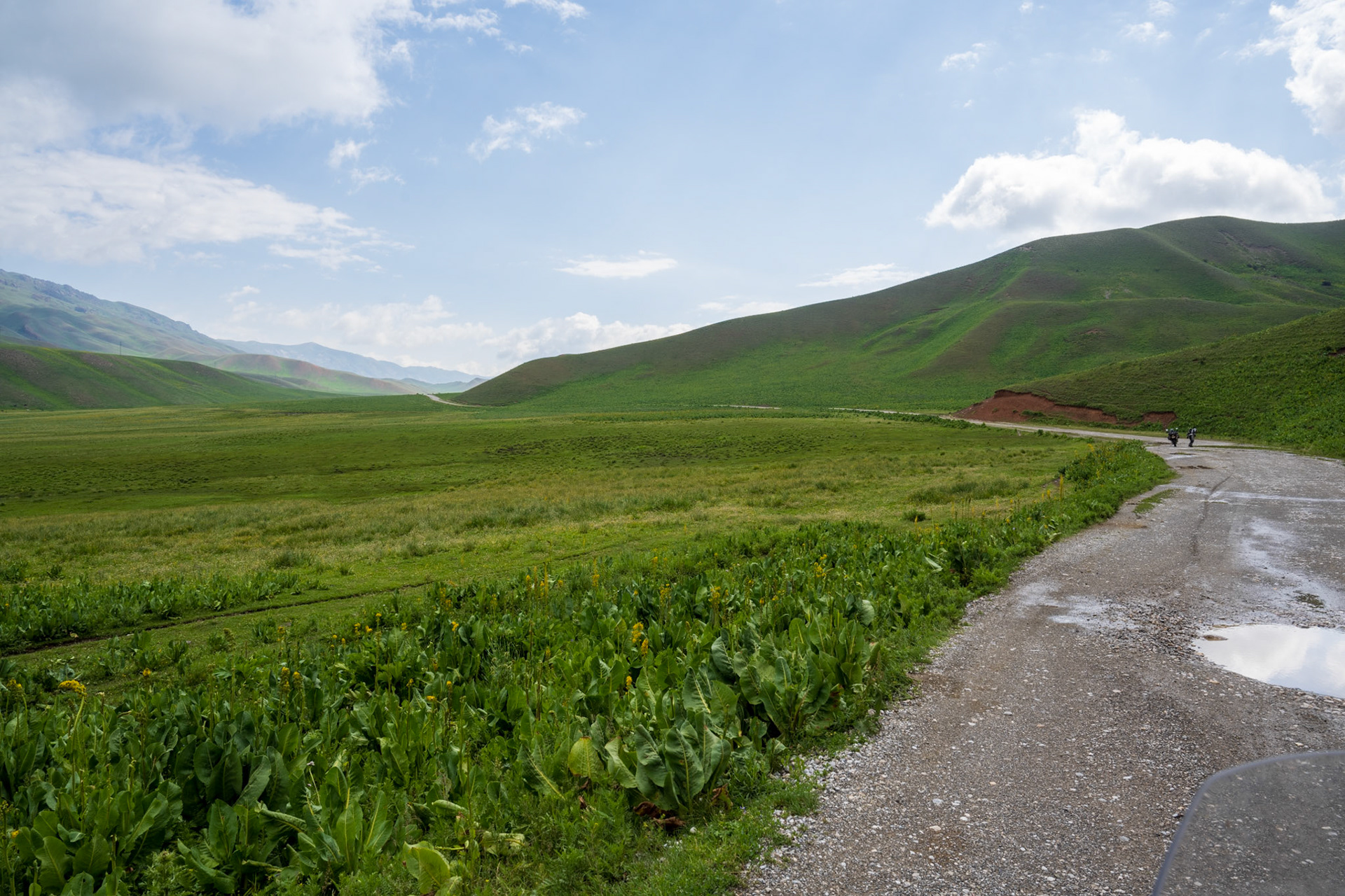
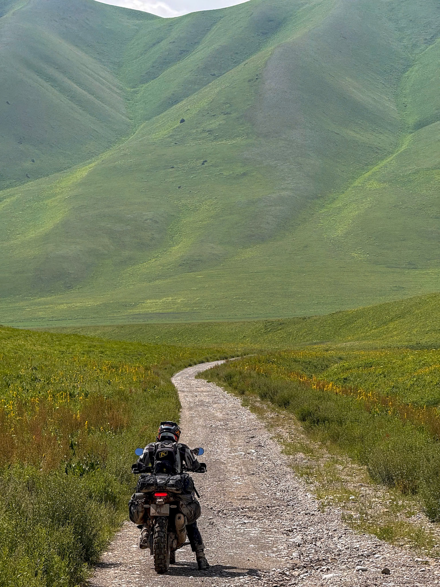
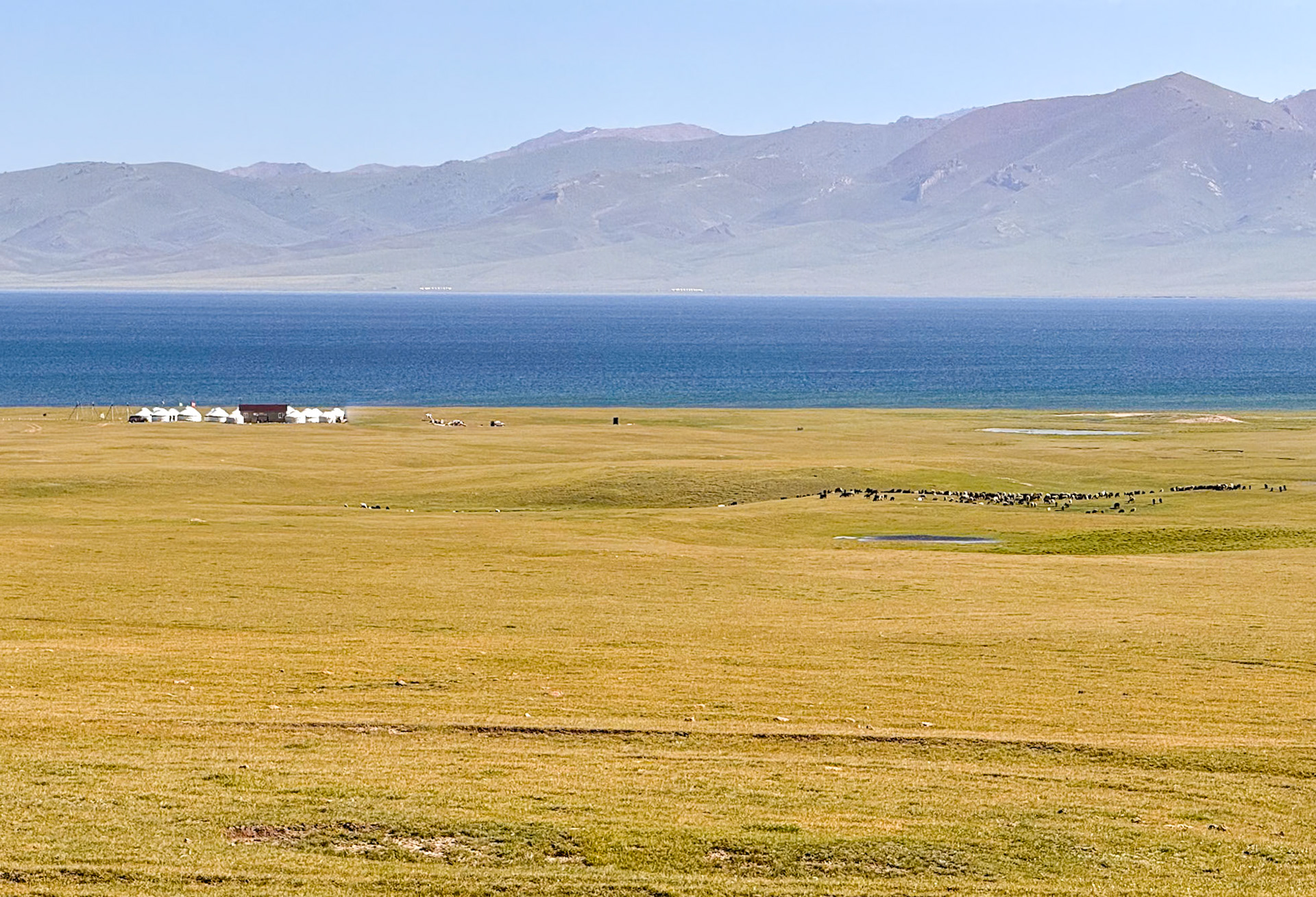
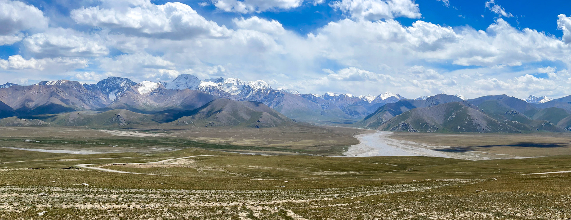
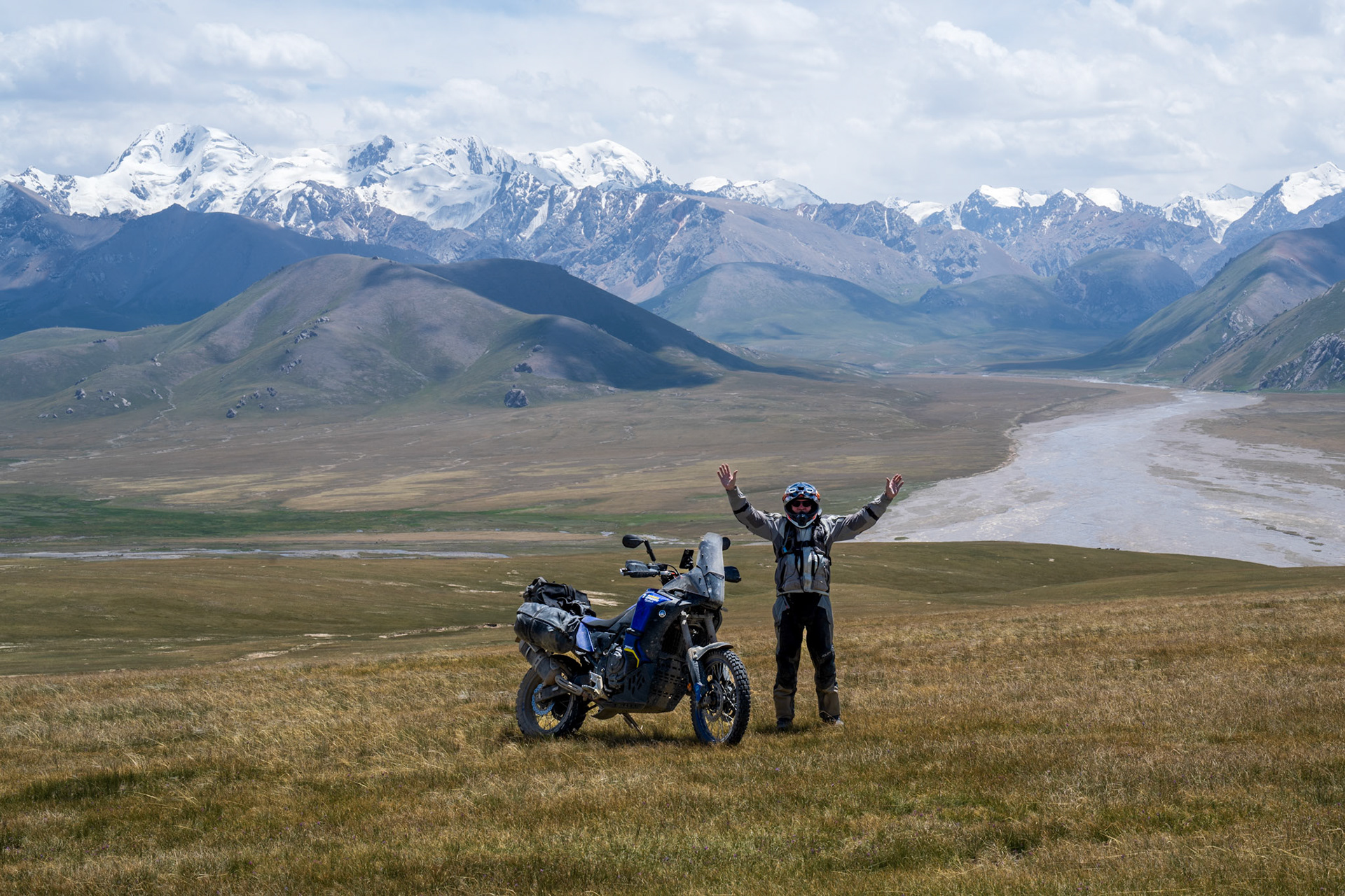
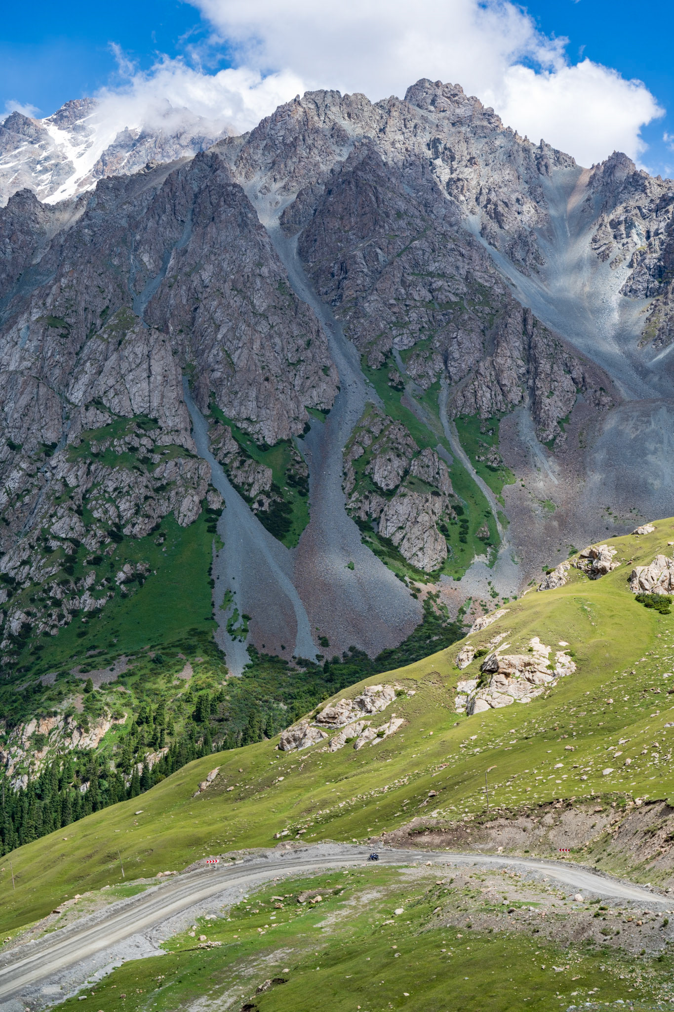
Further North the road got very narrow and did not look very used. The scenery through the river canyon we followed up to the pass was fantastic and it looked like we were riding through trees in the alps. At first the canyon was fairly narrow and eventually became a grassy valley. We ascended to the large plateau (3000m) up yet another set of switchbacks and a breathtaking vista unfolded: a vast plateau, a big lake at the center, snow-capped peaks, and endless meadows teeming with livestock. Dotted with yurts, it was a scene straight out of a nomad's dream. We rode along the south shore of the lake to look for a potential place to camp for the night and settled for a yurt camp close to the lake that we saw along the shore.
Yurts are essential to the Kyrgyz culture and the emblem on their flag is a yurt dome. For our 3rd night in a yurt it was a very different experience: The yurts had wooden raised floors with proper beds and sheets and a there was a large yurt that housed the dining room. There was electricity via solar panels and a generator, internet via Starlink and a building that housed proper toilets and showers —a luxury we hadn't anticipated. Definitely geared towards westerners and Russians.
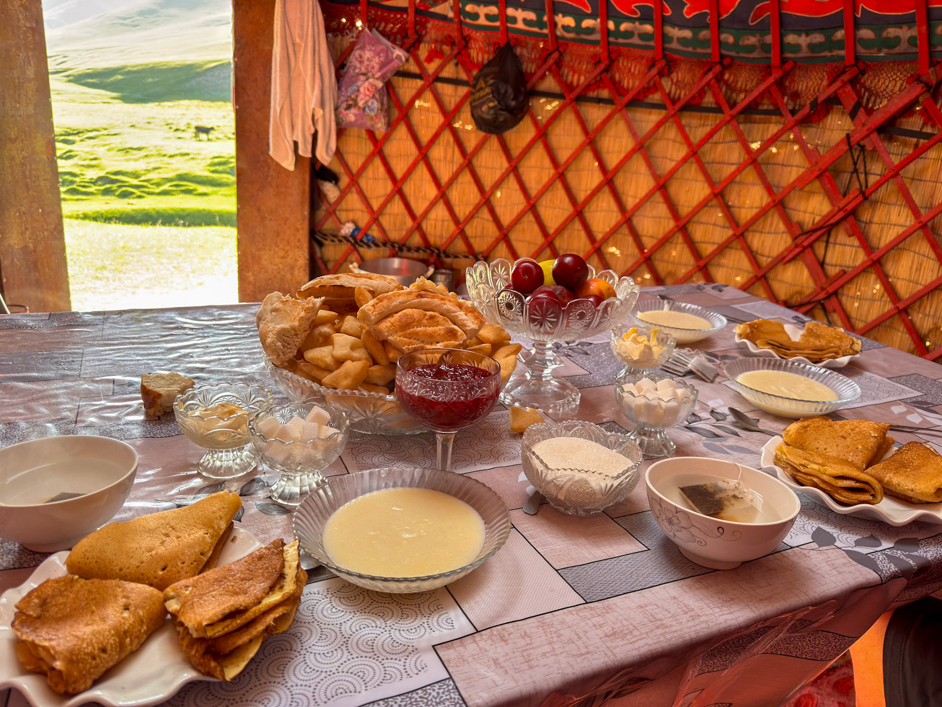
When we got up, the breakfast was ready for us, in the "kitchen yurt"
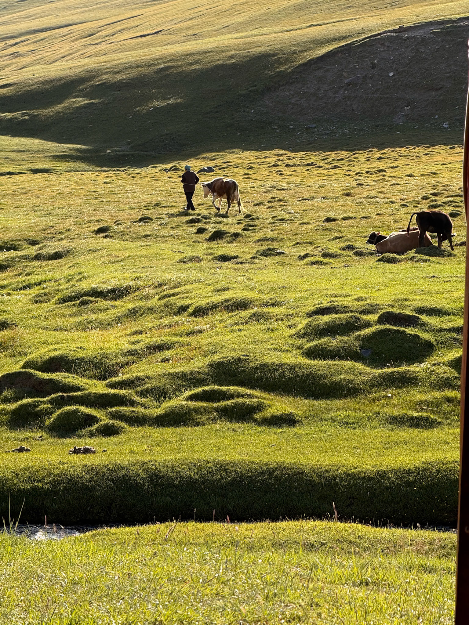
As we enjoyed breakfast, we could see through the door the mother who had already left to tend to the cattle
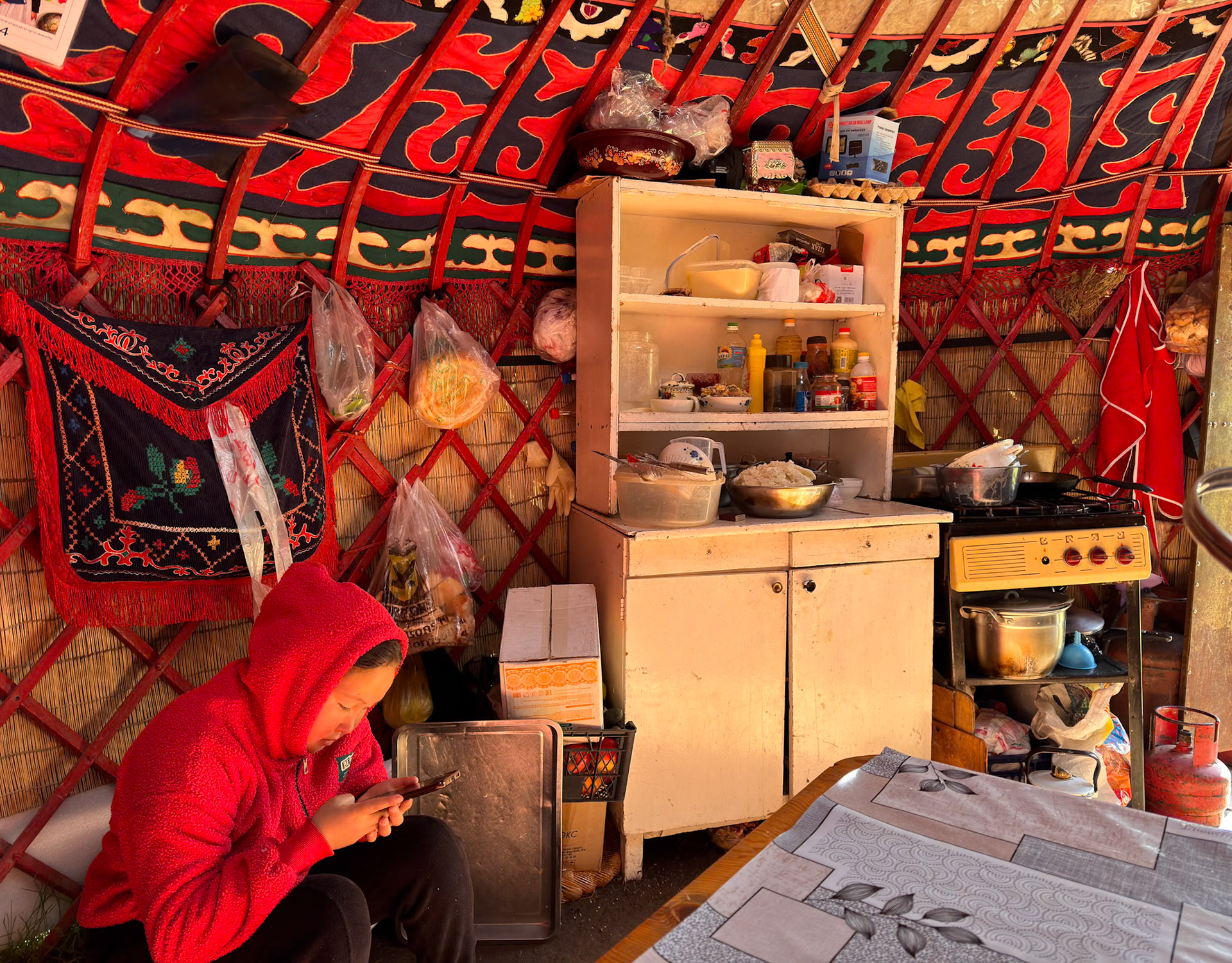
Meanwhile the daughter stayed in case we needed something. No fridge (since no electricity), no cell phone coverage and really not much to go by.
Another stunning day!
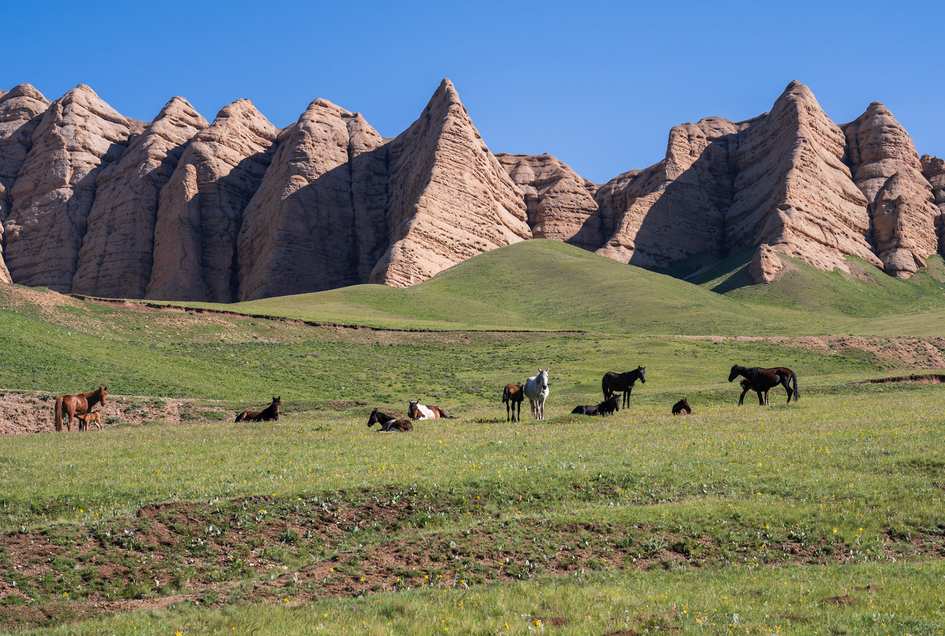
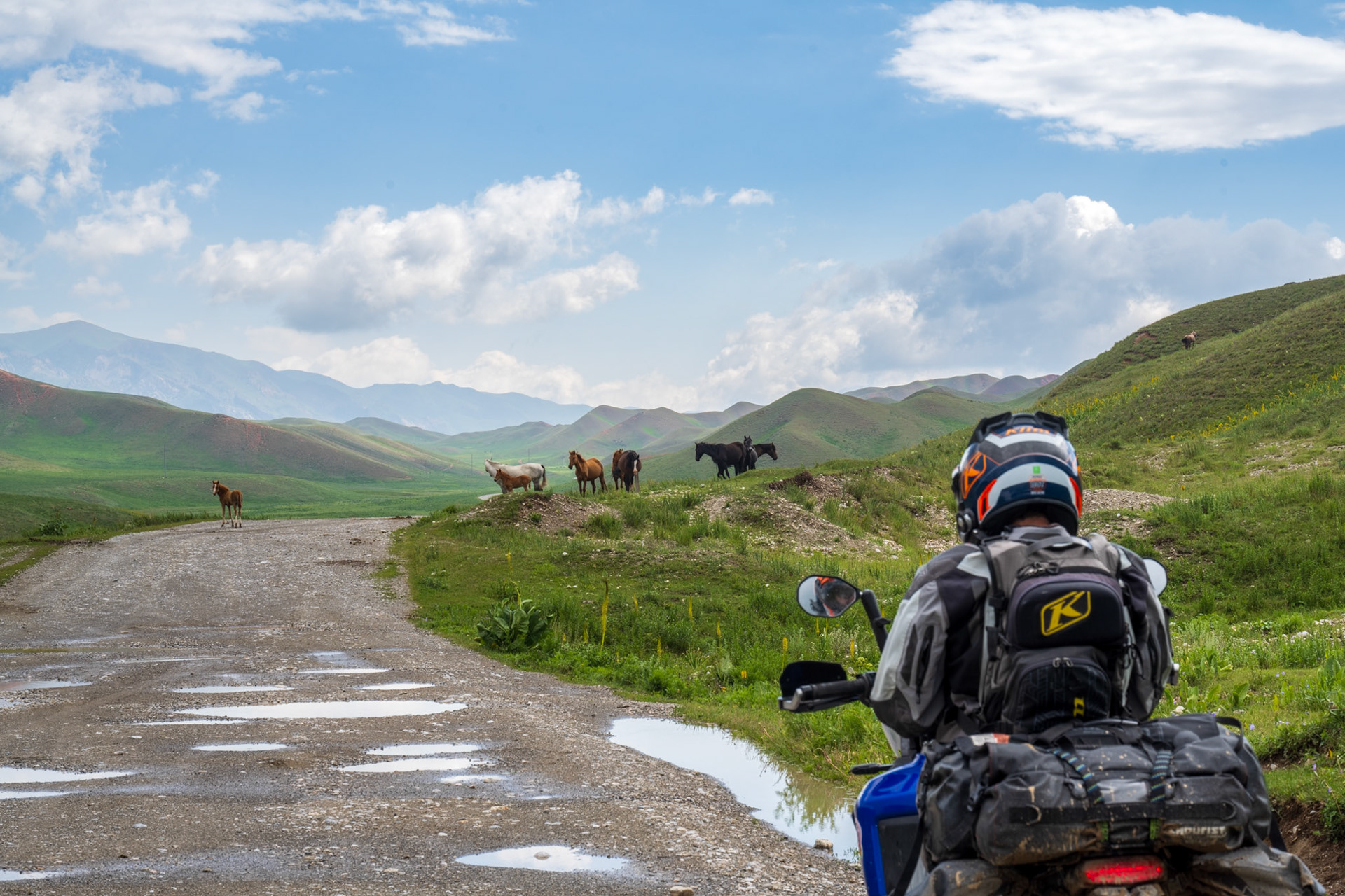
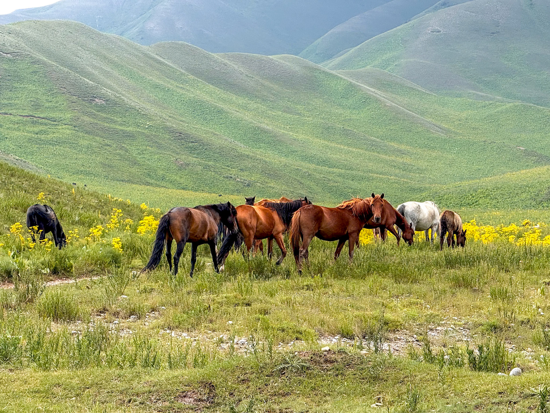
I stopped taking pictures of horses, unless in front of a gorgeous backdrop 😄
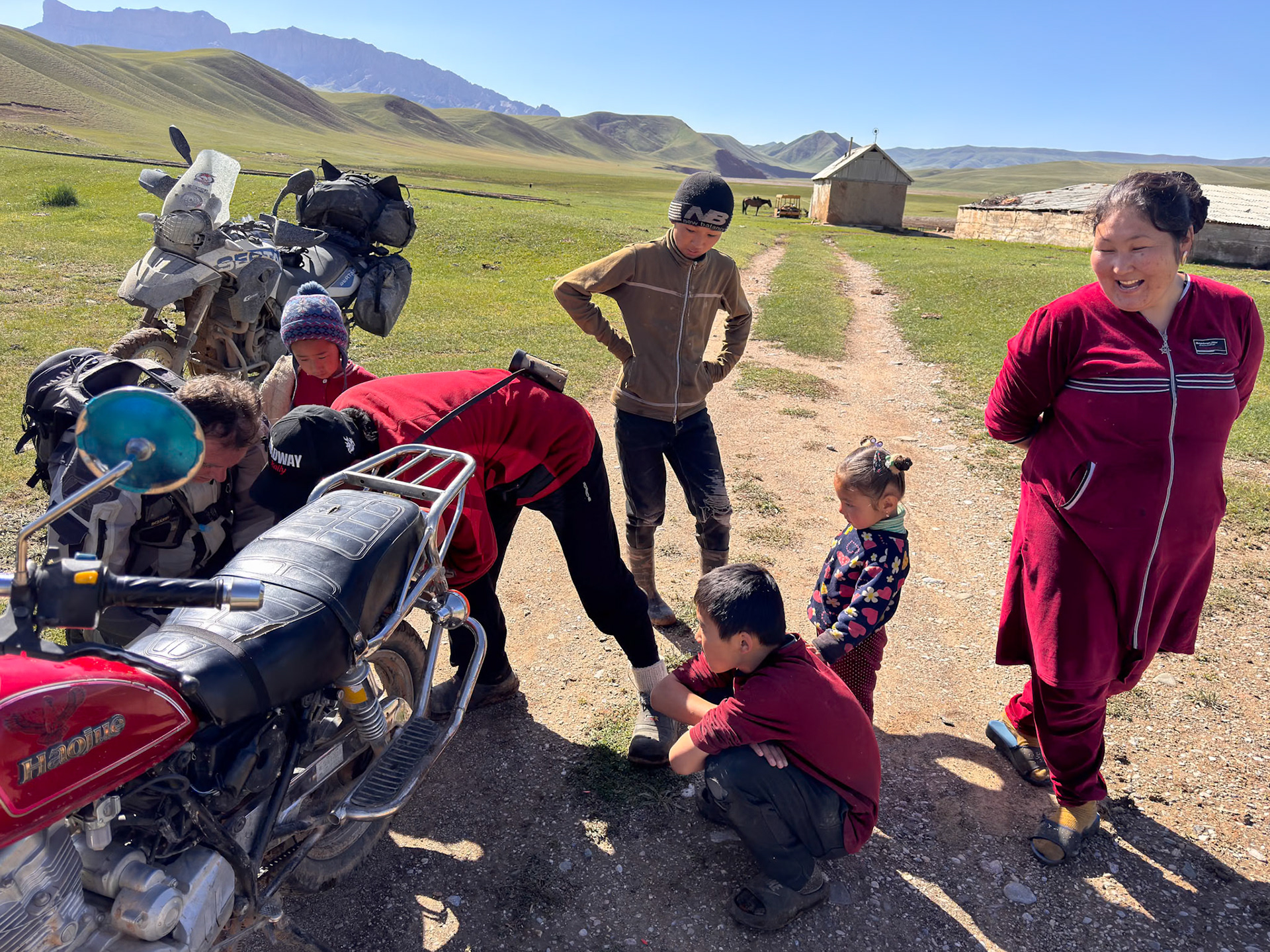
We stopped to help a guy in a middle of nowhere who had a punctured tire
Sceneries are always changing in Kyrgyzstan
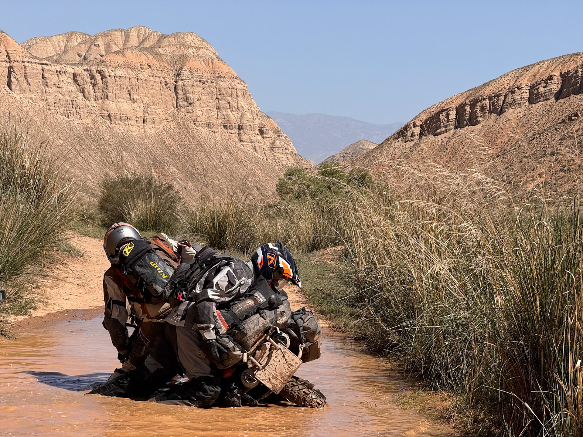
The ground was so slippery that it took all three of us to lift the bike back up.
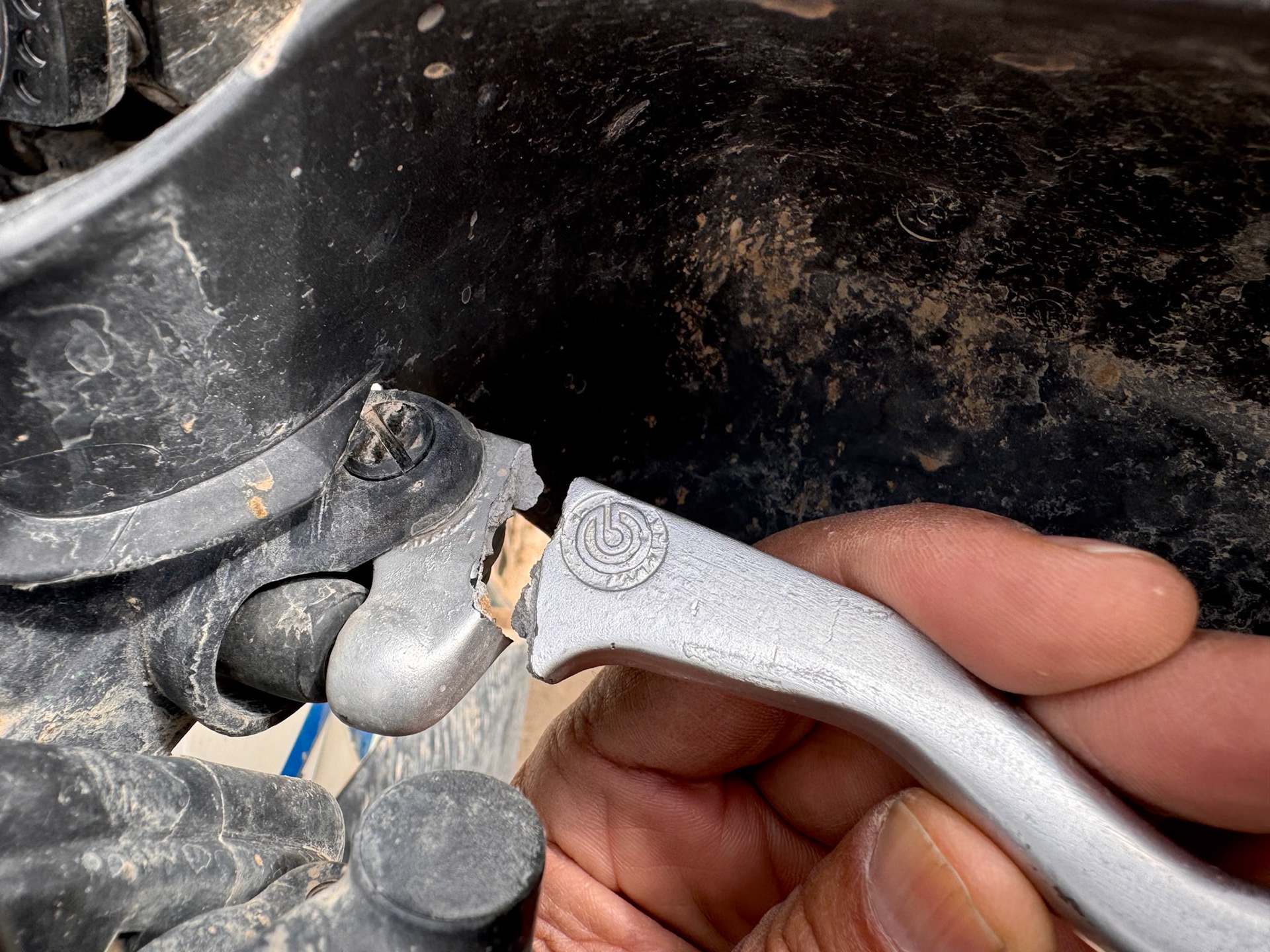
Not a chance to repair that on the road 😕
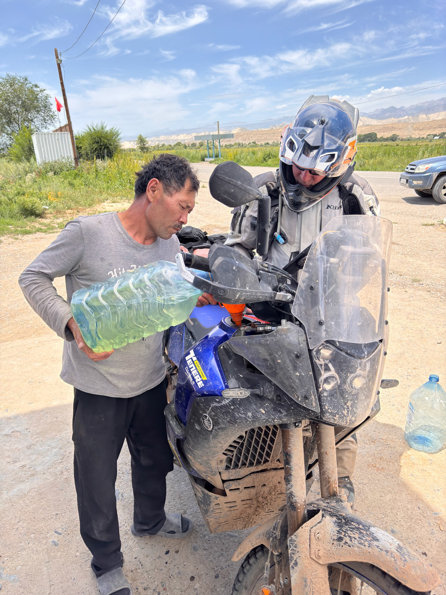
You have to fuel up, no matter where it's coming from
We were stunned as the scenery morphed into a beautiful Alpine panorama
We wound our way up the mountainside on switchbacks, ascending to the plateau where the lake lay
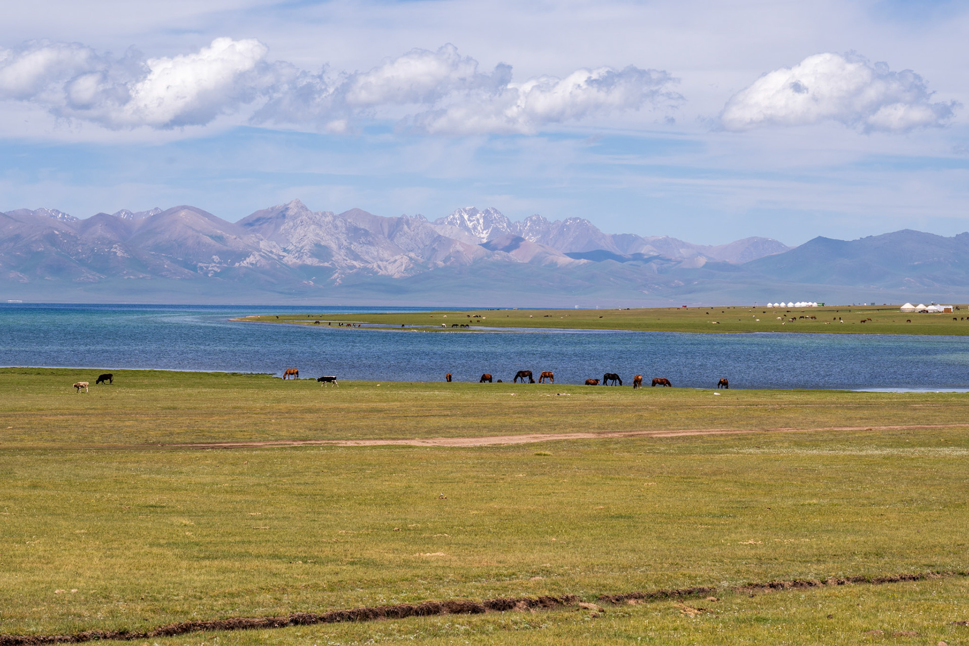
The gorgeous Son-Kul lake, at 3000 m / 9850 ft
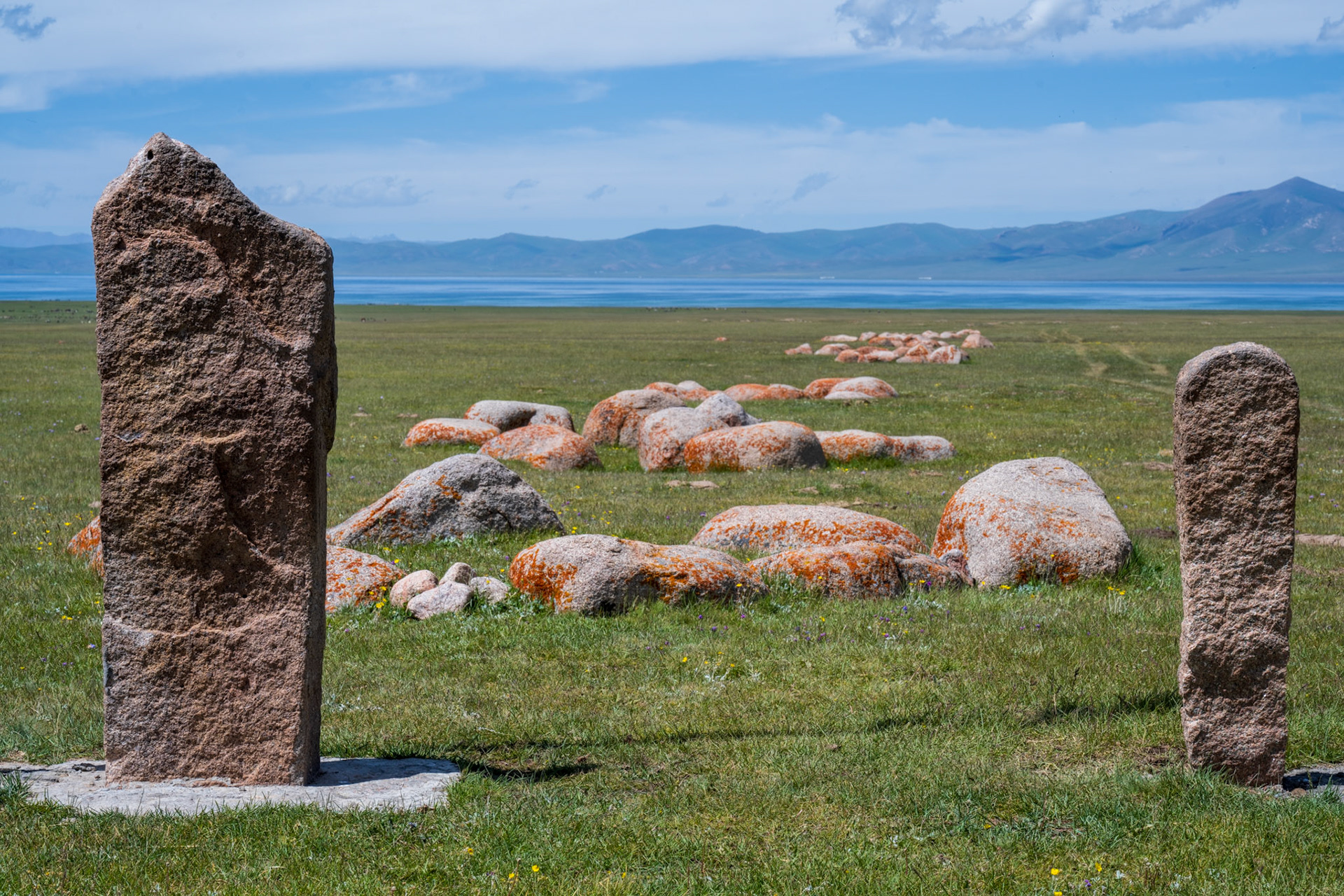
Tash-Tulga, a mysterious 1st-century B.C. stone complex, sits near the lake. Local legend claims it has a special energy.
Day 70 - 220 km
Day 71a - Son-Kul to Issyk-Kul
What a fantastic day we had! Waking up by the lake, with seemingly infinite space of prairies filled with edelweiss and other wild flowers is a wonderful experience.
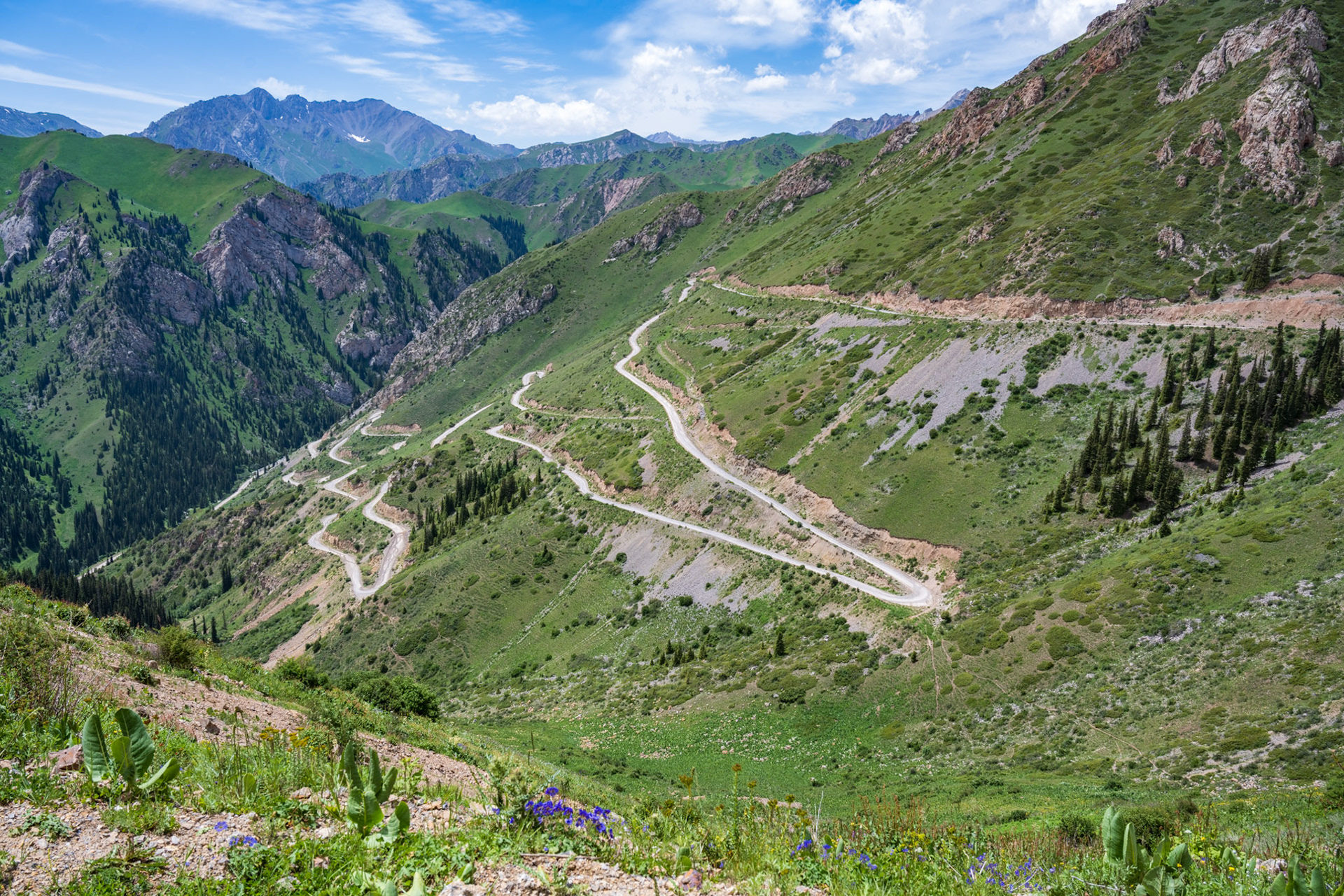
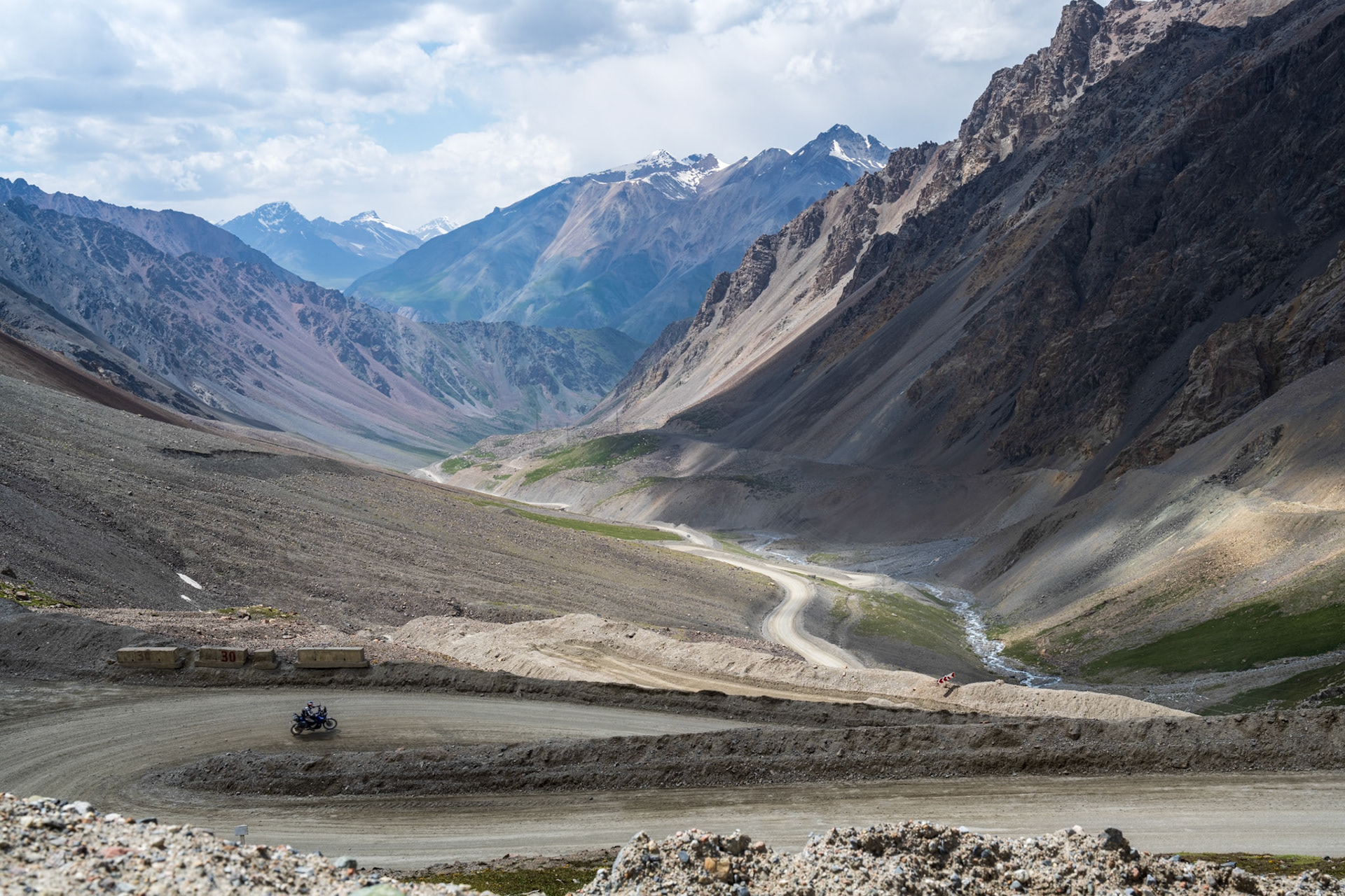
Still, we left the yurt camp with no regrets despite the beautiful setting and modern comfort, as it was all business and we missed the warmth of the family who welcomed us in their camp the night before. As soon as we turned to and left the dirt road along the shore, we ended up in a narrow path, the kind that usually doesn’t get very far. But here it’s actually the “main road” to go East and it went all the way through, via the Terskey Torpok pass at 3150m (10,340ft).
It was a spectacular descent from the Song Kul Lake plateau via very impressive switchbacks. It was challenging, especially for Vincent without front brake. He had to rely so much on the rear brake that it overheated and stopped working as well . Thankfully it was towards the end of the downhill and he managed to use only the engine brake until its brake fluid cooled down enough to function.
We were now in an alpine like scenery, so it was really shocking to suddenly encounter free-roaming camels! What were they doing in a landscape like this?
We finally reached a paved road that lead us to Naryn, the only city on our way to Issyk-Kul. We stopped for gas and then found a dusty workshop where we asked if they could repair Vincent’s brake lever. We had little hope and indeed the guy could not do it but he asked us to follow him 100m further to another dusty workshop where a guy was busy welding an exhaust. Welding would be the only way to repair the lever but being in aluminum very few welders can do it, even in the US. We couldn’t believe our luck but this guy had an aluminum welder in a back room and was able to repair the lever perfectly! While the repair was underway, we came across strange vehicles straight out of Mad Max.
What a relief for Vincent to get his main brake back, especially knowing that we still had to cross a 4,000-meter pass and several rivers before reaching Issyk Kul.
Bye Lake Son-Kul and our yurt camp
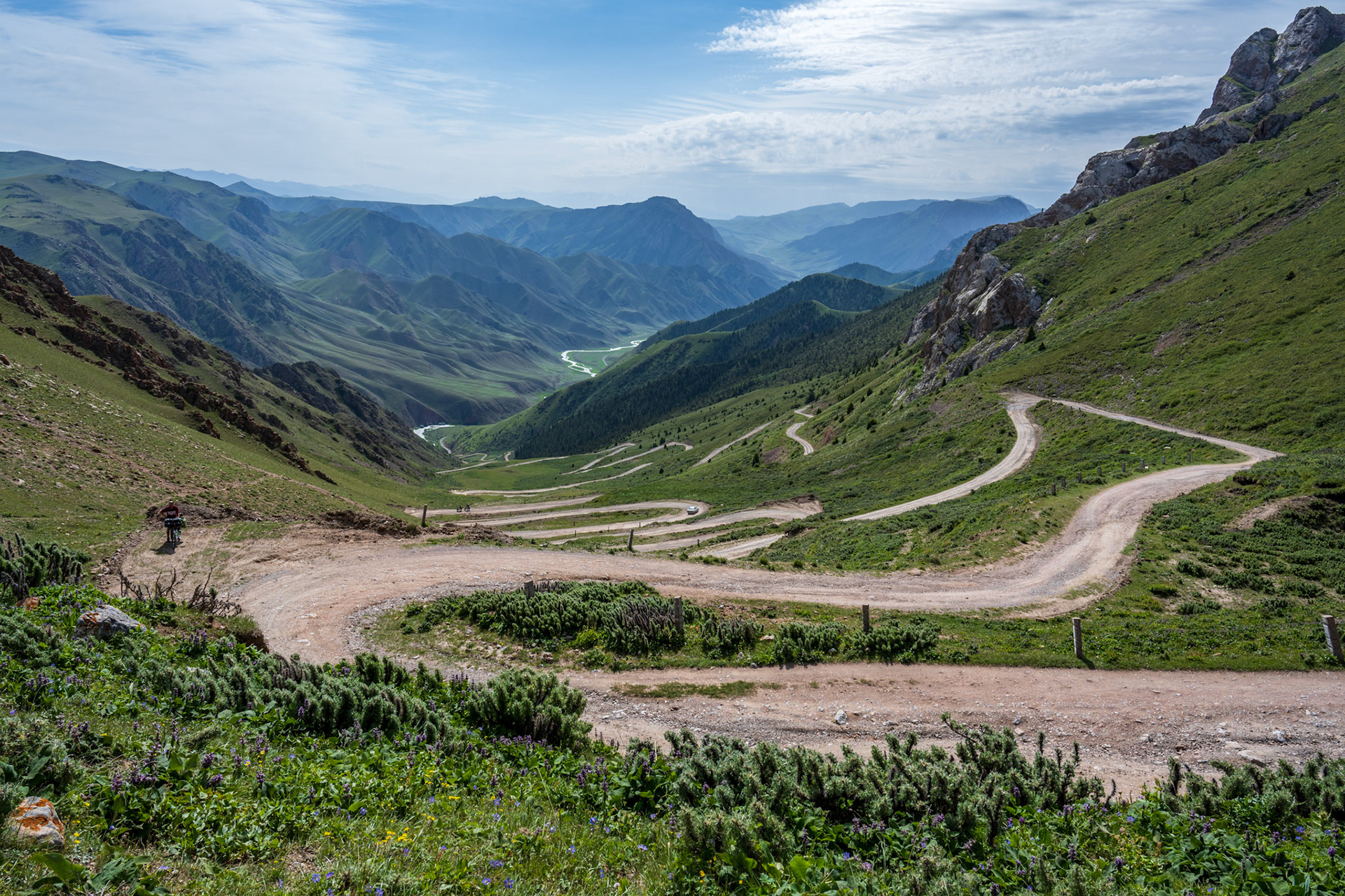
Incredible switchbacks!
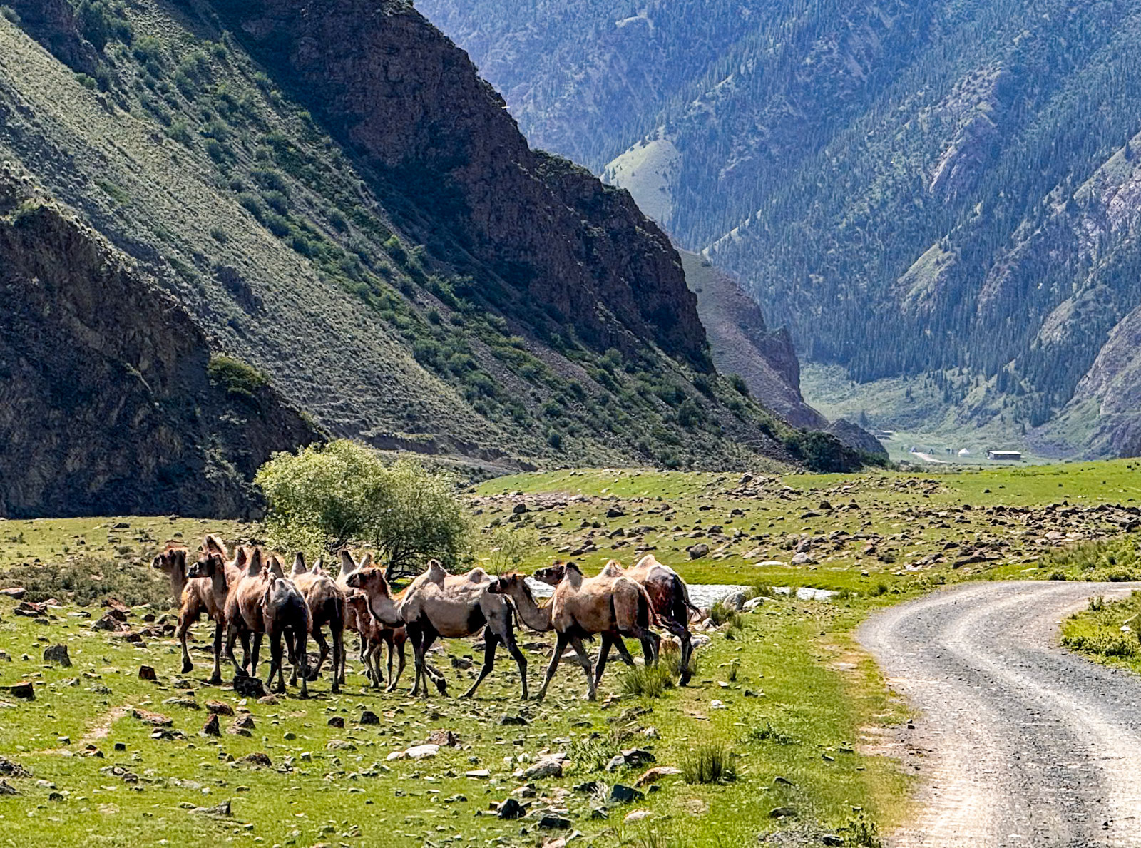
What are camels doing here?!?
Immense space, all for ourselves
A lush Kyrgyz valley, a common sight in this mountainous country
Is there hope for Vincent's lever?
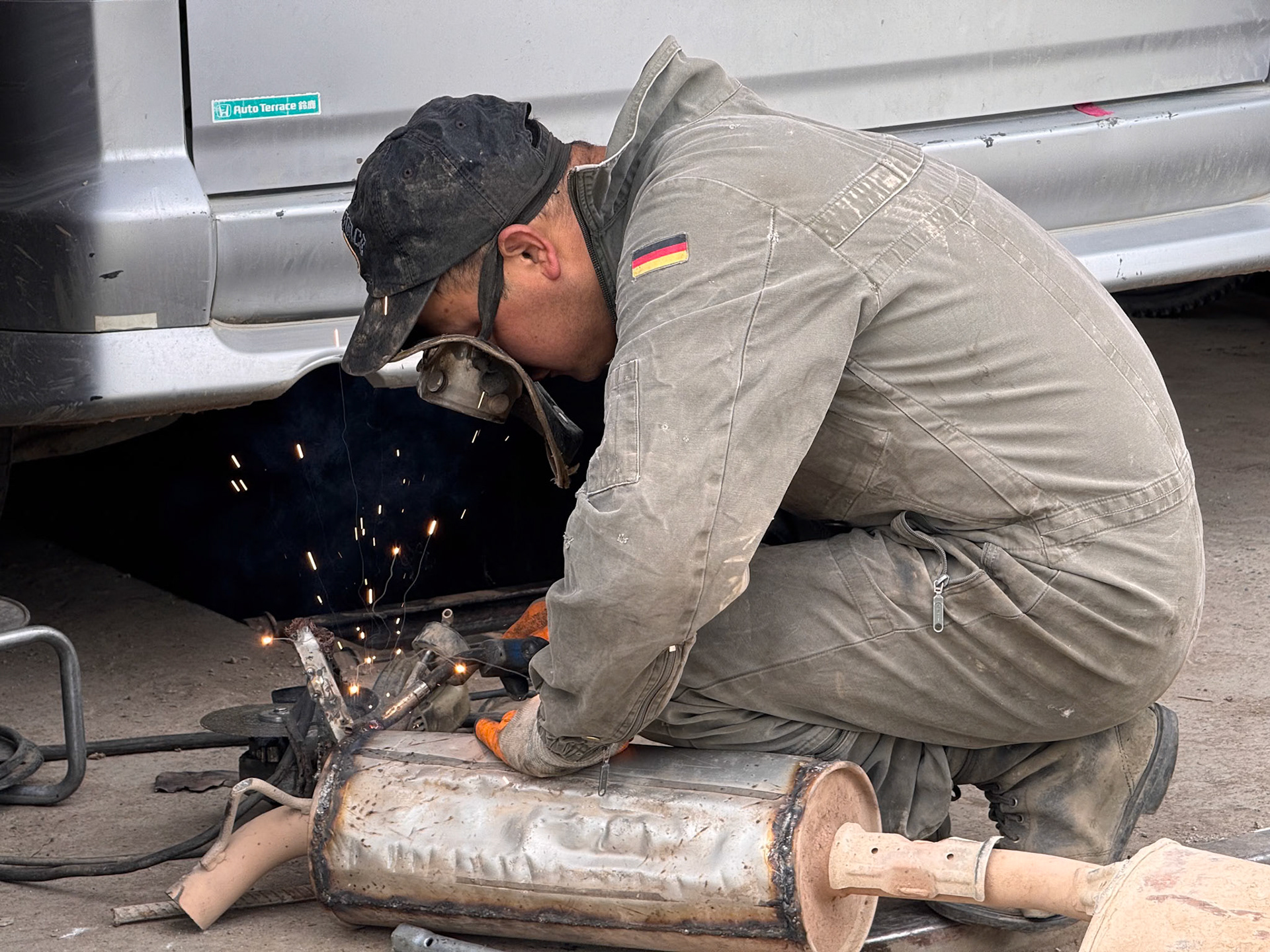
A welder is exactly what we need, and we couldn't believe that he was also able to weld aluminum!
Needs grinding, but that will hold forever!
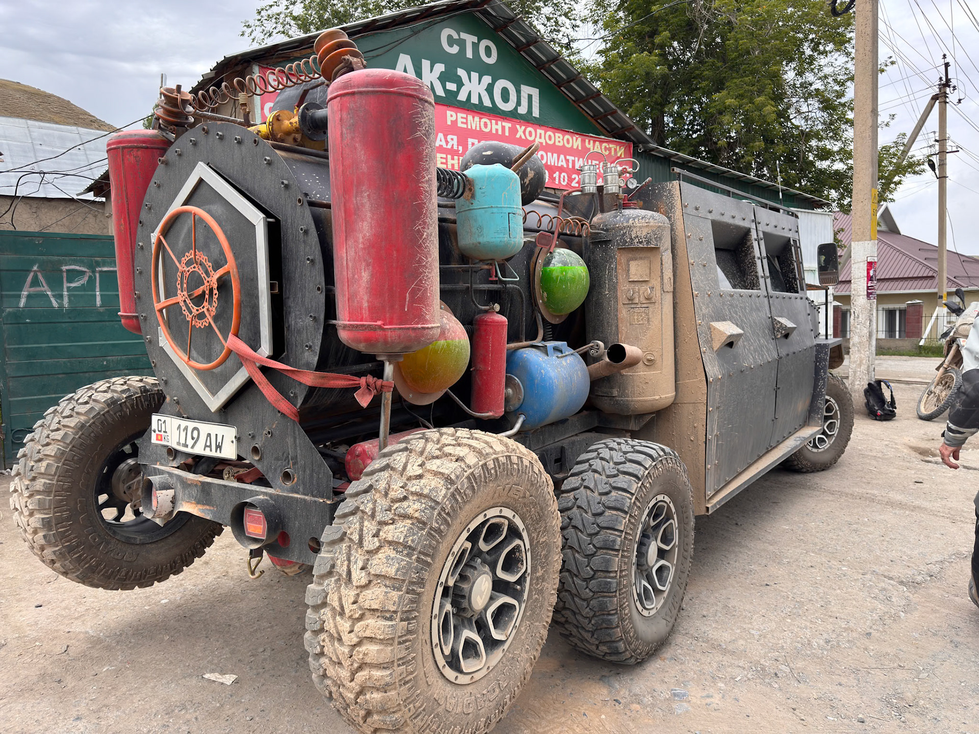
To our surprise a couple of Mad Max cars showed up at the shop!
Day 71b - Son-Kul to Issyk-Kul
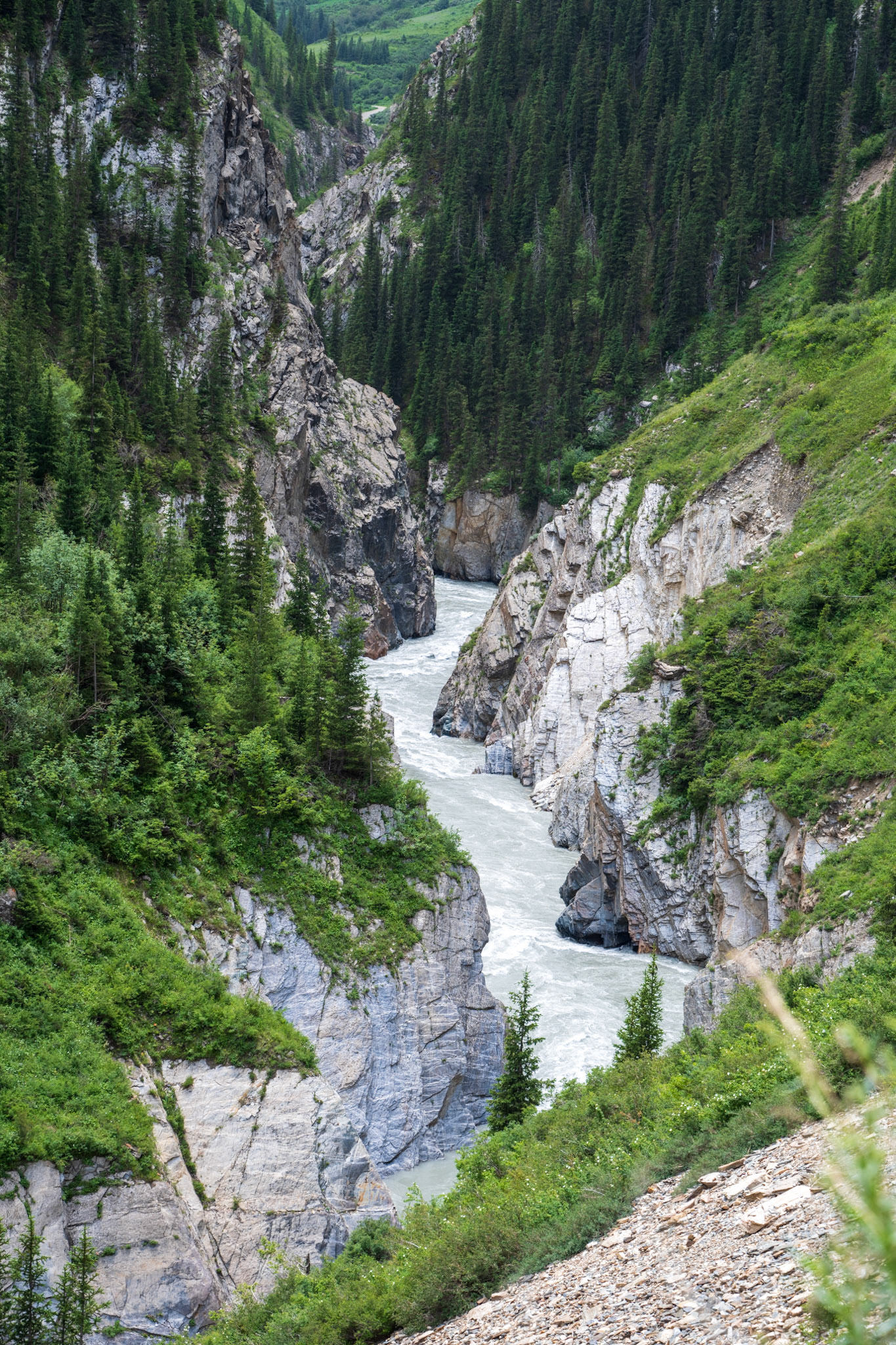
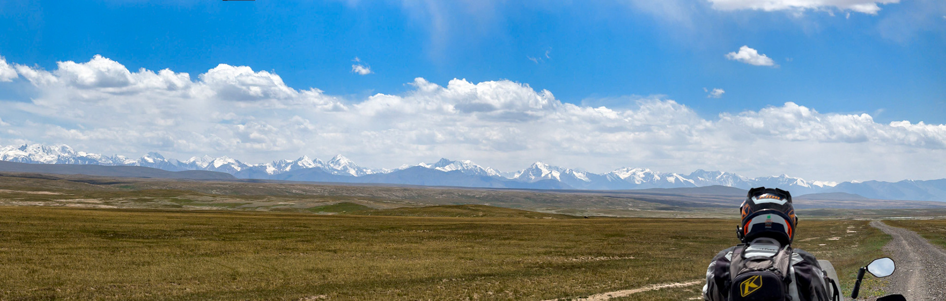
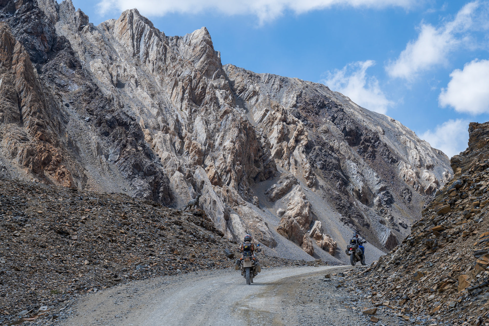
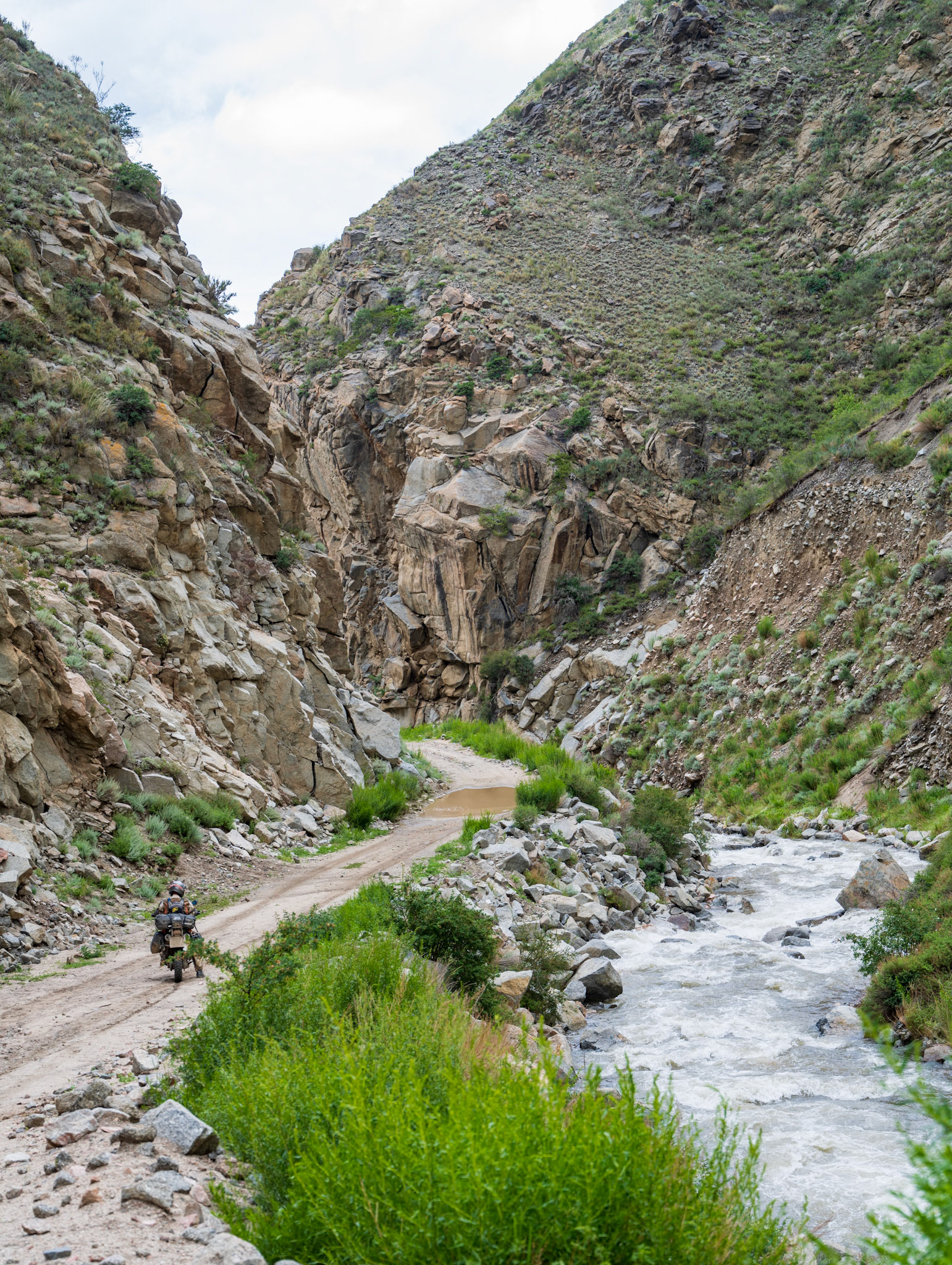
The road out of Naryn towards the Tosor Pass (3900m / 12,800ft) became less traveled as we headed north towards Issyk-Kul Lake. We quickly found ourselves in immense valleys, surrounded by snow-capped mountains. An endless track led us through these vast landscapes, inhabited only by animals and a few herders living in harsh conditions. The last signs of civilization were a couple of houses and a yurt camp before we entered a single-lane road leading through a narrow river canyon. With grassy patches on the ground and very few visible tracks, we wondered what lay ahead.
The road followed a narrow valley, winding along the canyon walls just above the river. The valley then widened into a huge grassy plain, giving us a true sense of the remoteness of our route to our evening’s destination. The feeling of freedom and space, with no one around, was exhilarating.
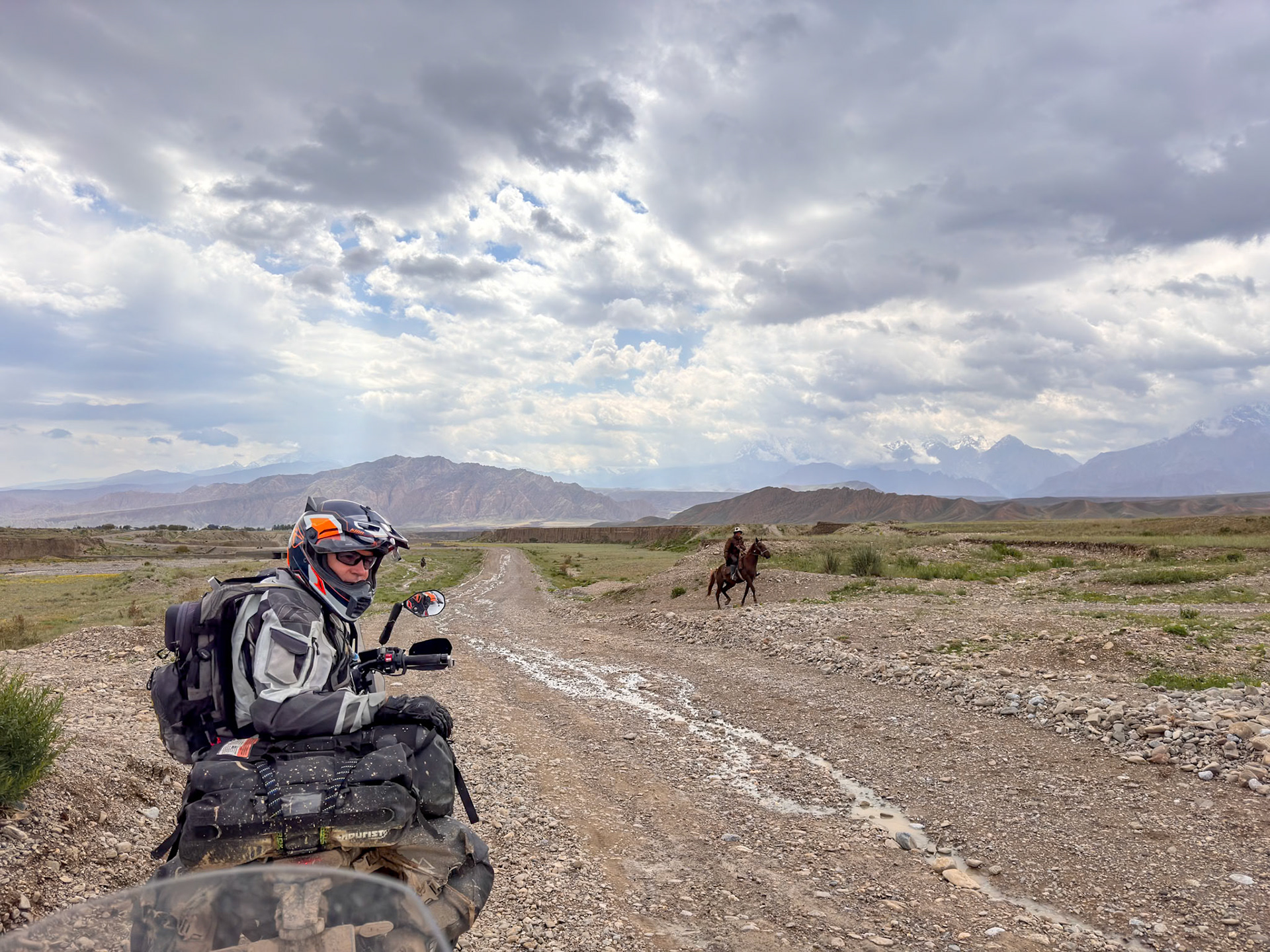
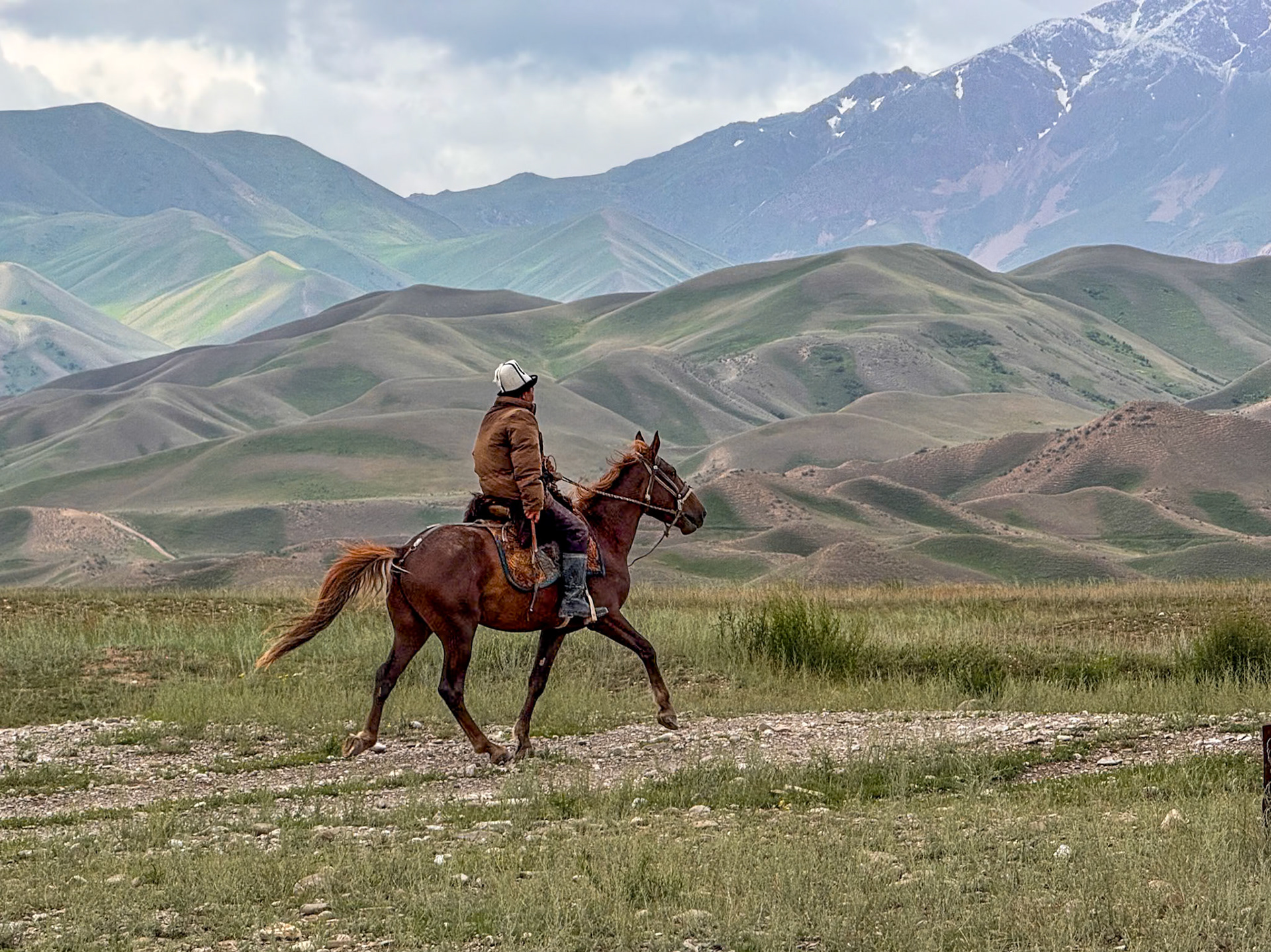
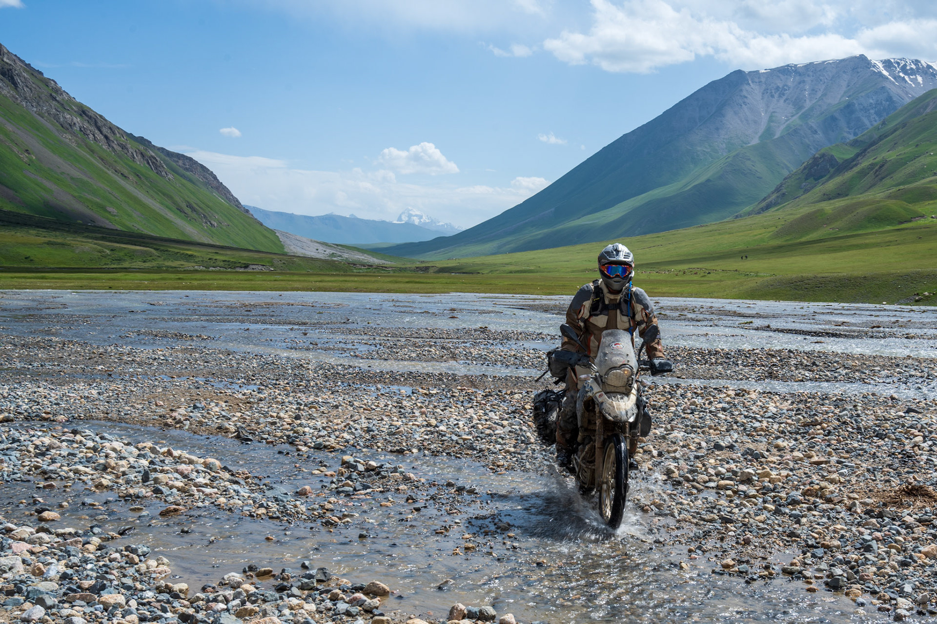
We eventually arrived at our first wide river crossing, which made us briefly contemplate whether to continue. The river flow was deep and powerful. We saw a horse herder and several horses crossing further downstream where the flow dispersed into many streams. I was leading that day and decided to cross where the horses had. There is always apprehension when crossing a river because a fall could mean a major failure for the engine if it ingest water.
We encountered many fords after that, some flowing more rapidly and appearing much deeper. By then, we were committed to pressing on. At one point, Dirk’s bike stalled, and the engine cut off every time he engaged a gear. We started to consider where we might pitch our tents, but Dirk diagnosed the problem: his side stand position sensor had broken, hir by a rock so the bike would only run in neutral. With dark clouds looming over the pass and the late afternoon approaching, we were concerned. Hardwiring the switch connectors together solved the problem, and off we went.
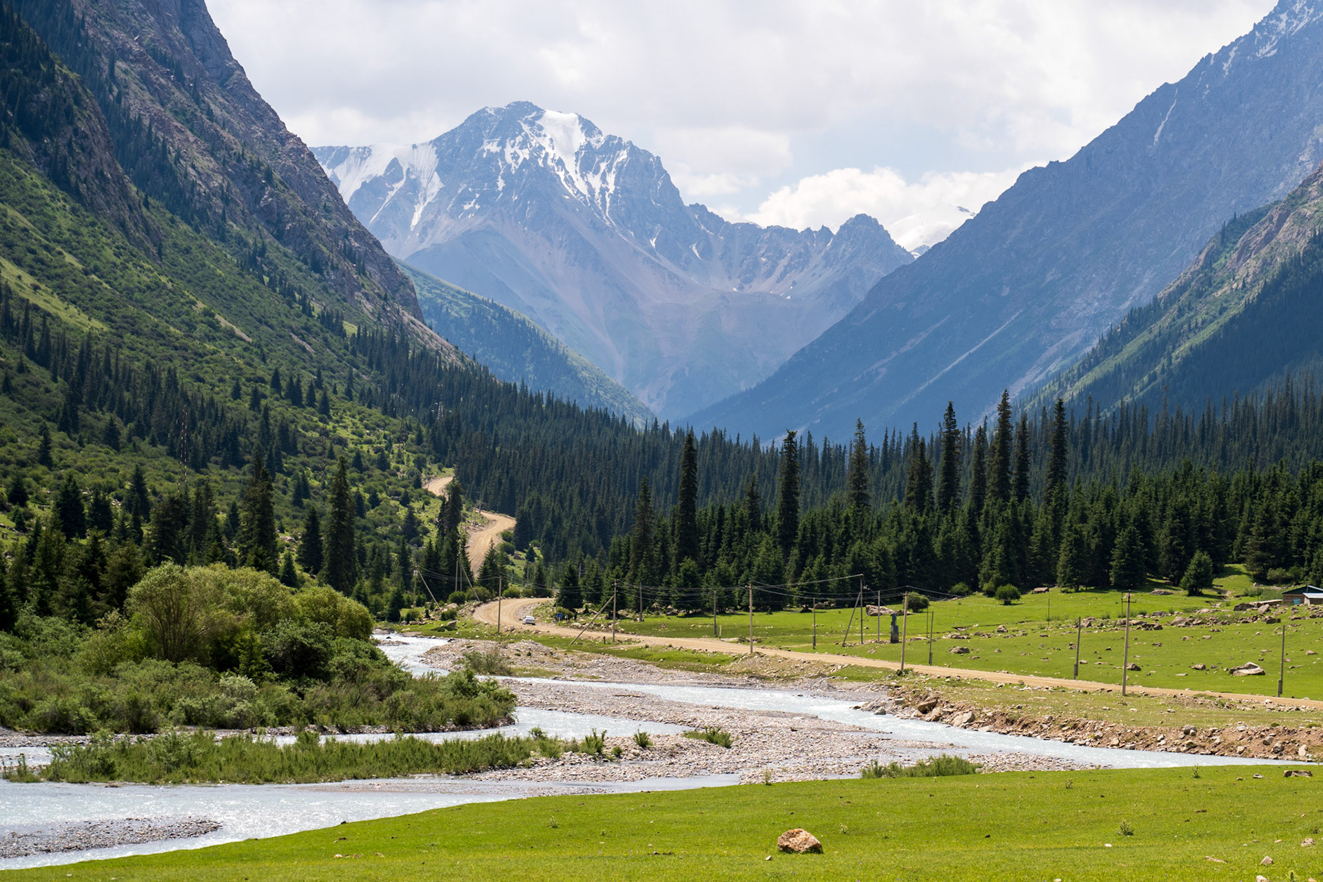
The winding path up to the pass was rocky and slippery on the uphill switchbacks. As we passed through what looked like a gate at the pass, the scenery completely changed. High, jagged, snow-covered peaks stood in a gray landscape. The switchbacks were tighter on the descent, and the track was even rockier all the way down into the valley below. After a grueling descent, and a winding canyon we could see the lake. We finally arrived in an almost Mediterranean atmosphere, on the shores of Issyk-Kul. Just a few more kilometers until beers and dinner.
We found a basic but great hotel in the small town of Tosor. Hidden behind a large gate, the hotel revealed a single track through an apricot orchard—a truly special place. What an incredible day!
Our last glimpse at civilization
A sheep herder above 3000m
Trying to take a picture without falling 😄
Dirk going in. What a wonderful scenery to "play in the water"
Vincent crossed it like a pro!
Vincent tackling another river crossing
Dirk fixing his side stand switch
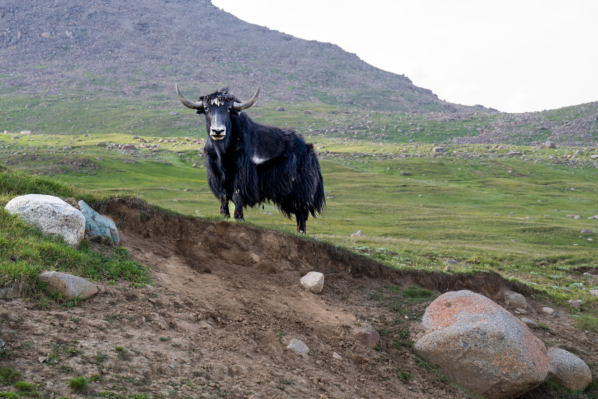
"What are you doing in my domain?"
Dirk, with a splash
We are so happy to be almost at the pass!
A harsh and lifeless environment on the other side of the pass
Even the sky looked hostile
Day 71, 320 km
Day 72 - Kumtor Mine Loop
Our adventure began after a leisurely breakfast beneath the apricot trees of our hotel. We packed light, leaving most of our gear behind for a day of riding through the stunning mountains south of the lake. Our first destination was the colossal Kumtor gold mine, one of the world's highest and largest.
The road to the mine, a testament to its economic significance, was a well-maintained dirt track, constantly watered down by a fleet of trucks to quell the relentless dust. As we ascended, the landscape transformed into an alpine wonderland, dotted with cascading waterfalls. The air grew thin, and the challenge of navigating the winding road, sharing it with massive mining trucks, added a thrilling edge to the journey.
Reaching the plateau, a barren expanse at over 3,500 meters, was a surreal experience. The vastness of the landscape, punctuated only by the mine's industrial infrastructure, was both awe-inspiring and sobering. The environmental impact of the mine was evident, a stark contrast to the pristine beauty of the surrounding mountains.
Leaving the mining district behind, we ventured into a more serene valley. Without the constraints of the mine, the road narrowed, the traffic stopped, and the sense of freedom grew. As we rode through rolling hills and lush pastures, we encountered herds of grazing livestock and the occasional nomadic herder. The air was crisp, the silence profound, and the scenery simply breathtaking. What a joy to be here, surrounded by this immensity!
Our journey South took us towards the Chinese border, a journey halted by a Kyrgyz military checkpoint about 60 km from the Chinese border. China imposes to its neighbors a buffer zone of 50 to 100 km from its border, and there is no going beyond this point without special papers.
Undeterred, we backtracked to a hidden viewpoint, a secret gem we'd spotted earlier. We left the trail and rode across the hilly pastureland, overwhelmed by an unparalleled sense of freedom until we find ourselves with a 360-degree view of these mountain ranges. It felt as if we might drop off the edge of the world once we reached it. A panoramic vista unfolded before us: snow-capped peaks, deep valleys, and a seemingly endless horizon. It was a moment of pure bliss, a testament to the raw beauty of the Kyrgyz mountains. What a joy to be here!
On the road leading to the plateau
Time to reset the luggage
Dirk, on that small road after the gold mine
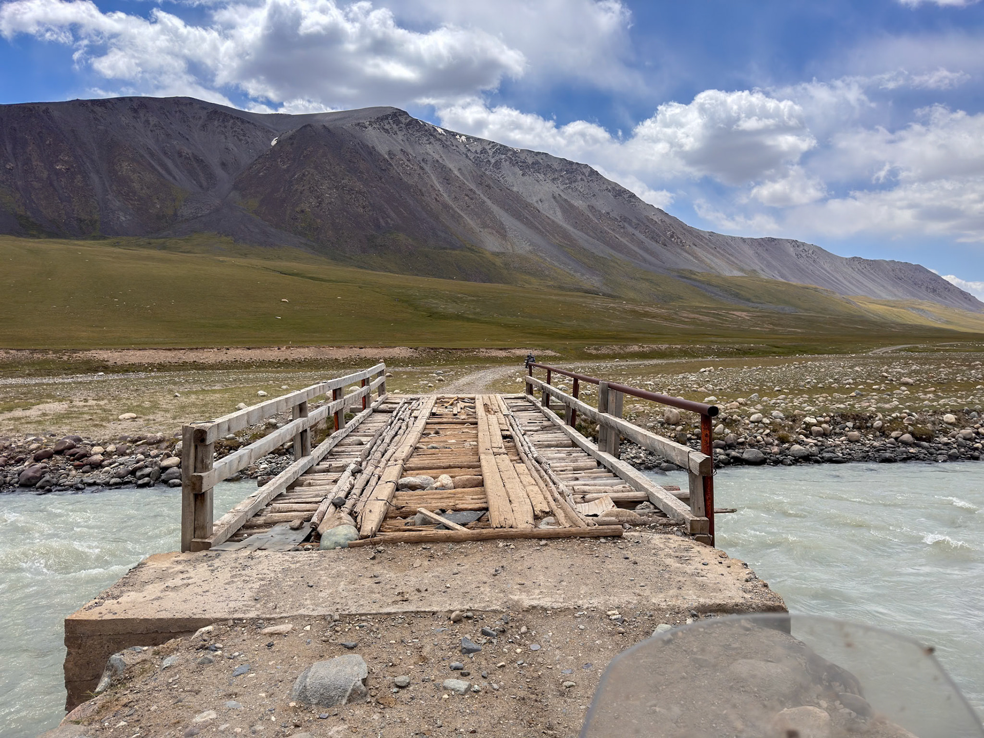
We're so happy every time there is a bridge
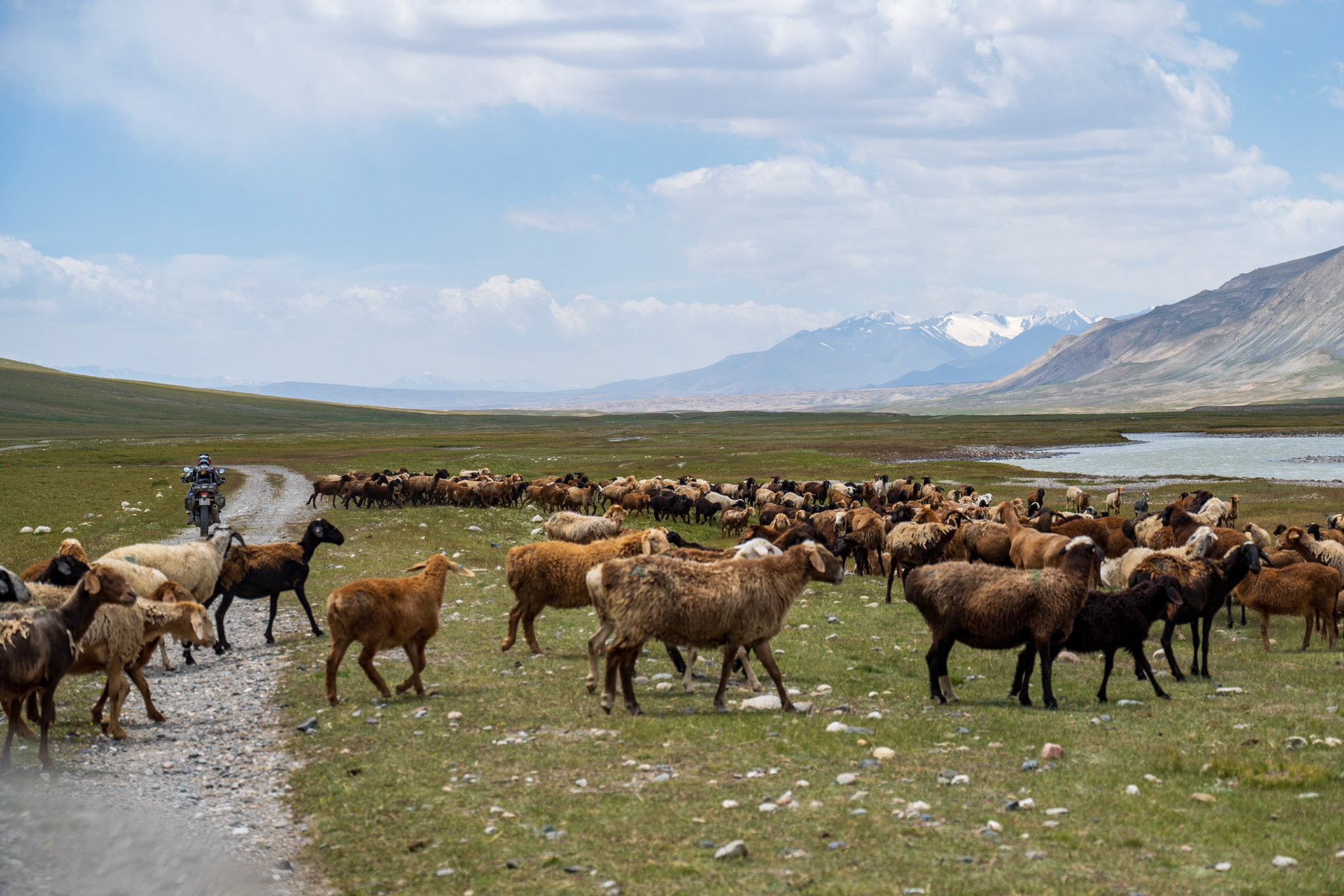
Too late, the herd closed its ranks again 😄
Exhilarating!
The checkpoint is below, but we feel like on top of the world
China, behind these beautiful mountains
We were all so happy, of the view but also the riding, freely, without any trail
What a valley, what a river!
Vincent, on the way back
The pass, before to start going down towards the lake
The ant in the curve below is actually Dirk
Day 72 - 260 km
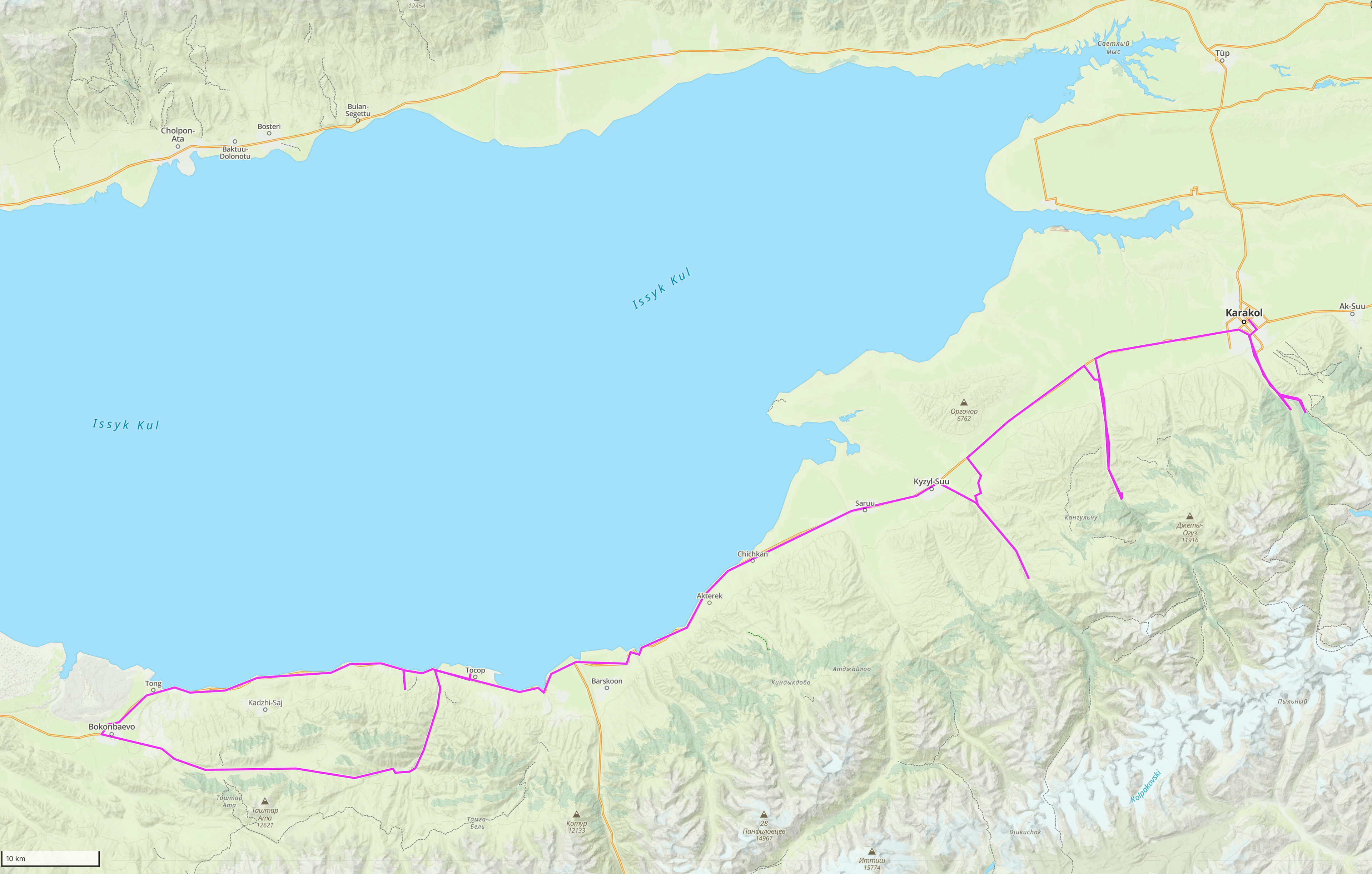
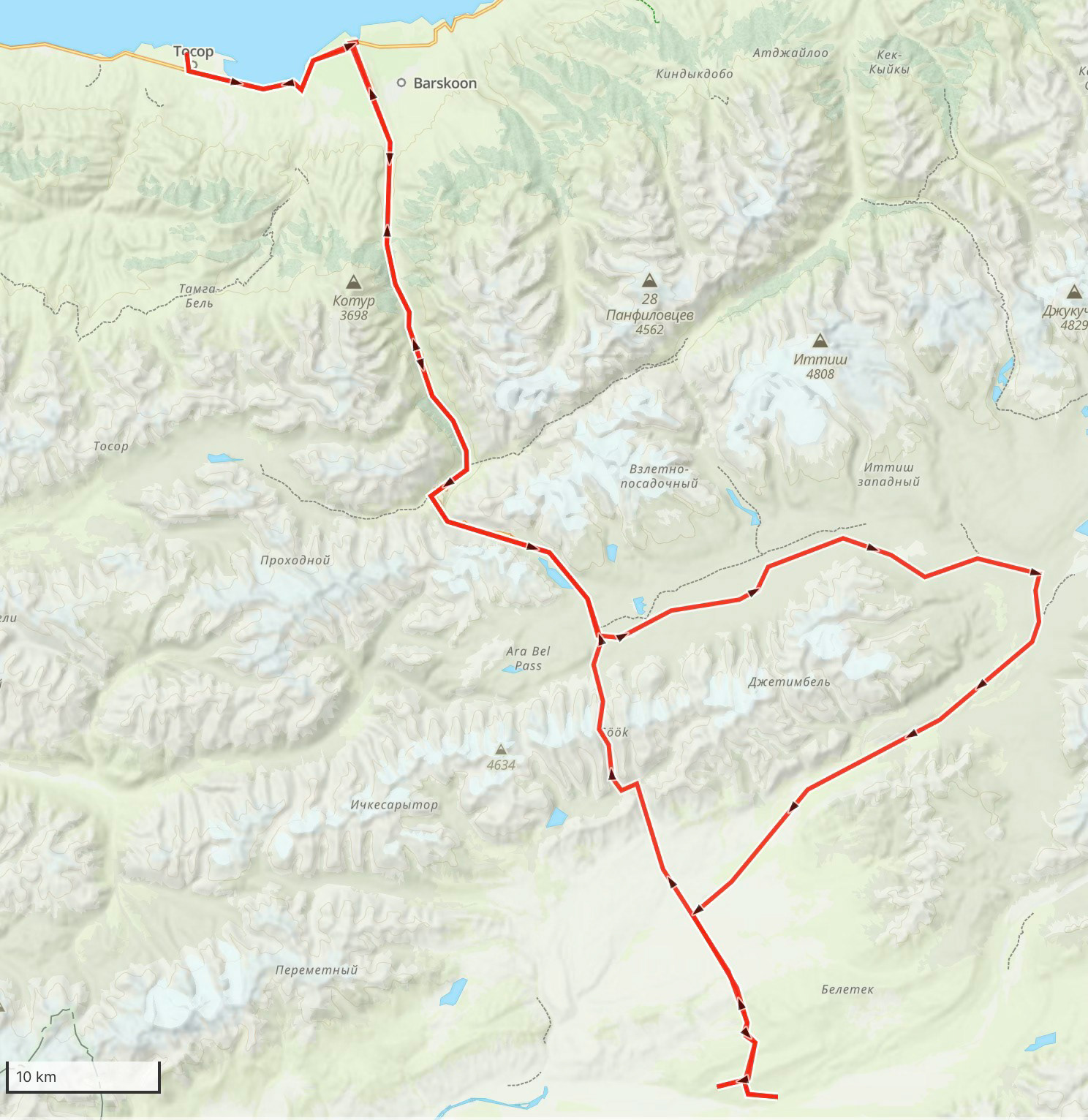
Day 73 - Tosor to Karakol
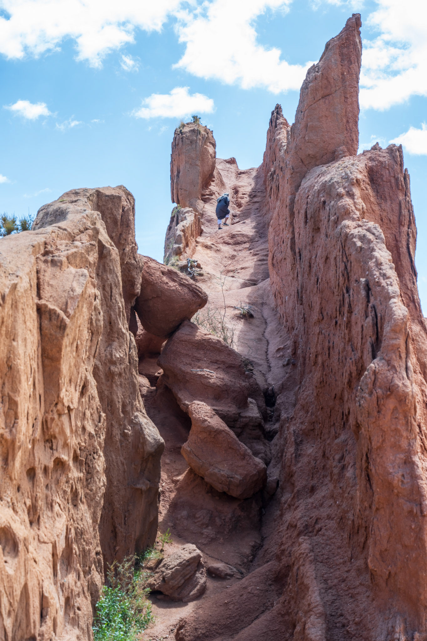
Today, we headed to Karakol, a picturesque town nestled between the mountains and the vast Issyk Kul Lake, renowned for its Russian architecture and lively atmosphere. However, our path took us in the opposite direction first - the Skazka (fairy tale) canyon. We headed west, following the shores of the lake, marveling at its immense expanse.
A small, rundown hut guarded by two children marked the entrance, charging a modest fee of 50 soms per person. The road, a winding dirt track, challenged us with deep gravel and sandy stretches. Eventually, we reached the parking lot, shared with a few tour buses and a tourist trap offering traditional Kyrgyz attire for photo opportunities.
Beyond the commercialism, the canyon's natural beauty shone through, with its unique rock formations, including one resembling a giant channel.
To return east from Bokonbayevo, we took a dirt road that paralleled the lake, offering a stark contrast to the Mediterranean climate we had just experienced. The landscape transformed into a rural, alpine terrain, with temperatures dropping by a significant 10 degrees Celsius.
We traversed several small towns and then ended up on a very rocky track before encountering a rugged track, a familiar path from our descent of the Tosor Pass. However, recent rain had transformed the road into a muddy obstacle course, with deep ruts and slippery slopes.
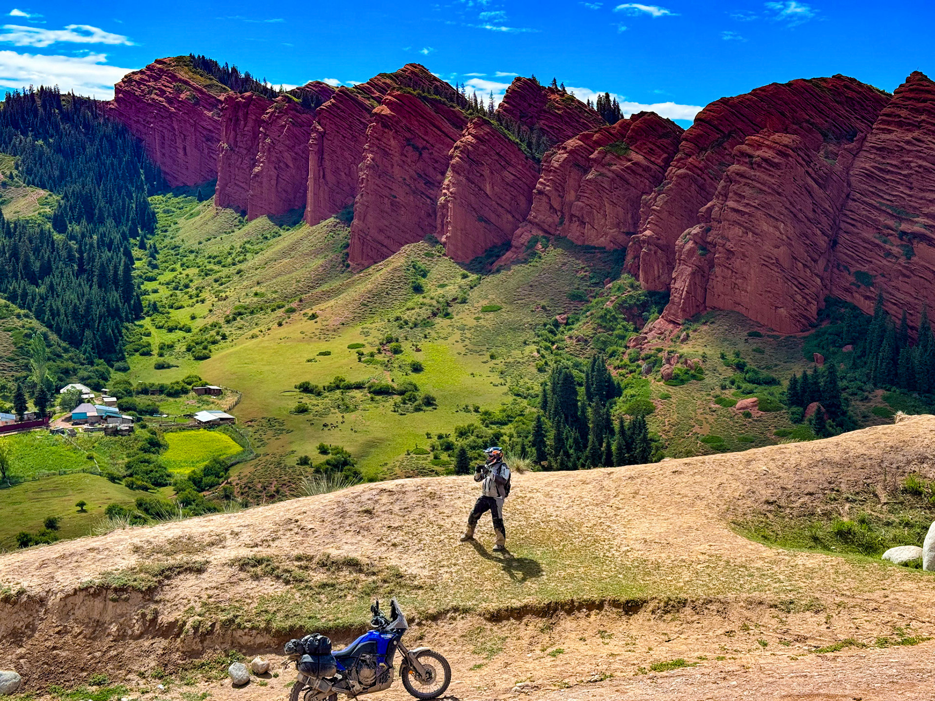
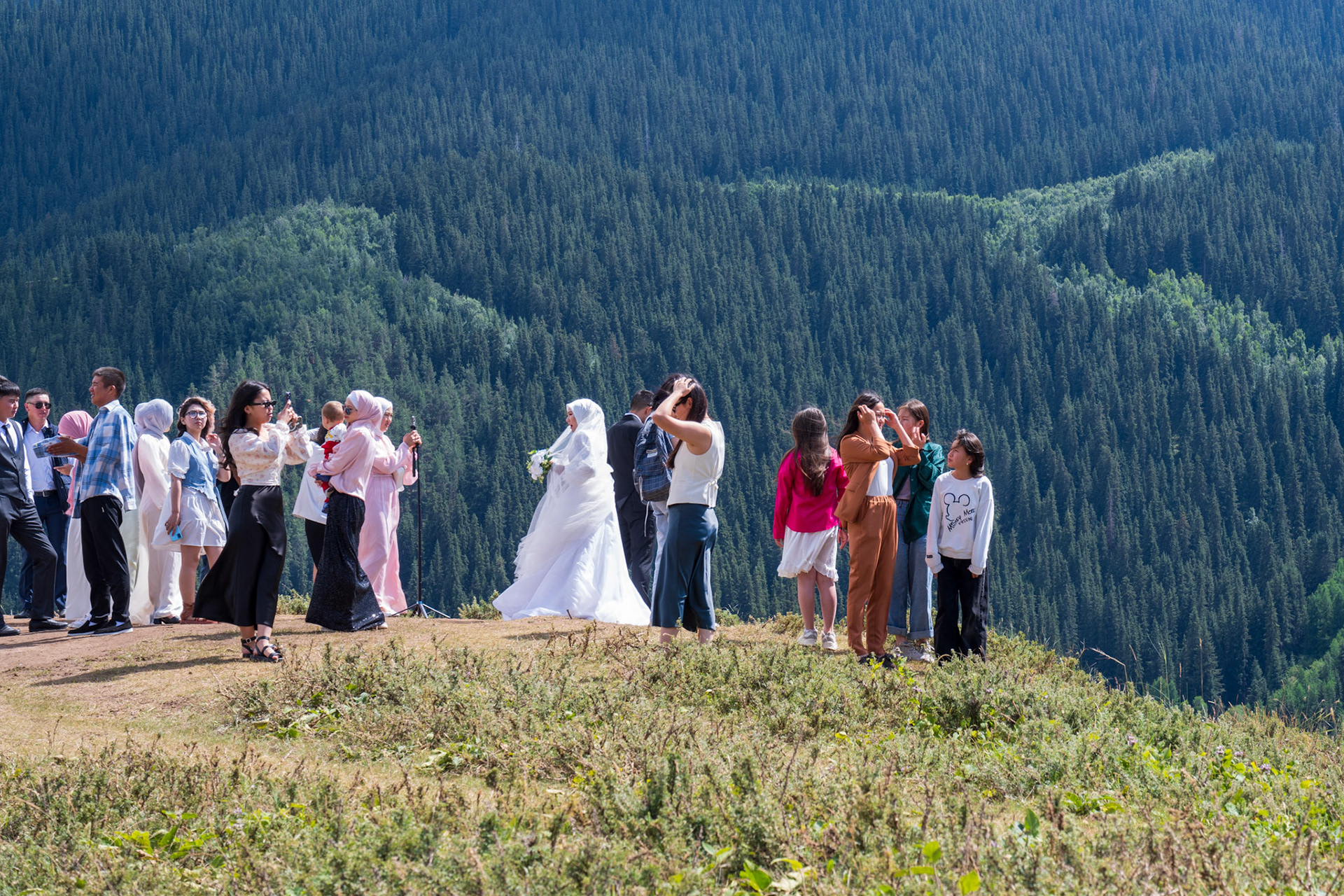
Next on the agenda was to explore some canyons on the way to Karakol. The most interesting one was the road to the Jeti Oguz (7 bulls) rock formation that was relatively busy since it’s a local tourist destination and it was a Saturday. The atmosphere was festive, with families gathered for picnics by the river. Vincent's venerable motorcycle (but a BMW!) once again stole the show, and he had to pose with his helmet for the delight of passersby.The Jeti Oguz rock formations were definitely worth the trip especially when we climbed a dirt road to a hilltop viewpoint, offering a stunning panorama of the rock formations.
To our surprise there was a wedding party at the top taking pictures there.
We finally arrived in Karakol and checked into our reserved apartment. While the online photos promised a modern and comfortable space, the reality was a dilapidated building and a challenging fifth-floor walk-up. Despite the initial disappointment, the apartment itself was pleasant, and we were even able to do some much-needed laundry.
A Bedouin in Kyrgyzstan 🙂
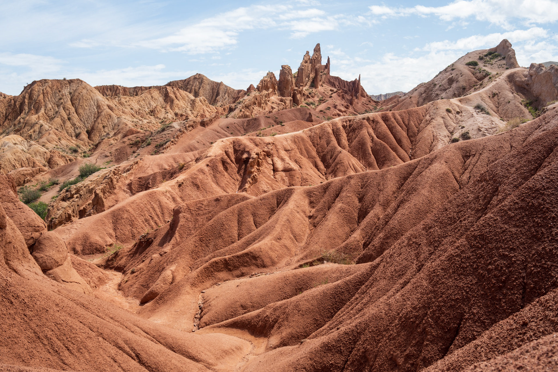
Fairy Tale canyon
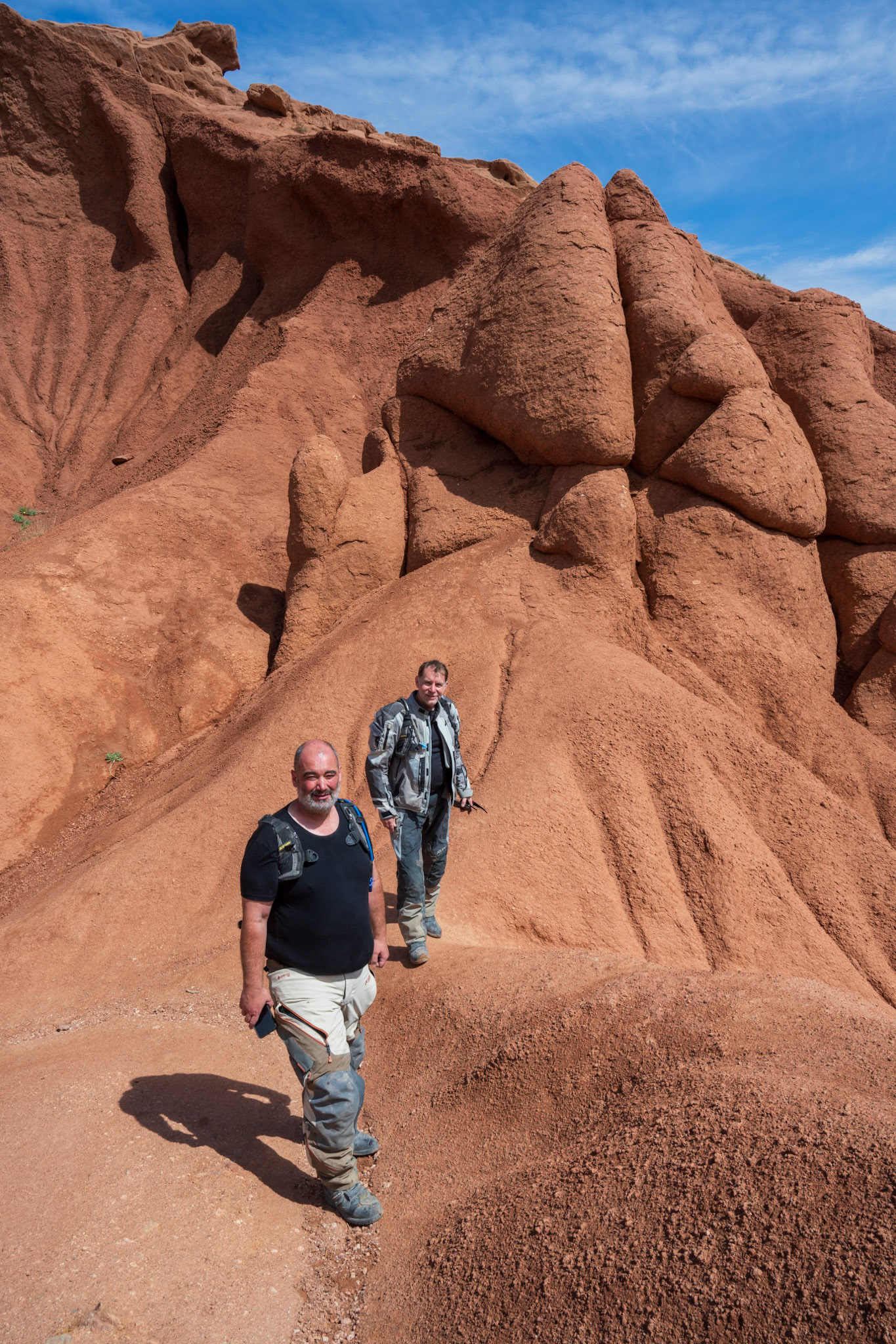
The pleasure of hiking in motorcycle boots 😉
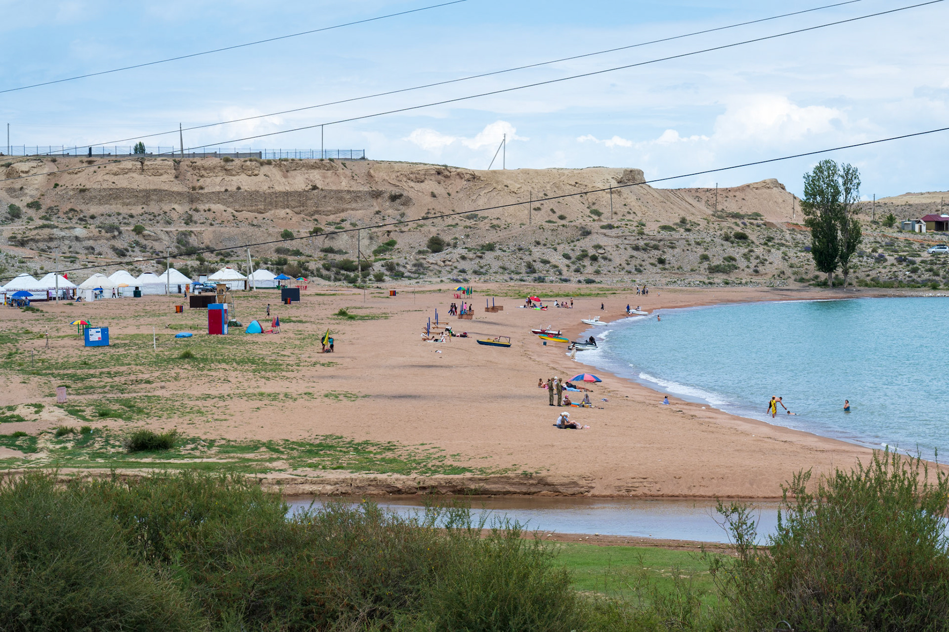
The Issyk-Kul's beaches cannot yet compete with the French Riviera but I find the idea of yurts on a beach very funny!
The canyon on the way back to the lake
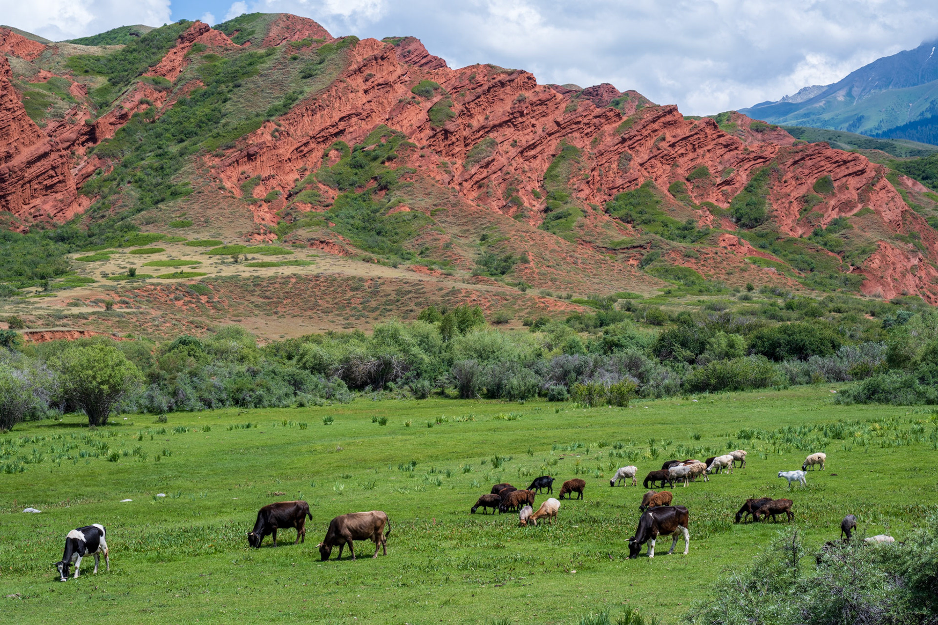
One of the canyons we explored had those beautiful red cliffs
Jeti Oguz (7 bulls) rock formation. (Pic by Vincent)
We had the surprise to find a wedding party in a photo op there